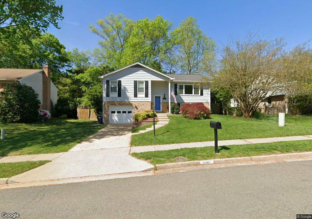
2002 Hoover Ln Alexandria, VA 22308
Fort Hunt NeighborhoodEstimated Value: $894,000 - $1,055,000
4
Beds
3
Baths
2,864
Sq Ft
$343/Sq Ft
Est. Value
About This Home
This home is located at 2002 Hoover Ln, Alexandria, VA 22308 and is currently estimated at $980,951, approximately $342 per square foot. 2002 Hoover Ln is a home located in Fairfax County with nearby schools including Fort Hunt Elementary School, Sandburg Middle, and West Potomac High School.
Ownership History
Date
Name
Owned For
Owner Type
Purchase Details
Closed on
Mar 13, 2009
Sold by
Gerow Kostandina
Bought by
Morissette Gregory A
Current Estimated Value
Home Financials for this Owner
Home Financials are based on the most recent Mortgage that was taken out on this home.
Original Mortgage
$458,900
Outstanding Balance
$292,571
Interest Rate
5.18%
Mortgage Type
VA
Estimated Equity
$688,380
Purchase Details
Closed on
Aug 8, 2007
Sold by
Silis Thomas P
Bought by
Konstandina Gerow
Create a Home Valuation Report for This Property
The Home Valuation Report is an in-depth analysis detailing your home's value as well as a comparison with similar homes in the area
Home Values in the Area
Average Home Value in this Area
Purchase History
| Date | Buyer | Sale Price | Title Company |
|---|---|---|---|
| Morissette Gregory A | $460,000 | -- | |
| Konstandina Gerow | -- | -- |
Source: Public Records
Mortgage History
| Date | Status | Borrower | Loan Amount |
|---|---|---|---|
| Open | Morissette Gregory A | $458,900 |
Source: Public Records
Tax History Compared to Growth
Tax History
| Year | Tax Paid | Tax Assessment Tax Assessment Total Assessment is a certain percentage of the fair market value that is determined by local assessors to be the total taxable value of land and additions on the property. | Land | Improvement |
|---|---|---|---|---|
| 2021 | $8,351 | $677,550 | $290,000 | $387,550 |
| 2020 | $7,928 | $638,640 | $266,000 | $372,640 |
| 2019 | $7,805 | $626,950 | $258,000 | $368,950 |
| 2018 | $7,524 | $606,200 | $248,000 | $358,200 |
| 2017 | $7,383 | $606,200 | $248,000 | $358,200 |
| 2016 | $7,368 | $606,200 | $248,000 | $358,200 |
| 2015 | $7,108 | $605,990 | $248,000 | $357,990 |
| 2014 | $6,512 | $553,820 | $234,000 | $319,820 |
Source: Public Records
Map
Nearby Homes
- 8601 Buckboard Dr
- 8628 Plymouth Rd
- 2308 Creek Dr
- 2410 Ryegate Ln
- 8705 Stockton Pkwy
- 8602 Cushman Place
- 2408 William And Mary Dr
- 8260 Colling Manor Ct
- Hampton II Plan at Collingwood Chase
- JAMESTOWN II Plan at Collingwood Chase
- 8305 Fort Hunt Rd
- 1700 Collingwood Rd
- 8281 Colling Manor Ct
- 8280 Colling Manor Ct
- 8276 Colling Manor Ct
- 8264 Colling Manor Ct
- 8127 Stacey Rd
- 8123 Stacey Rd
- 8119 Stacey Rd
- 8126 Stacey Rd
- 2004 Hoover Ln
- 8710 Linton Ln
- 8704 Linton Ln
- 2006 Hoover Ln
- 8706 Linton Ln
- 2003 Hoover Ln
- 2001 Hoover Ln
- 2005 Hoover Ln
- 2008 Hoover Ln
- 2101 Wittington Blvd
- 8702 Linton Ln
- 2007 Hoover Ln
- 8712 Linton Ln
- 8713 Linton Ln
- 8700 Linton Ln
- 2013 Hoover Ln
- 2010 Hoover Ln
- 8715 Linton Ln
- 8711 Linton Ln
- 2011 Hoover Ln