Estimated Value: $248,000 - $261,133
4
Beds
2
Baths
1,408
Sq Ft
$180/Sq Ft
Est. Value
About This Home
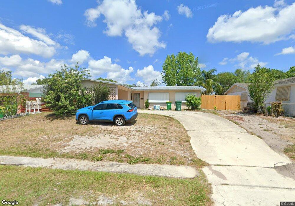
This home is located at 2002 Muskingum Ave, Cocoa, FL 32926 and is currently estimated at $252,783, approximately $179 per square foot. 2002 Muskingum Ave is a home located in Brevard County with nearby schools including Cambridge Elementary Magnet School, Cocoa High School, and Emma Jewel Charter Academy.
Ownership History
Date
Name
Owned For
Owner Type
Purchase Details
Closed on
Nov 17, 2016
Sold by
Gunde Jessica and Carr Jordan
Bought by
Warf Jordan
Current Estimated Value
Home Financials for this Owner
Home Financials are based on the most recent Mortgage that was taken out on this home.
Original Mortgage
$43,518
Outstanding Balance
$39,040
Interest Rate
8%
Mortgage Type
Balloon
Estimated Equity
$213,743
Purchase Details
Closed on
Sep 1, 2010
Sold by
Gunde David
Bought by
Riggs Teresa and Gunde Jessica
Purchase Details
Closed on
Oct 21, 2009
Sold by
Gunde Clara
Bought by
Gunde Clara and Gunde David Anton
Create a Home Valuation Report for This Property
The Home Valuation Report is an in-depth analysis detailing your home's value as well as a comparison with similar homes in the area
Home Values in the Area
Average Home Value in this Area
Purchase History
| Date | Buyer | Sale Price | Title Company |
|---|---|---|---|
| Warf Jordan | $45,000 | The Title Co Of Brevard Inc | |
| Riggs Teresa | -- | None Available | |
| Gunde Clara | -- | None Available |
Source: Public Records
Mortgage History
| Date | Status | Borrower | Loan Amount |
|---|---|---|---|
| Open | Warf Jordan | $43,518 |
Source: Public Records
Tax History Compared to Growth
Tax History
| Year | Tax Paid | Tax Assessment Tax Assessment Total Assessment is a certain percentage of the fair market value that is determined by local assessors to be the total taxable value of land and additions on the property. | Land | Improvement |
|---|---|---|---|---|
| 2025 | $1,022 | $72,090 | -- | -- |
| 2024 | $1,003 | $70,060 | -- | -- |
| 2023 | $1,003 | $68,020 | $0 | $0 |
| 2022 | $934 | $66,040 | $0 | $0 |
| 2021 | $930 | $64,120 | $0 | $0 |
| 2020 | $909 | $63,240 | $0 | $0 |
| 2019 | $895 | $61,820 | $0 | $0 |
| 2018 | $784 | $60,670 | $0 | $0 |
| 2017 | $786 | $59,430 | $30,000 | $29,430 |
| 2016 | $789 | $58,500 | $19,000 | $39,500 |
| 2015 | $796 | $58,100 | $19,000 | $39,100 |
| 2014 | $749 | $57,640 | $19,000 | $38,640 |
Source: Public Records
Map
Nearby Homes
- 2111 Otterbein Ave
- 1933 Quail Ridge Ct Unit 1101
- 00 N Unknown
- 0000 Unknown
- 00000 Unknown
- 1954 Quail Ridge Ct Unit 1704
- 2523 Auburn Dr
- 1627 Calvados Dr
- 2426 Granville Dr
- 2411 Stanford Dr
- 2413 Cherbourg Rd
- 3004 Winchester Dr
- 2713 Winchester Dr
- 2702 Winchester Dr
- 2314 Mercer Dr
- 3104 Winchester Dr
- 3057 Skyline Dr
- 3116 Winchester Dr
- 2221 Catawba Dr
- 1556 University Ln Unit 406
- 1998 Muskingum Ave
- 2006 Muskingum Ave
- 2003 Hofstra Dr
- 2007 Hofstra Dr
- 1994 Muskingum Ave
- 2003 Muskingum Ave
- 2010 Muskingum Ave
- 2007 Muskingum Ave
- 1999 Muskingum Ave
- 1999 Hofstra Dr
- 2011 Hofstra Dr
- 1995 Muskingum Ave
- 1990 Muskingum Ave
- 2011 Muskingum Ave
- 2744 Cherbourg Rd
- 2748 Cherbourg Rd
- 2740 Cherbourg Rd
- 1995 Hofstra Dr
- 1991 Muskingum Ave
- 2006 Hofstra Dr