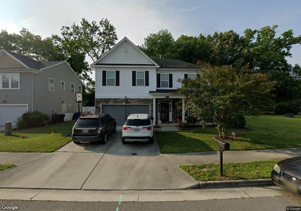
2002 Redgate Dr Suffolk, VA 23434
Cyprus NeighborhoodEstimated Value: $436,000 - $462,000
4
Beds
3
Baths
2,568
Sq Ft
$176/Sq Ft
Est. Value
About This Home
This home is located at 2002 Redgate Dr, Suffolk, VA 23434 and is currently estimated at $450,757, approximately $175 per square foot. 2002 Redgate Dr is a home located in Suffolk City with nearby schools including Mack Benn Jr. Elementary School, John F. Kennedy Middle School, and King's Fork High School.
Ownership History
Date
Name
Owned For
Owner Type
Purchase Details
Closed on
Jan 31, 2013
Sold by
New Port Llc
Bought by
Mitchell Deandre J
Current Estimated Value
Home Financials for this Owner
Home Financials are based on the most recent Mortgage that was taken out on this home.
Original Mortgage
$273,910
Outstanding Balance
$189,456
Interest Rate
3.41%
Mortgage Type
VA
Estimated Equity
$261,301
Create a Home Valuation Report for This Property
The Home Valuation Report is an in-depth analysis detailing your home's value as well as a comparison with similar homes in the area
Home Values in the Area
Average Home Value in this Area
Purchase History
| Date | Buyer | Sale Price | Title Company |
|---|---|---|---|
| Mitchell Deandre J | $268,145 | -- |
Source: Public Records
Mortgage History
| Date | Status | Borrower | Loan Amount |
|---|---|---|---|
| Open | Mitchell Deandre J | $273,910 |
Source: Public Records
Tax History
| Year | Tax Paid | Tax Assessment Tax Assessment Total Assessment is a certain percentage of the fair market value that is determined by local assessors to be the total taxable value of land and additions on the property. | Land | Improvement |
|---|---|---|---|---|
| 2025 | $5,152 | $439,400 | $80,000 | $359,400 |
| 2024 | $5,152 | $405,600 | $80,000 | $325,600 |
| 2023 | $4,733 | $412,200 | $80,000 | $332,200 |
| 2022 | $3,995 | $366,500 | $80,000 | $286,500 |
| 2021 | $3,422 | $308,300 | $69,400 | $238,900 |
| 2020 | $3,233 | $291,300 | $69,400 | $221,900 |
| 2019 | $3,146 | $283,400 | $69,400 | $214,000 |
| 2018 | $3,146 | $283,200 | $69,400 | $213,800 |
| 2017 | $3,030 | $283,200 | $69,400 | $213,800 |
| 2016 | $2,946 | $275,300 | $69,400 | $205,900 |
| 2015 | $341 | $269,100 | $69,400 | $199,700 |
| 2014 | $341 | $269,100 | $69,400 | $199,700 |
Source: Public Records
Map
Nearby Homes
- 311 Peachwood Ct
- 307 Peachwood Ct
- 418 Williams Rd
- 226 Reids Place Dr
- 224 Reids Place Dr
- 105 Margaret Reid Pkwy
- 103 Margaret Reid Pkwy
- 2619 Riddick Dr
- 225 Reid's Place Dr
- 222 Reid's Place Dr
- 223 Reid's Place Dr
- 220 Reid's Place Dr
- 233 Reid's Place Dr
- 218 Reid's Place Dr
- 216 Reid's Place Dr
- 217 Reid's Place Dr
- 214 Reid's Place Dr
- 213 Reid's Place Dr
- 212 Reid's Place Dr
- 211 Reid's Place Dr
- 2004 Redgate Dr
- 2000 Redgate Dr
- 2006 Redgate Dr
- 315 Applewood Ct
- 2005 Redgate Dr
- 2008 Redgate Dr
- 2007 Redgate Dr
- 2003 Redgate Dr
- 2009 Redgate Dr
- 314 Applewood Ct
- 313 Applewood Ct
- 2010 Redgate Dr
- 317 Suburban Dr
- 2013 Redgate Dr
- 315 Suburban Dr
- 319 Suburban Dr
- 2012 Redgate Dr
- 312 Applewood Ct
- 2015 Redgate Dr
- 3008 Stone Creek Dr
Your Personal Tour Guide
Ask me questions while you tour the home.