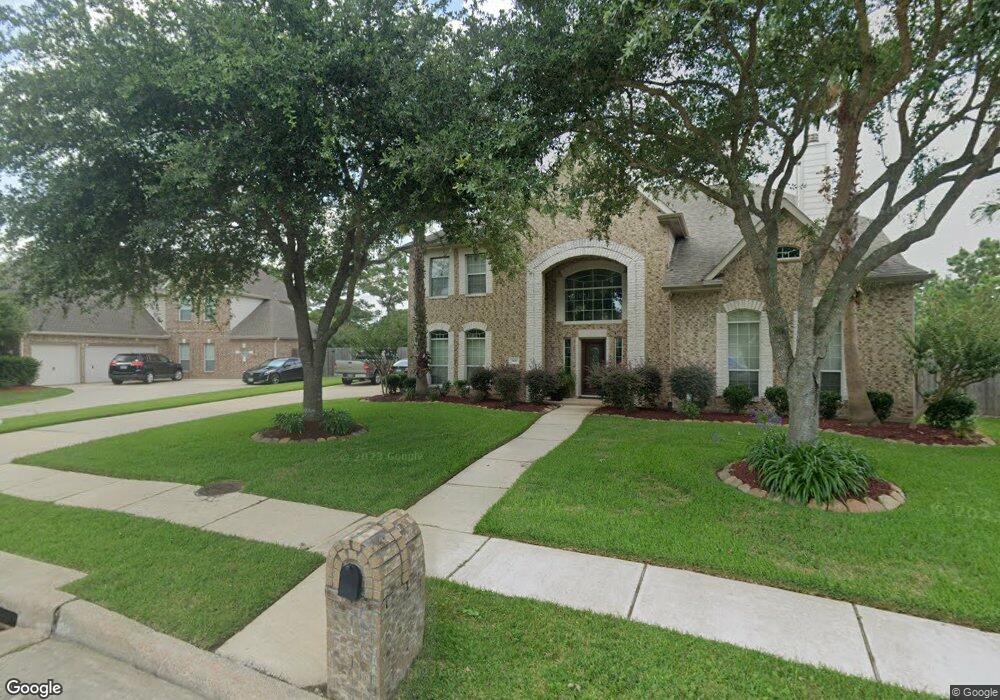
2002 S Friendswood Dr Friendswood, TX 77546
Estimated Value: $542,000 - $753,476
--
Bed
3
Baths
4,517
Sq Ft
$149/Sq Ft
Est. Value
About This Home
This home is located at 2002 S Friendswood Dr, Friendswood, TX 77546 and is currently estimated at $673,159, approximately $149 per square foot. 2002 S Friendswood Dr is a home located in Galveston County with nearby schools including C.W. Cline Elementary School, Windsong Elementary School, and Friendswood Junior High School.
Ownership History
Date
Name
Owned For
Owner Type
Purchase Details
Closed on
Nov 6, 2009
Sold by
Pinder Pamela R
Bought by
Pinder Pamela R and The Pinder Family Trust
Current Estimated Value
Purchase Details
Closed on
Mar 30, 1998
Sold by
Gloger Mary Spencer and Anderson George Preston
Bought by
Pinder George I and Pinder Pamela R
Home Financials for this Owner
Home Financials are based on the most recent Mortgage that was taken out on this home.
Original Mortgage
$225,000
Interest Rate
7.12%
Create a Home Valuation Report for This Property
The Home Valuation Report is an in-depth analysis detailing your home's value as well as a comparison with similar homes in the area
Home Values in the Area
Average Home Value in this Area
Purchase History
| Date | Buyer | Sale Price | Title Company |
|---|---|---|---|
| Pinder Pamela R | -- | None Available | |
| Pinder George I | -- | Alamo Title |
Source: Public Records
Mortgage History
| Date | Status | Borrower | Loan Amount |
|---|---|---|---|
| Closed | Pinder George I | $225,000 |
Source: Public Records
Tax History Compared to Growth
Tax History
| Year | Tax Paid | Tax Assessment Tax Assessment Total Assessment is a certain percentage of the fair market value that is determined by local assessors to be the total taxable value of land and additions on the property. | Land | Improvement |
|---|---|---|---|---|
| 2025 | $15,438 | $1,493,090 | $1,047,600 | $445,490 |
| 2024 | $15,438 | $772,050 | $334,820 | $437,230 |
| 2023 | $15,438 | $777,840 | $334,820 | $443,020 |
| 2022 | $16,583 | $752,910 | $334,820 | $418,090 |
| 2021 | $16,221 | $754,280 | $334,820 | $419,460 |
| 2020 | $14,747 | $612,130 | $334,820 | $277,310 |
| 2019 | $14,663 | $577,450 | $334,820 | $242,630 |
| 2018 | $14,804 | $579,580 | $334,820 | $244,760 |
| 2017 | $15,125 | $582,390 | $334,820 | $247,570 |
| 2016 | $15,124 | $582,380 | $334,820 | $247,560 |
| 2015 | $4,318 | $582,380 | $334,820 | $247,560 |
| 2014 | $4,287 | $553,560 | $334,820 | $218,740 |
Source: Public Records
Map
Nearby Homes
- 506 Lakeside Ln
- 110 Century Dr
- 505 Hunters Ln
- 204 Oak Dr
- 1010 High Ridge Dr
- 705 High Ridge Dr
- 1811 Hunt Dr
- 1802 Creekside Dr
- 1906 Blue Quail Dr
- 2316 Durango Bend Ln
- 1904 Candlelight Ct
- 120 Bandera Creek Ln
- 2304 Old Rd
- 2204 Airline Dr
- 611 Oak Dr
- 1509 Windsor Dr
- 2405 Pebble Lodge Ln
- 124 Lamar Canyon Ln
- 1531 Briar Bend Dr
- 314 Parkwood Village Dr
- 312 Falcon Lake Dr
- 2009 Cardinal Ridge Ct
- 316 Falcon Lake Dr
- 308 Falcon Lake Dr
- 2013 Cardinal Ridge Ct
- 303 Eagle Lakes Dr
- 2005 Cardinal Ridge Ct
- 320 Falcon Lake Dr
- 305 Eagle Lakes Dr
- 304 Falcon Lake Dr
- 115 Eagle Lakes Dr
- 307 Eagle Lakes Dr
- 2001 Cardinal Ridge Ct
- 2001 Cardinal Ridge Cir
- 113 Eagle Lakes Dr
- 300 Falcon Lake Dr
- 2012 Cardinal Ridge Cir
- 2012 Cardinal Ridge Ct
- 309 Eagle Lakes Dr
- 309 Falcon Lake Dr