Estimated Value: $309,405 - $345,000
Studio
--
Bath
1,138
Sq Ft
$291/Sq Ft
Est. Value
About This Home
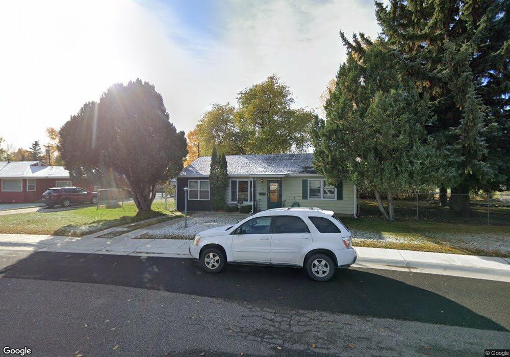
This home is located at 2002 Shoshone Trail N, Cody, WY 82414 and is currently estimated at $331,351, approximately $291 per square foot. 2002 Shoshone Trail N is a home located in Park County with nearby schools including Cody Middle School, Cody High School, and Park Christian Schools.
Ownership History
Date
Name
Owned For
Owner Type
Purchase Details
Closed on
Nov 2, 2015
Sold by
Spivak Robin E
Bought by
Raduenz Robin E
Current Estimated Value
Purchase Details
Closed on
Jul 20, 2015
Sold by
Sivak Robert W and Spivak Robin E
Bought by
Spivak Robin E
Home Financials for this Owner
Home Financials are based on the most recent Mortgage that was taken out on this home.
Original Mortgage
$112,150
Interest Rate
4.13%
Mortgage Type
New Conventional
Create a Home Valuation Report for This Property
The Home Valuation Report is an in-depth analysis detailing your home's value as well as a comparison with similar homes in the area
Purchase History
| Date | Buyer | Sale Price | Title Company |
|---|---|---|---|
| Raduenz Robin E | -- | None Available | |
| Spivak Robin E | -- | None Available |
Source: Public Records
Mortgage History
| Date | Status | Borrower | Loan Amount |
|---|---|---|---|
| Previous Owner | Spivak Robin E | $112,150 |
Source: Public Records
Tax History
| Year | Tax Paid | Tax Assessment Tax Assessment Total Assessment is a certain percentage of the fair market value that is determined by local assessors to be the total taxable value of land and additions on the property. | Land | Improvement |
|---|---|---|---|---|
| 2025 | $1,319 | $17,707 | $4,596 | $13,111 |
| 2024 | $1,657 | $22,242 | $6,128 | $16,114 |
| 2023 | $1,657 | $22,247 | $6,128 | $16,119 |
| 2022 | $1,434 | $19,092 | $6,128 | $12,964 |
| 2021 | $1,082 | $14,433 | $5,339 | $9,094 |
| 2020 | $1,042 | $13,889 | $4,959 | $8,930 |
| 2019 | $943 | $12,569 | $3,942 | $8,627 |
| 2018 | $922 | $12,290 | $3,942 | $8,348 |
| 2017 | $907 | $12,093 | $3,942 | $8,151 |
| 2016 | $872 | $11,628 | $3,467 | $8,161 |
| 2015 | $886 | $11,662 | $3,467 | $8,195 |
| 2014 | $896 | $11,364 | $3,467 | $7,897 |
Source: Public Records
Map
Nearby Homes
- 2026 Shoshoni Trail N
- 1815 Stampede Ave
- 1817 Mountain View Dr
- 1825 Mountain View Dr
- 1632 20th St
- 1616 21st St
- 1525 19th St
- 1607 Park Ln
- 2432 Songbird Ct Unit 10
- 1513 22nd St
- 1420 Meadow Lane Ave Unit 2
- 2314 Songbird Ct Unit 17
- 2340 Larkspur Ct
- 2320 Songbird Ct Unit 16
- 2319 Songbird Ct Unit 4
- 2381 Larkspur Ct
- 1505 Draw St
- 1725 Alger Ave
- 1608 Alger Ave
- 2501 Singing Lark Ct Unit 20
- 2008 Shoshone Trail N
- 1901 Kerper Blvd
- 1907 Kerper Blvd
- 2014 Shoshone Trail N
- 125 Goodturn Dr
- 2007 Shoshone Trail N
- 135 Goodturn Dr
- 2001 Kerper Blvd
- 115 Goodturn Dr
- 145 Goodturn Dr
- 110 Goodturn Dr
- 2007 Kerper Blvd
- 2020 Shoshone Trail N
- 2019 Shoshone Trail N
- 105 Goodturn Dr
- 1902 Kerper Blvd
- 155 Goodturn Dr
- 100 Goodturn Dr
- 100 Goodturn Dr Unit Lot 16
Your Personal Tour Guide
Ask me questions while you tour the home.