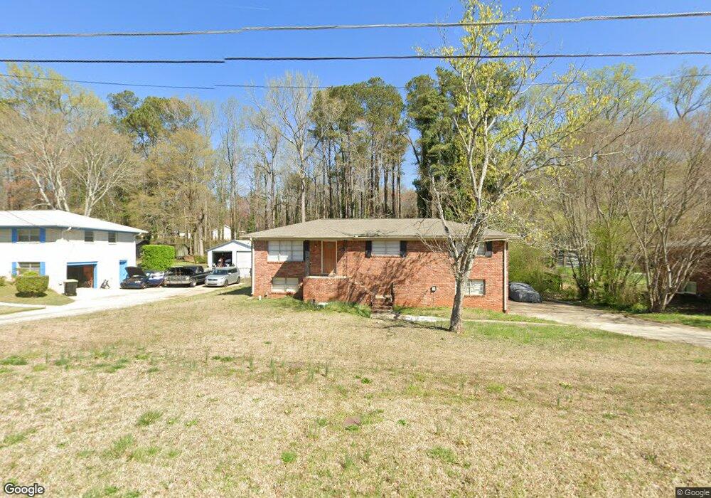
2002 Silver Creek Dr Austell, GA 30168
Estimated Value: $248,000 - $308,000
3
Beds
2
Baths
1,325
Sq Ft
$208/Sq Ft
Est. Value
About This Home
This home is located at 2002 Silver Creek Dr, Austell, GA 30168 and is currently estimated at $276,101, approximately $208 per square foot. 2002 Silver Creek Dr is a home located in Cobb County with nearby schools including Austell Elementary School, Garrett Middle School, and Pebblebrook High School.
Ownership History
Date
Name
Owned For
Owner Type
Purchase Details
Closed on
Aug 8, 2018
Sold by
Rha 1 Llc
Bought by
Fyr Sfr Borrower Llc
Current Estimated Value
Purchase Details
Closed on
Jan 9, 2014
Sold by
Ross Sanchaze
Bought by
Rha 1 Llc
Purchase Details
Closed on
Oct 3, 2011
Sold by
Ross Sanchaze
Bought by
Ross Curly
Purchase Details
Closed on
Mar 6, 2006
Sold by
Jp Morgan Chase Bk
Bought by
Ross Anthony
Purchase Details
Closed on
Jul 5, 2005
Sold by
Stanford Richard B
Bought by
Jpmorgan Chase Bank
Purchase Details
Closed on
Jul 25, 1997
Sold by
Young Hubert E
Bought by
Stanford Richard B
Home Financials for this Owner
Home Financials are based on the most recent Mortgage that was taken out on this home.
Original Mortgage
$72,012
Interest Rate
7.61%
Mortgage Type
VA
Create a Home Valuation Report for This Property
The Home Valuation Report is an in-depth analysis detailing your home's value as well as a comparison with similar homes in the area
Home Values in the Area
Average Home Value in this Area
Purchase History
| Date | Buyer | Sale Price | Title Company |
|---|---|---|---|
| Fyr Sfr Borrower Llc | $127,589 | -- | |
| Rha 1 Llc | $74,000 | -- | |
| Ross Curly | -- | -- | |
| Ross Anthony | $87,300 | -- | |
| Jpmorgan Chase Bank | $119,754 | -- | |
| Stanford Richard B | $70,600 | -- |
Source: Public Records
Mortgage History
| Date | Status | Borrower | Loan Amount |
|---|---|---|---|
| Previous Owner | Stanford Richard B | $72,012 |
Source: Public Records
Tax History
| Year | Tax Paid | Tax Assessment Tax Assessment Total Assessment is a certain percentage of the fair market value that is determined by local assessors to be the total taxable value of land and additions on the property. | Land | Improvement |
|---|---|---|---|---|
| 2025 | $3,458 | $114,768 | $26,000 | $88,768 |
| 2024 | $3,460 | $114,768 | $26,000 | $88,768 |
| 2023 | $3,733 | $123,824 | $18,000 | $105,824 |
Source: Public Records
Map
Nearby Homes
- 1920 Silver Creek Dr Unit 4
- 1972 Cox Dr Unit 5
- 6182 Grove Crest Way Unit 3
- 1961 Abbey Province
- 6083 Oak Hill Dr
- 1151 S Gordon Rd
- 6486 Drake Manor
- 6488 Drake Manor
- 6496 Drake Manor
- 0 Maxham Rd Unit 10652291
- 6718 Roscommon Dr
- 6445 Sherwood Trail
- 6559 Brandemere Way
- 1784 Brandemere Dr Unit 3
- 6563 Brandemere Way
- 1794 Blossom Ln
- 2414 Old Alabama Rd
- 2042 Linda Dr SW
- 1138 Pontiac Cir Unit 23
- 1984 Brenda Dr
- 2002 Silver Creek Dr
- 2002 Silver Creek Dr
- W Silver Creek Dr
- 2012 Silver Creek Dr
- 1585 Silver Creek Dr
- 2620 Silver Creek Dr
- 2019 Silver Creek Dr
- 2026 Silver Creek Dr
- 1980 Silver Creek Dr
- 2025 Silver Creek Dr
- 1992 Woodbine Cir
- 1968 Silver Creek Dr
- 2036 Silver Creek Dr
- 2035 Silver Creek Dr Unit 4
- 1971 Silver Creek Dr
- 2048 Silver Creek Dr Unit 4
- 2002 Woodbine Cir
- 1956 Silver Creek Dr
- 1962 Silver Creek Dr
Your Personal Tour Guide
Ask me questions while you tour the home.