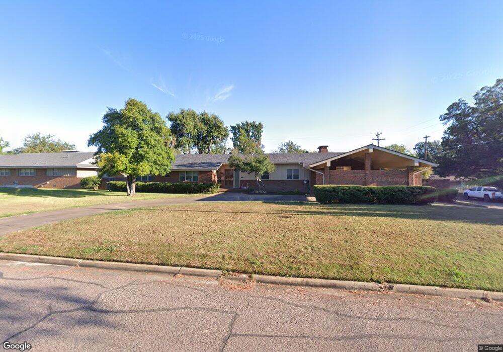
2002 W Liveoak St Durant, OK 74701
Estimated Value: $231,599 - $294,000
4
Beds
2
Baths
2,501
Sq Ft
$105/Sq Ft
Est. Value
About This Home
This home is located at 2002 W Liveoak St, Durant, OK 74701 and is currently estimated at $262,400, approximately $104 per square foot. 2002 W Liveoak St is a home located in Bryan County with nearby schools including Northwest Heights Elementary School, Durant Intermediate Elementary School, and Durant Middle School.
Ownership History
Date
Name
Owned For
Owner Type
Purchase Details
Closed on
Mar 3, 2023
Sold by
Edelen Susan M
Bought by
Edelen Susan M and Edelen Jeffery Christopher
Current Estimated Value
Purchase Details
Closed on
Jul 24, 2000
Sold by
Haggard Philllip Trust
Bought by
Edelen Kenneth and Edelen Susan
Purchase Details
Closed on
Apr 29, 1999
Sold by
Haggard Earl A
Bought by
Haggard Phillip E
Create a Home Valuation Report for This Property
The Home Valuation Report is an in-depth analysis detailing your home's value as well as a comparison with similar homes in the area
Home Values in the Area
Average Home Value in this Area
Purchase History
| Date | Buyer | Sale Price | Title Company |
|---|---|---|---|
| Edelen Susan M | -- | -- | |
| Edelen Kenneth | $130,000 | -- | |
| Haggard Phillip E | -- | -- |
Source: Public Records
Tax History Compared to Growth
Tax History
| Year | Tax Paid | Tax Assessment Tax Assessment Total Assessment is a certain percentage of the fair market value that is determined by local assessors to be the total taxable value of land and additions on the property. | Land | Improvement |
|---|---|---|---|---|
| 2025 | $1,575 | $17,677 | $1,153 | $16,524 |
| 2024 | $1,588 | $17,307 | $1,153 | $16,154 |
| 2023 | $1,588 | $17,623 | $1,153 | $16,470 |
| 2022 | $1,512 | $17,110 | $1,153 | $15,957 |
| 2021 | $1,501 | $16,612 | $1,153 | $15,459 |
| 2020 | $1,453 | $16,128 | $1,153 | $14,975 |
| 2019 | $1,329 | $15,658 | $1,153 | $14,505 |
| 2018 | $1,381 | $16,369 | $4,670 | $11,699 |
| 2017 | $1,372 | $16,369 | $4,670 | $11,699 |
| 2016 | $1,384 | $16,369 | $4,670 | $11,699 |
| 2015 | $1,326 | $15,784 | $1,650 | $14,134 |
| 2014 | $1,325 | $15,784 | $1,650 | $14,134 |
Source: Public Records
Map
Nearby Homes
- 1822 W Elm St
- 617 N 18th Ave
- 3507 W Arkansas St
- 0 Criswell Blvd Unit 2526521
- 0 Criswell Blvd Unit 2526619
- 1524 Maple St
- 0 University Blvd Unit 2539500
- 1501 W Beech St
- 3224 Seabiscuit St
- 3232 Seabiscuit St
- 3147 Seabiscuit St
- 3233 Seabiscuit St
- 3146 Seabiscuit St
- 3216 Seabiscuit St
- 3217 Seabiscuit St
- 3225 Seabiscuit St
- 002 Folsom
- 3800 W Main
- 1320 W Liveoak St
- 1412 Houston St
- 2010 W Liveoak St
- 2003 W Locust St
- 1948 W Liveoak St
- 2011 W Locust St
- 2001 W Liveoak St
- 1941 W Locust St
- 2009 W Liveoak St
- 2022 W Liveoak St
- 1936 W Liveoak St
- 1955 W Liveoak St
- 1939 W Locust St
- 2021 W Locust St
- 2015 W Liveoak St
- 1933 W Locust St
- 2002 W Elm St
- 1945 W Liveoak St
- 2002 W Locust St
- 1924 W Liveoak St
- 1942 W Locust St
- 2010 W Elm St