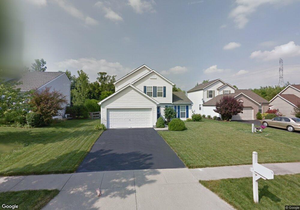
2002 Weber Rd Loveland, OH 45140
Outer Loveland NeighborhoodEstimated Value: $331,000 - $361,841
3
Beds
3
Baths
1,550
Sq Ft
$227/Sq Ft
Est. Value
About This Home
This home is located at 2002 Weber Rd, Loveland, OH 45140 and is currently estimated at $352,210, approximately $227 per square foot. 2002 Weber Rd is a home located in Clermont County with nearby schools including Milford Senior High School, Milford Christian Academy, and St. Andrew - St. Elizabeth Ann Seton School.
Ownership History
Date
Name
Owned For
Owner Type
Purchase Details
Closed on
Jul 20, 2007
Sold by
Modery Anne Marie and Modery Richard G
Bought by
Upton Terry
Current Estimated Value
Home Financials for this Owner
Home Financials are based on the most recent Mortgage that was taken out on this home.
Original Mortgage
$159,900
Outstanding Balance
$101,034
Interest Rate
6.71%
Mortgage Type
Purchase Money Mortgage
Estimated Equity
$251,176
Purchase Details
Closed on
Feb 18, 2004
Sold by
Hoelscher Karrie A
Bought by
Modery Anne Marie
Purchase Details
Closed on
Dec 2, 1999
Sold by
M/I Schottenstein Homes
Bought by
Hoelscher Karrie A
Home Financials for this Owner
Home Financials are based on the most recent Mortgage that was taken out on this home.
Original Mortgage
$139,700
Interest Rate
7.97%
Mortgage Type
VA
Create a Home Valuation Report for This Property
The Home Valuation Report is an in-depth analysis detailing your home's value as well as a comparison with similar homes in the area
Home Values in the Area
Average Home Value in this Area
Purchase History
| Date | Buyer | Sale Price | Title Company |
|---|---|---|---|
| Upton Terry | $159,900 | Prodigy Title Agency | |
| Modery Anne Marie | $146,000 | First Title Agency Inc | |
| Hoelscher Karrie A | $139,716 | -- |
Source: Public Records
Mortgage History
| Date | Status | Borrower | Loan Amount |
|---|---|---|---|
| Open | Upton Terry | $159,900 | |
| Previous Owner | Hoelscher Karrie A | $139,700 |
Source: Public Records
Tax History Compared to Growth
Tax History
| Year | Tax Paid | Tax Assessment Tax Assessment Total Assessment is a certain percentage of the fair market value that is determined by local assessors to be the total taxable value of land and additions on the property. | Land | Improvement |
|---|---|---|---|---|
| 2024 | $4,132 | $89,780 | $18,170 | $71,610 |
| 2023 | $4,175 | $89,780 | $18,170 | $71,610 |
| 2022 | $3,802 | $62,270 | $12,600 | $49,670 |
| 2021 | $3,806 | $62,270 | $12,600 | $49,670 |
| 2020 | $3,649 | $62,270 | $12,600 | $49,670 |
| 2019 | $3,943 | $64,020 | $12,600 | $51,420 |
| 2018 | $3,945 | $64,020 | $12,600 | $51,420 |
| 2017 | $3,585 | $64,020 | $12,600 | $51,420 |
| 2016 | $3,616 | $53,340 | $10,500 | $42,840 |
| 2015 | $3,344 | $53,340 | $10,500 | $42,840 |
| 2014 | $3,344 | $53,340 | $10,500 | $42,840 |
| 2013 | $3,084 | $47,710 | $11,200 | $36,510 |
Source: Public Records
Map
Nearby Homes
- 1803 Wheatfield Way
- 2013 Weber Rd
- 1140 Weber Rd
- 6211 Spires Dr
- 5933 Firm Stance Dr
- 6108 Donna Jay Dr
- 6320 Ashford Dr
- 6149 Century Farm Dr
- 6141 Brandywine Ct
- 1376 Barre Ln
- 1064 Weber Rd
- 6395 Barre Rd
- 6467 Smith Rd
- 1124 Clover Field Dr
- 6077 Branch Hill Guinea Pike
- 1113 Clover Field Dr
- 1513 Charleston Ln
- 6379 Derbyshire Ln
- 6211 Cook Rd
- 1285 State Rte 28
- 2004 Weber Rd
- 2000 Weber Rd
- 2006 Weber Rd
- 1998 Weber Rd
- 2003 Weber Rd
- 2005 Weber Rd
- 1996 Weber Rd
- 2001 Weber Rd
- 1524 Summit Ridge Rd
- 1522 Summit Ridge Rd
- 1526 Summit Ridge Rd
- 2007 Weber Rd
- 1520 Summit Ridge Rd
- 1520 Summit Ridge
- 1518 Summit Ridge Rd
- 1995 Weber Rd
- 1997 Weber Rd
- 1528 Summit Ridge Rd
- 2009 Weber Rd
- 2011 Weber Rd