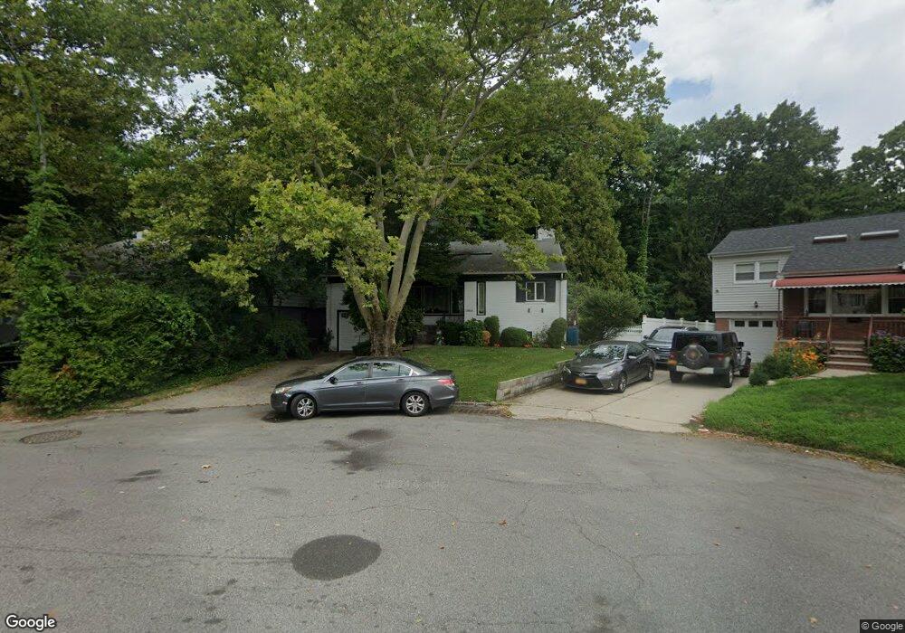
20021 Keno Ave Hollis, NY 11423
Holliswood NeighborhoodEstimated Value: $682,436 - $843,000
--
Bed
--
Bath
1,440
Sq Ft
$534/Sq Ft
Est. Value
About This Home
This home is located at 20021 Keno Ave, Hollis, NY 11423 and is currently estimated at $769,109, approximately $534 per square foot. 20021 Keno Ave is a home located in Queens County with nearby schools including The Bellaire School, Jean Nuzzi Intermediate School, and The Wellspring Schools.
Ownership History
Date
Name
Owned For
Owner Type
Purchase Details
Closed on
Jun 15, 2005
Sold by
Germain Frantzie and Germain Ronald
Bought by
Gray Natasha and Joassainte Joseph A
Current Estimated Value
Home Financials for this Owner
Home Financials are based on the most recent Mortgage that was taken out on this home.
Original Mortgage
$345,600
Outstanding Balance
$180,075
Interest Rate
5.73%
Mortgage Type
Purchase Money Mortgage
Estimated Equity
$589,034
Create a Home Valuation Report for This Property
The Home Valuation Report is an in-depth analysis detailing your home's value as well as a comparison with similar homes in the area
Home Values in the Area
Average Home Value in this Area
Purchase History
| Date | Buyer | Sale Price | Title Company |
|---|---|---|---|
| Gray Natasha | $432,000 | -- | |
| Gray Natasha | $432,000 | -- |
Source: Public Records
Mortgage History
| Date | Status | Borrower | Loan Amount |
|---|---|---|---|
| Open | Gray Natasha | $345,600 | |
| Closed | Gray Natasha | $345,600 |
Source: Public Records
Tax History Compared to Growth
Tax History
| Year | Tax Paid | Tax Assessment Tax Assessment Total Assessment is a certain percentage of the fair market value that is determined by local assessors to be the total taxable value of land and additions on the property. | Land | Improvement |
|---|---|---|---|---|
| 2025 | $6,395 | $34,634 | $11,240 | $23,394 |
| 2024 | $6,408 | $33,242 | $10,421 | $22,821 |
| 2023 | $6,197 | $32,256 | $9,699 | $22,557 |
| 2022 | $6,127 | $39,960 | $13,260 | $26,700 |
| 2021 | $6,083 | $38,220 | $13,260 | $24,960 |
| 2020 | $5,813 | $34,560 | $13,260 | $21,300 |
| 2019 | $5,502 | $31,680 | $13,260 | $18,420 |
| 2018 | $5,182 | $26,880 | $13,260 | $13,620 |
| 2017 | $5,158 | $26,775 | $13,062 | $13,713 |
| 2016 | $4,740 | $26,775 | $13,062 | $13,713 |
| 2015 | $2,855 | $24,052 | $14,695 | $9,357 |
| 2014 | $2,855 | $23,085 | $12,653 | $10,432 |
Source: Public Records
Map
Nearby Homes
- 86-70 Francis Lewis Blvd Unit A-44
- 86-70 Francis Lewis Blvd Unit A55
- 86-70 Francis Lewis Blvd Unit A-13
- 8730 204th St Unit A61
- 87-30 204th St Unit B48
- 87-30 204th St Unit A-78
- 87-30 204th St Unit B55
- 8649 Dunton St
- 87-10 204th St Unit B-28
- 87-10 204th St Unit A-62
- 8719 204th St Unit A41
- 87-15 204th St Unit B57
- 87-50 204 St Unit B46
- 87-50 204 St Unit A72
- 87-50 204th St Unit A66
- 87-50 204 St Unit B74
- 8750 204th St Unit A72
- 198-31 Pompeii Ave
- 198-02 Pompeii Ave Unit 1 B
- 87-40 Francis Lewis Blvd Unit A76
- 20021 Keno Ave
- 20017 Keno Ave
- 200-17 Keno Ave
- 20025 Keno Ave
- 20011 Keno Ave
- 8683 Dunton St
- 200-28 Keno Ave
- 20005 Keno Ave
- 20028 Keno Ave
- 20014 Keno Ave
- 20014 Keno Ave
- 200-20 Keno Ave
- 20020 Keno Ave
- 200-08 Keno Ave
- 20024 Keno Ave
- 8667 Dunton St
- 20008 Keno Ave
- 8676 Dunton St
- 8670 Dunton St
- 8711 Dunton St