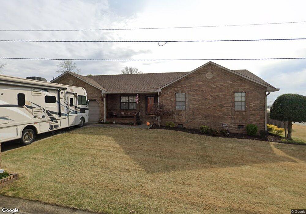
2003 Julie Ann Ln Paragould, AR 72450
Estimated Value: $233,000 - $253,000
--
Bed
2
Baths
1,810
Sq Ft
$134/Sq Ft
Est. Value
About This Home
This home is located at 2003 Julie Ann Ln, Paragould, AR 72450 and is currently estimated at $241,933, approximately $133 per square foot. 2003 Julie Ann Ln is a home located in Greene County with nearby schools including Greene County Tech Primary School, Greene County Tech Elementary School, and Greene County Tech Intermediate School.
Ownership History
Date
Name
Owned For
Owner Type
Purchase Details
Closed on
Dec 4, 1998
Bought by
Jeffery Scott and Angela Gail Cupples
Current Estimated Value
Purchase Details
Closed on
Jan 2, 1998
Bought by
Davenport
Purchase Details
Closed on
May 5, 1994
Bought by
Samuel Lee and Sherri Leah Hays
Purchase Details
Closed on
Mar 2, 1994
Bought by
Douglas Mcleskey and Steve Mcleskey D
Create a Home Valuation Report for This Property
The Home Valuation Report is an in-depth analysis detailing your home's value as well as a comparison with similar homes in the area
Home Values in the Area
Average Home Value in this Area
Purchase History
| Date | Buyer | Sale Price | Title Company |
|---|---|---|---|
| Jeffery Scott | $126,000 | -- | |
| Davenport | $120,000 | -- | |
| Samuel Lee | $13,000 | -- | |
| Douglas Mcleskey | -- | -- |
Source: Public Records
Tax History Compared to Growth
Tax History
| Year | Tax Paid | Tax Assessment Tax Assessment Total Assessment is a certain percentage of the fair market value that is determined by local assessors to be the total taxable value of land and additions on the property. | Land | Improvement |
|---|---|---|---|---|
| 2025 | $1,237 | $37,610 | $7,500 | $30,110 |
| 2024 | $1,237 | $37,610 | $7,500 | $30,110 |
| 2023 | $1,237 | $29,010 | $6,450 | $22,560 |
| 2022 | $862 | $29,010 | $6,450 | $22,560 |
| 2021 | $862 | $29,010 | $6,450 | $22,560 |
| 2020 | $1,237 | $28,740 | $5,400 | $23,340 |
| 2019 | $862 | $28,740 | $5,400 | $23,340 |
| 2018 | $887 | $28,740 | $5,400 | $23,340 |
| 2017 | $1,199 | $28,740 | $5,400 | $23,340 |
| 2016 | $849 | $28,740 | $5,400 | $23,340 |
| 2015 | $1,183 | $26,400 | $7,200 | $19,200 |
| 2014 | $1,183 | $26,400 | $7,200 | $19,200 |
Source: Public Records
Map
Nearby Homes
- 2006 Julie Ann Ln
- 2800 Wildrose Cove
- 2106 Julie Ann Ln
- 2101 Wildrose Ln
- 2117 Jones Rd
- 1700 Birch St
- 2601 S 18th St
- 1910 Sequoia Trail
- 2205 S 19th St
- 2307 S 22nd St
- 2801 Linwood Dr
- 2100 Villa Ridge
- 2206 Linwood Dr
- 2721 Honey Bee Ln
- 000 U S Highway 412
- 11 U S Highway 412
- Tract 2 U S Highway 412
- 11.43 Acres U S Highway 412
- 14.48 Acres U S Highway 412 Unit Walcott Road
- 7209 U S Highway 412
- 2806 Mockingbird Ln
- 2005 Julie Ann Ln
- 2007 Julie Ann Ln
- 2008 Julie Ann Ln
- 2807 Mockingbird Ln
- 2009 Julie Ann Ln
- 2800 Mockingbird Ln
- 2100 Julie Ann Ln
- 2906 Mockingbird Ln
- 0 Mockingbird Unit 20038501
- 0 Mockingbird Unit 20036828
- 0 Mockingbird Unit 17031743
- 0 Mockingbird Unit 16005845
- 0 Mockingbird Unit 16009872
- 0 Mockingbird Unit 18001727
- 0 Mockingbird Unit 17018286
- 0 Mockingbird Unit 17022504
- 0 Mockingbird Unit 17022508
- 0 Mockingbird Unit 17023889
- 0 Mockingbird Unit 1 17031667