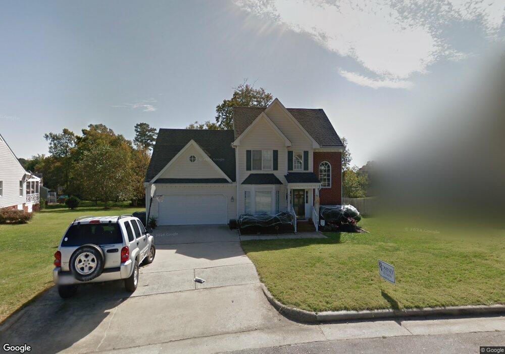
2003 Keokuk Ct Apex, NC 27523
West Cary NeighborhoodEstimated Value: $506,000 - $541,332
3
Beds
3
Baths
2,001
Sq Ft
$262/Sq Ft
Est. Value
About This Home
This home is located at 2003 Keokuk Ct, Apex, NC 27523 and is currently estimated at $524,083, approximately $261 per square foot. 2003 Keokuk Ct is a home located in Wake County with nearby schools including Salem Elementary, Salem Middle, and Green Hope High.
Ownership History
Date
Name
Owned For
Owner Type
Purchase Details
Closed on
Jan 19, 2018
Sold by
Beatty Michael Scott and Beatty Maryellen
Bought by
Emmanuel Robins and Emmanuel Crisma J
Current Estimated Value
Home Financials for this Owner
Home Financials are based on the most recent Mortgage that was taken out on this home.
Original Mortgage
$225,250
Outstanding Balance
$190,084
Interest Rate
3.94%
Mortgage Type
New Conventional
Estimated Equity
$333,999
Purchase Details
Closed on
Jun 3, 2010
Sold by
Knoke Bert W and Knoke Karyn L
Bought by
Beatty Michael Scott and Beatty Mary
Home Financials for this Owner
Home Financials are based on the most recent Mortgage that was taken out on this home.
Original Mortgage
$189,776
Interest Rate
5.12%
Mortgage Type
FHA
Purchase Details
Closed on
Jan 16, 1998
Sold by
Knoke Bert W and Knoke Karyn L
Bought by
Knoke Bert W and Knoke Karyn L
Create a Home Valuation Report for This Property
The Home Valuation Report is an in-depth analysis detailing your home's value as well as a comparison with similar homes in the area
Home Values in the Area
Average Home Value in this Area
Purchase History
| Date | Buyer | Sale Price | Title Company |
|---|---|---|---|
| Emmanuel Robins | $265,000 | None Available | |
| Beatty Michael Scott | $232,000 | None Available | |
| Knoke Bert W | -- | -- |
Source: Public Records
Mortgage History
| Date | Status | Borrower | Loan Amount |
|---|---|---|---|
| Open | Emmanuel Robins | $225,250 | |
| Previous Owner | Beatty Michael Scott | $189,776 |
Source: Public Records
Tax History
| Year | Tax Paid | Tax Assessment Tax Assessment Total Assessment is a certain percentage of the fair market value that is determined by local assessors to be the total taxable value of land and additions on the property. | Land | Improvement |
|---|---|---|---|---|
| 2025 | $4,361 | $497,212 | $200,000 | $297,212 |
| 2024 | $4,264 | $497,212 | $200,000 | $297,212 |
Source: Public Records
Map
Nearby Homes
- 2013 Keokuk Ct
- 700 Oak Ridge Dr
- 1808 Beaudet Ln
- 112 Del Rio Dr
- 105 Holmhurst Ct
- 2300 Walden Creek Dr
- 416 Hopwood Way
- 479 Clark Creek Ln
- 6716 Valley Woods Ln
- 105 Catchpenny Ct
- 1624 Shepherds Glade Dr
- 610 Wakehurst Dr
- 552 Rowanwood Way
- 538 Rowanwood Way
- 100 Wentbridge Rd
- 103 Jordan Creek Dr
- 309 Amiable Loop
- 427 Eyam Hall Ln
- 434 Eyam Hall Ln
- 2134 Grouse Ski Cir
- 2005 Keokuk Ct
- 2001 Keokuk Ct
- 508 Pointe Grove Ln
- 508 Pointe Grove Ln Unit Lot 32-Spec
- 504 Pointe Grove Ln
- 1903 Battlewood Rd
- 2007 Keokuk Ct
- 512 Pointe Grove Ln Unit 31
- 2002 Keokuk Ct
- 516 Pointe Grove Ln
- 500 Pointe Grove Ln Unit Lot 34- Presale
- 2009 Keokuk Ct
- 1809 Castleburg Dr
- 1807 Castleburg Dr
- 2008 Keokuk Ct
- 520 Pointe Grove Ln
- 1909 Keokuk Ct
- 501 Pointe Grove Ln
- 501 Pointe Grove Ln Unit Lot 35-Presale
- 2001 Catskill Ct
Your Personal Tour Guide
Ask me questions while you tour the home.