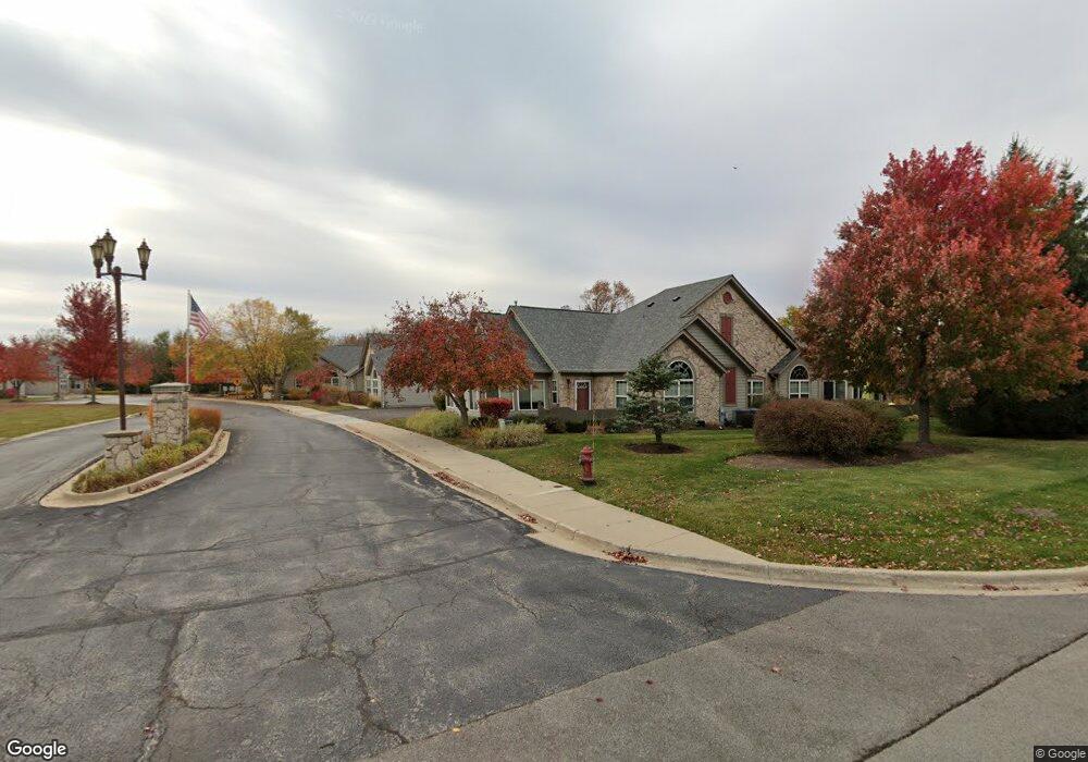
2003 Olmstead Dr Unit 7D Woodstock, IL 60098
Estimated Value: $196,000 - $270,000
--
Bed
--
Bath
--
Sq Ft
0.32
Acres
About This Home
This home is located at 2003 Olmstead Dr Unit 7D, Woodstock, IL 60098 and is currently estimated at $236,667. 2003 Olmstead Dr Unit 7D is a home located in McHenry County with nearby schools including Prairiewood Elementary School, Creekside Middle School, and Woodstock High School.
Ownership History
Date
Name
Owned For
Owner Type
Purchase Details
Closed on
May 17, 2011
Sold by
Boho John
Bought by
Maple Trees Llc
Current Estimated Value
Purchase Details
Closed on
Nov 20, 2008
Sold by
The Maples At Woodstock Llc and 2019 Olmstead Dr D Richard Olmstead
Bought by
Sugar Maple Llc
Purchase Details
Closed on
Jun 25, 2008
Sold by
The Maples At Woodstock Llc
Bought by
Lockwood Paul E and Baker Lockwood Diane M
Home Financials for this Owner
Home Financials are based on the most recent Mortgage that was taken out on this home.
Original Mortgage
$192,000
Interest Rate
5.96%
Mortgage Type
Purchase Money Mortgage
Create a Home Valuation Report for This Property
The Home Valuation Report is an in-depth analysis detailing your home's value as well as a comparison with similar homes in the area
Home Values in the Area
Average Home Value in this Area
Purchase History
| Date | Buyer | Sale Price | Title Company |
|---|---|---|---|
| Maple Trees Llc | -- | None Available | |
| Sugar Maple Llc | $550,000 | Lawyers Title | |
| Lockwood Paul E | $240,000 | Chicago Title Insurance Co |
Source: Public Records
Mortgage History
| Date | Status | Borrower | Loan Amount |
|---|---|---|---|
| Previous Owner | Lockwood Paul E | $192,000 |
Source: Public Records
Tax History Compared to Growth
Tax History
| Year | Tax Paid | Tax Assessment Tax Assessment Total Assessment is a certain percentage of the fair market value that is determined by local assessors to be the total taxable value of land and additions on the property. | Land | Improvement |
|---|---|---|---|---|
| 2024 | $1,057 | $11,470 | $11,470 | -- |
| 2023 | $1,015 | $10,373 | $10,373 | -- |
| 2022 | $949 | $9,206 | $9,206 | $0 |
| 2021 | $908 | $8,601 | $8,601 | $0 |
| 2020 | $878 | $8,173 | $8,173 | $0 |
| 2019 | $951 | $8,669 | $8,669 | $0 |
| 2018 | $1,102 | $9,889 | $9,889 | $0 |
| 2017 | $1,089 | $9,307 | $9,307 | $0 |
| 2016 | $1,088 | $8,618 | $8,618 | $0 |
| 2013 | -- | $13,350 | $13,350 | $0 |
Source: Public Records
Map
Nearby Homes
- Lot 5 Olmstead Dr
- Lot 2 Olmstead Dr
- lot 1 Mcconnell Rd
- 2108 Aspen Dr
- 2525 Applewood Ln
- 2101 Preswick Ln
- 2019 Aspen Dr
- 2101 Red Barn Ct
- 2021 Aspen Dr
- Lot #23 Ridgemoor Trail
- Lot #22 Ridgemoor Trail
- Lot #21 Ridgemoor Trail
- Lot #34 W Longwood Dr
- Lot #33 W Longwood Dr
- Lot #28 W Longwood Dr
- Lot #29 W Longwood Dr
- 2417 Fairview Cir
- 1624 Bull Valley Dr
- 1480 W Longwood Dr
- 1601 Bobolink Cir
- 2003 Olmstead Dr
- 2001 Olmstead Dr
- 2001 Olmstead Dr Unit 2001
- 2001 Olmstead Dr Unit B
- 2001 Olmstead Dr Unit 1B
- 2005 Olmstead Dr
- 2250 Applewood Ln
- 2260 Applewood Ln
- 2013 Olmstead Dr
- 2013 Olmstead Dr Unit 9A
- 2220 Applewood Ln
- 2010 Olmstead Dr
- 2014 Olmstead Dr Unit 3D
- 2012 Olmstead Dr
- 2008 Olmstead Dr
- 2012 Olmstead Dr Unit 2012
- 2014 Olmstead Dr Unit DR
- 2012 Olmstead Dr Unit 3B
- 2270 Applewood Ln
- 2019 Olmstead Dr Unit 9D