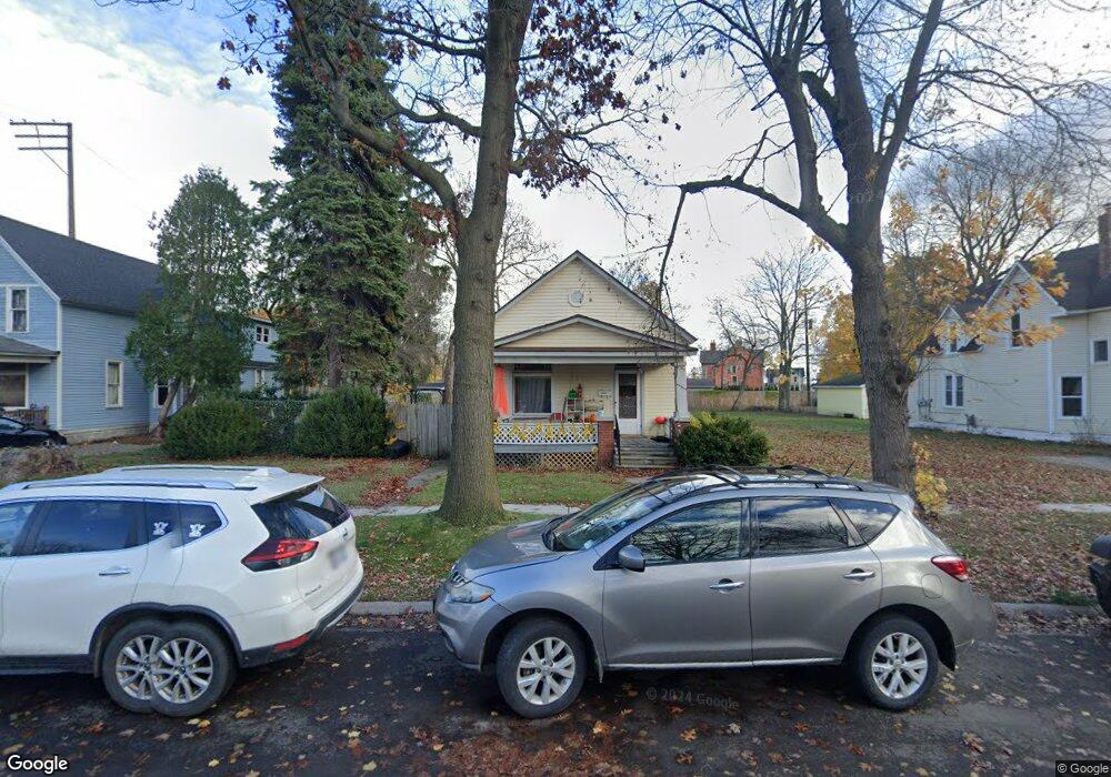
2004 7th St Port Huron, MI 48060
Estimated Value: $111,801 - $145,000
2
Beds
1
Bath
1,180
Sq Ft
$105/Sq Ft
Est. Value
About This Home
This home is located at 2004 7th St, Port Huron, MI 48060 and is currently estimated at $124,200, approximately $105 per square foot. 2004 7th St is a home located in St. Clair County with nearby schools including Woodrow Wilson Elementary School, Central Middle School, and Port Huron High School.
Ownership History
Date
Name
Owned For
Owner Type
Purchase Details
Closed on
Aug 26, 2015
Sold by
Federal Home Loan Mortgage Corporation
Bought by
Union Properties Ii Llc
Current Estimated Value
Purchase Details
Closed on
Mar 26, 2015
Sold by
Jankowski David M and Jankowski Kaloha
Bought by
Federal Home Loan Mortgage Corporation
Create a Home Valuation Report for This Property
The Home Valuation Report is an in-depth analysis detailing your home's value as well as a comparison with similar homes in the area
Home Values in the Area
Average Home Value in this Area
Purchase History
| Date | Buyer | Sale Price | Title Company |
|---|---|---|---|
| Union Properties Ii Llc | -- | Attorney | |
| Union Properties Ii Llc | $22,500 | A S K Services Inc | |
| Federal Home Loan Mortgage Corporation | $21,129 | None Available |
Source: Public Records
Tax History
| Year | Tax Paid | Tax Assessment Tax Assessment Total Assessment is a certain percentage of the fair market value that is determined by local assessors to be the total taxable value of land and additions on the property. | Land | Improvement |
|---|---|---|---|---|
| 2025 | $1,369 | $48,400 | $0 | $0 |
| 2024 | $1,331 | $45,800 | $0 | $0 |
| 2023 | $1,261 | $40,500 | $0 | $0 |
| 2022 | $1,220 | $33,600 | $0 | $0 |
| 2020 | $1,170 | $25,700 | $25,700 | $0 |
| 2019 | $1,149 | $18,000 | $0 | $0 |
| 2018 | $1,124 | $18,000 | $0 | $0 |
| 2017 | $1,032 | $16,900 | $0 | $0 |
| 2016 | $910 | $16,900 | $0 | $0 |
| 2015 | $627 | $16,900 | $16,900 | $0 |
| 2014 | $627 | $17,500 | $17,500 | $0 |
| 2013 | -- | $18,800 | $0 | $0 |
Source: Public Records
Map
Nearby Homes
- 738 Bancroft St
- 1918 7th St
- 1712 7th St
- 1623 8th St
- 727 Griswold St
- 926 Griswold St
- 1831 11th St
- 2444 Military St
- 1127 Minnie St
- 835 Vanderburgh Place
- 1804 12th St
- 1132 Griswold St
- 1133 Chestnut St
- 1334 Beard St
- 822 Wall St
- 828 Wall St
- 1311 12th St
- 1100 10th St Unit 1124
- 1403 Catherine McAuley Dr
- 2704 Military St
Your Personal Tour Guide
Ask me questions while you tour the home.