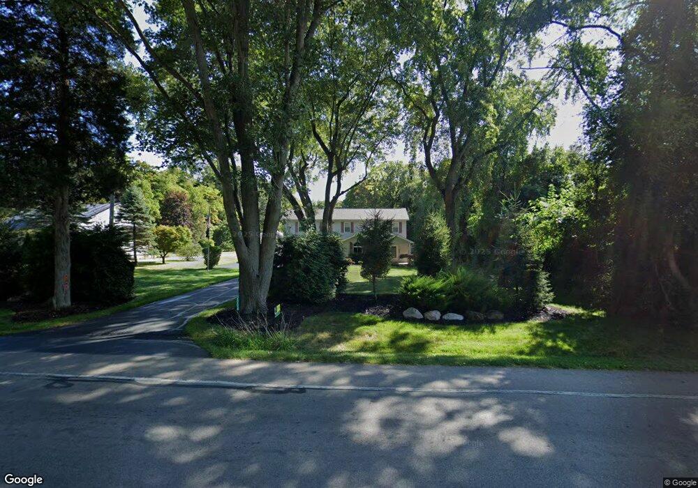
2004 King Rd Toledo, OH 43617
Estimated Value: $250,000 - $432,000
3
Beds
3
Baths
2,868
Sq Ft
$119/Sq Ft
Est. Value
About This Home
This home is located at 2004 King Rd, Toledo, OH 43617 and is currently estimated at $341,477, approximately $119 per square foot. 2004 King Rd is a home located in Lucas County with nearby schools including Dorr Street Elementary School, Springfield Middle School, and Springfield High School.
Ownership History
Date
Name
Owned For
Owner Type
Purchase Details
Closed on
Nov 9, 2023
Sold by
Smenner Bruce A and Smenner Wendy A
Bought by
Northwest Ohio Inc
Current Estimated Value
Home Financials for this Owner
Home Financials are based on the most recent Mortgage that was taken out on this home.
Original Mortgage
$212,500
Outstanding Balance
$179,233
Interest Rate
6.78%
Mortgage Type
Credit Line Revolving
Estimated Equity
$162,244
Purchase Details
Closed on
Nov 8, 2023
Sold by
Northwest Ohio Inc
Bought by
Smenner Bruce A and Smenner Wendy A
Home Financials for this Owner
Home Financials are based on the most recent Mortgage that was taken out on this home.
Original Mortgage
$212,500
Outstanding Balance
$179,233
Interest Rate
6.78%
Mortgage Type
Credit Line Revolving
Estimated Equity
$162,244
Purchase Details
Closed on
Nov 23, 2022
Sold by
All Ours 2014 Llc
Bought by
Midland Agency Of Northwest Ohio Inc
Purchase Details
Closed on
Jan 31, 2017
Sold by
King Rd 2004 Llc
Bought by
All Ours 2014 Llc
Purchase Details
Closed on
Oct 15, 2015
Sold by
Delanie Properties Llc
Bought by
King Rd 2004 Llc
Purchase Details
Closed on
May 9, 2014
Sold by
Smenner Bruce A and Smenner Wendy
Bought by
Delanie Properties Llc
Purchase Details
Closed on
Sep 19, 1994
Sold by
Gleason Jay J
Bought by
Smenner Bruce A and Smenner Wendy
Home Financials for this Owner
Home Financials are based on the most recent Mortgage that was taken out on this home.
Original Mortgage
$52,250
Interest Rate
8.44%
Mortgage Type
New Conventional
Create a Home Valuation Report for This Property
The Home Valuation Report is an in-depth analysis detailing your home's value as well as a comparison with similar homes in the area
Home Values in the Area
Average Home Value in this Area
Purchase History
| Date | Buyer | Sale Price | Title Company |
|---|---|---|---|
| Northwest Ohio Inc | -- | None Listed On Document | |
| Smenner Bruce A | -- | None Listed On Document | |
| Midland Agency Of Northwest Ohio Inc | -- | -- | |
| All Ours 2014 Llc | -- | None Available | |
| King Rd 2004 Llc | $126,000 | None Available | |
| Delanie Properties Llc | $125,000 | Manattan Title Agency | |
| Smenner Bruce A | $55,000 | -- |
Source: Public Records
Mortgage History
| Date | Status | Borrower | Loan Amount |
|---|---|---|---|
| Open | Smenner Bruce A | $212,500 | |
| Previous Owner | Smenner Bruce A | $52,250 |
Source: Public Records
Tax History
| Year | Tax Paid | Tax Assessment Tax Assessment Total Assessment is a certain percentage of the fair market value that is determined by local assessors to be the total taxable value of land and additions on the property. | Land | Improvement |
|---|---|---|---|---|
| 2025 | -- | $87,220 | $11,270 | $75,950 |
| 2024 | $2,686 | $87,220 | $11,270 | $75,950 |
| 2023 | $4,360 | $58,380 | $10,010 | $48,370 |
| 2022 | $4,350 | $58,380 | $10,010 | $48,370 |
| 2021 | $4,108 | $58,380 | $10,010 | $48,370 |
| 2020 | $3,836 | $49,175 | $7,980 | $41,195 |
| 2019 | $3,754 | $49,175 | $7,980 | $41,195 |
| 2018 | $3,661 | $49,175 | $7,980 | $41,195 |
| 2017 | $3,593 | $43,750 | $7,875 | $35,875 |
| 2016 | $3,625 | $125,000 | $22,500 | $102,500 |
| 2015 | $3,620 | $125,000 | $22,500 | $102,500 |
| 2014 | $3,481 | $49,570 | $7,880 | $41,690 |
| 2013 | $3,481 | $49,570 | $7,880 | $41,690 |
Source: Public Records
Map
Nearby Homes
- 2015 King Rd
- 2117 Sunset Creek Dr
- 7233 Turncreek Dr
- 2300 Whispering Pines Dr
- 1053 Plum Grove Ln
- 1025 Plum Grove Ln
- 1015 Plumcreek Rd
- 6957 Cloister Rd
- 608 Tall Pines Dr
- 812 Meadowchase Ln
- 6955 Dorr St Unit 64
- 817 Wind Breeze Dr
- 2110 Austin Bluffs Ct
- 7028 Shooters Hill Rd
- 2132 The Bluffs Unit 2132
- 7043 Mourning Dove Ct
- 7035 Mourning Dove Ct
- 2355 Parliament Square
- 6830 Regents Park Blvd
- 8241 Bucks Run Ct
- 2014 King Rd
- 2030 King Rd
- 1940 King Rd
- 1935 King Rd
- 1906 King Rd
- 2102 King Rd
- 7417 Turncreek Dr
- 1937 Sunset Creek Dr
- 1929 Sunset Creek Dr
- 1929 Sunset Creek Dr Unit 44
- 1921 Sunset Creek Dr
- 1945 Sunset Creek Dr
- 2015 King Rd Unit 45
- 1953 Sunset Creek Dr
- 1844 King Rd
- 1941 Sunrise Creek Dr
- 7409 Turncreek Dr
- 1834 King Rd
- 1905 King Rd
- 7401 Turncreek Dr
Your Personal Tour Guide
Ask me questions while you tour the home.