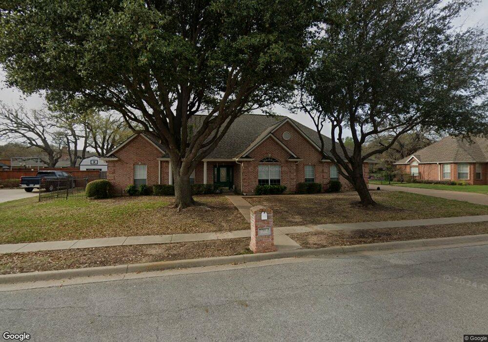
2004 Maplewood Dr Weatherford, TX 76087
Estimated Value: $385,981 - $431,000
3
Beds
2
Baths
2,132
Sq Ft
$193/Sq Ft
Est. Value
About This Home
This home is located at 2004 Maplewood Dr, Weatherford, TX 76087 and is currently estimated at $410,495, approximately $192 per square foot. 2004 Maplewood Dr is a home located in Parker County with nearby schools including Austin Elementary School, Hall Middle School, and Weatherford High School.
Ownership History
Date
Name
Owned For
Owner Type
Purchase Details
Closed on
Jun 1, 2021
Sold by
Degrand John L
Bought by
Degrand Donna K
Current Estimated Value
Purchase Details
Closed on
Aug 8, 2008
Sold by
Windels R Leonard and Windels Laura
Bought by
Degrand John L and Degrand Donna K
Home Financials for this Owner
Home Financials are based on the most recent Mortgage that was taken out on this home.
Original Mortgage
$192,596
Interest Rate
6.47%
Mortgage Type
Purchase Money Mortgage
Create a Home Valuation Report for This Property
The Home Valuation Report is an in-depth analysis detailing your home's value as well as a comparison with similar homes in the area
Home Values in the Area
Average Home Value in this Area
Purchase History
| Date | Buyer | Sale Price | Title Company |
|---|---|---|---|
| Degrand Donna K | -- | None Listed On Document | |
| Degrand John L | -- | Stnt |
Source: Public Records
Mortgage History
| Date | Status | Borrower | Loan Amount |
|---|---|---|---|
| Previous Owner | Degrand John L | $192,596 |
Source: Public Records
Tax History Compared to Growth
Tax History
| Year | Tax Paid | Tax Assessment Tax Assessment Total Assessment is a certain percentage of the fair market value that is determined by local assessors to be the total taxable value of land and additions on the property. | Land | Improvement |
|---|---|---|---|---|
| 2025 | $3,145 | $396,670 | $50,000 | $346,670 |
| 2024 | $3,145 | $360,987 | -- | -- |
| 2023 | $3,145 | $328,170 | $0 | $0 |
| 2022 | $6,618 | $298,340 | $30,000 | $268,340 |
| 2021 | $7,165 | $298,340 | $30,000 | $268,340 |
| 2020 | $6,554 | $271,240 | $30,000 | $241,240 |
| 2019 | $6,458 | $271,240 | $30,000 | $241,240 |
| 2018 | $5,897 | $229,890 | $30,000 | $199,890 |
| 2017 | $6,049 | $229,890 | $30,000 | $199,890 |
| 2016 | $5,439 | $206,690 | $30,000 | $176,690 |
| 2015 | $5,326 | $206,690 | $30,000 | $176,690 |
| 2014 | -- | $194,940 | $30,000 | $164,940 |
Source: Public Records
Map
Nearby Homes
- 1910 Maplewood Dr
- 2020 Maplewood Dr
- 2102 Clear Creek Dr
- 104 Carriage Hill Ct
- 1905 Clear Creek Dr
- 2116 Clear Lake Rd
- 2214 Lake Country Dr
- 2113 Country Brook Dr
- 2218 Lake Country Dr
- 2202 Lakeforest Dr
- 2001 Santa fe Dr
- 344 Clear Lake Ln
- 128 Black Forest Dr
- 118 Black Forest Dr
- 101 Black Forest Dr
- 105 Country Green Ct
- 1421 Highlake Ln
- 115 Autumn Springs Ct
- 207 Camelot Dr
- 221 Arapahoe Ridge
- 2000 Maplewood Dr
- 2008 Maplewood Dr
- 1917 Country Brook Dr
- 2001 Maplewood Dr
- 2005 Maplewood Dr
- 1919 Country Brook Dr
- 1915 Country Brook Dr
- 1926 Maplewood Dr
- 2012 Maplewood Dr
- 2214 Springwood Ln
- 1921 Country Brook Dr
- 1916 Country Brook Dr
- 2213 Pebblebrook Dr
- 1929 Maplewood Dr
- 2013 Maplewood Dr
- 1918 Country Brook Dr
- 1913 Country Brook Dr
- 1914 Country Brook Dr
- 2210 Springwood Ln
- 1920 Country Brook Dr