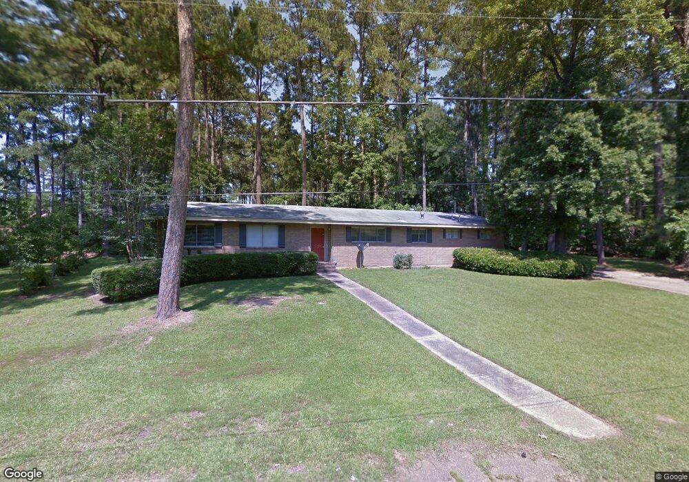
2004 Roosevelt Dr Ruston, LA 71270
Estimated Value: $194,000 - $251,000
4
Beds
2
Baths
3,525
Sq Ft
$60/Sq Ft
Est. Value
About This Home
This home is located at 2004 Roosevelt Dr, Ruston, LA 71270 and is currently estimated at $211,942, approximately $60 per square foot. 2004 Roosevelt Dr is a home located in Lincoln Parish with nearby schools including Cypress Springs Elementary School, Glen View Elementary School, and Ruston Junior High School.
Ownership History
Date
Name
Owned For
Owner Type
Purchase Details
Closed on
May 1, 2009
Sold by
Moss James L and Moss Sally Denise
Bought by
Hearn Fred Douglas and Williams Lillie Christine
Current Estimated Value
Home Financials for this Owner
Home Financials are based on the most recent Mortgage that was taken out on this home.
Original Mortgage
$130,098
Outstanding Balance
$81,213
Interest Rate
5.03%
Mortgage Type
FHA
Estimated Equity
$130,729
Create a Home Valuation Report for This Property
The Home Valuation Report is an in-depth analysis detailing your home's value as well as a comparison with similar homes in the area
Purchase History
| Date | Buyer | Sale Price | Title Company |
|---|---|---|---|
| Hearn Fred Douglas | $132,500 | None Available |
Source: Public Records
Mortgage History
| Date | Status | Borrower | Loan Amount |
|---|---|---|---|
| Open | Hearn Fred Douglas | $130,098 |
Source: Public Records
Tax History
| Year | Tax Paid | Tax Assessment Tax Assessment Total Assessment is a certain percentage of the fair market value that is determined by local assessors to be the total taxable value of land and additions on the property. | Land | Improvement |
|---|---|---|---|---|
| 2025 | $1,282 | $15,018 | $3,107 | $11,911 |
| 2024 | $1,282 | $15,018 | $3,107 | $11,911 |
| 2023 | $1,372 | $15,438 | $1,606 | $13,832 |
| 2022 | $1,379 | $15,438 | $1,606 | $13,832 |
| 2021 | $1,276 | $15,438 | $1,606 | $13,832 |
| 2020 | $1,209 | $14,541 | $1,606 | $12,935 |
| 2019 | $1,181 | $14,541 | $1,606 | $12,935 |
| 2018 | $1,149 | $14,541 | $1,606 | $12,935 |
| 2017 | $1,152 | $14,541 | $1,606 | $12,935 |
| 2016 | $1,147 | $0 | $0 | $0 |
| 2015 | $1,115 | $12,986 | $1,460 | $11,526 |
| 2013 | $1,133 | $12,986 | $1,460 | $11,526 |
Source: Public Records
Map
Nearby Homes
- 2105 Franklin Ave
- 0 Tech Farm Rd
- 908 S Maple St
- 2103 Beech Ave
- 600 Robert St
- 601 Robert St
- 3100 Lakeview Place
- 606 University Blvd
- 1704 Wade Dr
- 1702 Wade Dr
- 3105 Lakeview Place
- 405 Barber Dr
- 1502 Shelor Dr
- 401 Barber Dr
- 406 University Blvd
- 000 W Barnett Springs Rd
- 165 Markia Dr
- 1506 Allen St
- 207 S Maple St
- 3264 Highway 818
- 2002 Roosevelt Dr
- 2000 Roosevelt Dr
- 2010 Roosevelt Dr
- 2009 Roosevelt Dr
- 1914 Roosevelt Dr
- 2001 Roosevelt Dr
- 2101 W California Ave
- 2001 W California Ave
- 1919 Roosevelt Dr
- 1915 Roosevelt Dr
- 1912 Roosevelt Dr
- 2109 W California Ave
- 1913 Roosevelt Dr
- 1911 Roosevelt Dr
- 1908 Roosevelt Dr
- 1909 Roosevelt Dr
- 2012 W California Ave
- 1410 S Maple St
- 2100 W California Plant Rd
- 2102 W California Ave
Your Personal Tour Guide
Ask me questions while you tour the home.