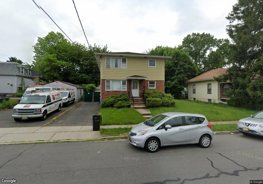
2005 Bond St Rahway, NJ 07065
Estimated Value: $588,065 - $653,000
--
Bed
--
Bath
1,924
Sq Ft
$317/Sq Ft
Est. Value
About This Home
This home is located at 2005 Bond St, Rahway, NJ 07065 and is currently estimated at $609,266, approximately $316 per square foot. 2005 Bond St is a home located in Union County with nearby schools including Rahway High School and Sunshine Academy.
Ownership History
Date
Name
Owned For
Owner Type
Purchase Details
Closed on
Dec 18, 2003
Sold by
Sapia Christine
Bought by
Smith Barry
Current Estimated Value
Home Financials for this Owner
Home Financials are based on the most recent Mortgage that was taken out on this home.
Original Mortgage
$290,700
Outstanding Balance
$134,705
Interest Rate
5.88%
Mortgage Type
VA
Estimated Equity
$474,561
Purchase Details
Closed on
Dec 12, 2000
Sold by
Sanchez Susan Wooten and Sapia Christine
Bought by
Sapia Christine
Purchase Details
Closed on
Apr 10, 2000
Sold by
Wooten John C and Wooten Susan
Bought by
Sanchez Susan Wooten and Sapia Christine
Purchase Details
Closed on
Feb 5, 1997
Sold by
Lafi Properties
Bought by
Wooten John C and Wooten Susan
Home Financials for this Owner
Home Financials are based on the most recent Mortgage that was taken out on this home.
Original Mortgage
$137,700
Interest Rate
7.6%
Create a Home Valuation Report for This Property
The Home Valuation Report is an in-depth analysis detailing your home's value as well as a comparison with similar homes in the area
Home Values in the Area
Average Home Value in this Area
Purchase History
| Date | Buyer | Sale Price | Title Company |
|---|---|---|---|
| Smith Barry | $290,000 | -- | |
| Sapia Christine | -- | -- | |
| Sanchez Susan Wooten | -- | -- | |
| Wooten John C | $153,000 | -- |
Source: Public Records
Mortgage History
| Date | Status | Borrower | Loan Amount |
|---|---|---|---|
| Open | Smith Barry | $290,700 | |
| Previous Owner | Wooten John C | $137,700 |
Source: Public Records
Tax History Compared to Growth
Tax History
| Year | Tax Paid | Tax Assessment Tax Assessment Total Assessment is a certain percentage of the fair market value that is determined by local assessors to be the total taxable value of land and additions on the property. | Land | Improvement |
|---|---|---|---|---|
| 2025 | $13,329 | $180,000 | $53,400 | $126,600 |
| 2024 | $12,910 | $180,000 | $53,400 | $126,600 |
| 2023 | $12,910 | $180,000 | $53,400 | $126,600 |
| 2022 | $12,640 | $180,000 | $53,400 | $126,600 |
| 2021 | $12,512 | $180,000 | $53,400 | $126,600 |
| 2020 | $12,465 | $180,000 | $53,400 | $126,600 |
| 2019 | $12,307 | $180,000 | $53,400 | $126,600 |
| 2018 | $12,047 | $180,000 | $53,400 | $126,600 |
| 2017 | $11,750 | $180,000 | $53,400 | $126,600 |
| 2016 | $11,500 | $180,000 | $53,400 | $126,600 |
| 2015 | $11,371 | $180,000 | $53,400 | $126,600 |
| 2014 | $11,167 | $180,000 | $53,400 | $126,600 |
Source: Public Records
Map
Nearby Homes
- 1860 Paterson St
- 36 E Grand Ave Unit 26
- 1727 Essex St Unit 604
- 566 E Milton Ave Unit 1
- 716 E Grand Ave Unit 4
- 716 E Grand Ave Unit 18
- 1922 Barnett St Unit 24
- 2046 Barnett St
- 2277 Price St
- 244 W Scott Ave
- 272 Egolf Dr
- 1811 W Price St
- 173 W Main St Unit 7
- 1435 Barnhardt Ln Unit 604
- 193 Donald Ave
- 211 Bradford Ave
- 1 Carriage City Plaza Unit 1502
- 1 Carriage City Plaza Unit 503
- 1 Carriage City Plaza Unit 1212
- 1 Carriage City Plaza Unit 711
- 1991 Bond St
- 309 E Scott Ave
- 297 E Scott Ave
- 297 E Scott Ave Unit 1
- 297 E Scott Ave Unit 2
- 317 E Scott Ave
- 1981 Bond St
- 323 E Scott Ave
- 2000 Lufberry St
- 1973 Bond St
- 1990 Lufberry St
- 2012 Lufberry St
- 1980 Lufberry St
- 1963 Bond St
- 2024 Lufberry St
- 1986 Bond St
- 1970 Lufberry St
- 1959 Bond St
- 1978 Bond St
- 1953 Bond St