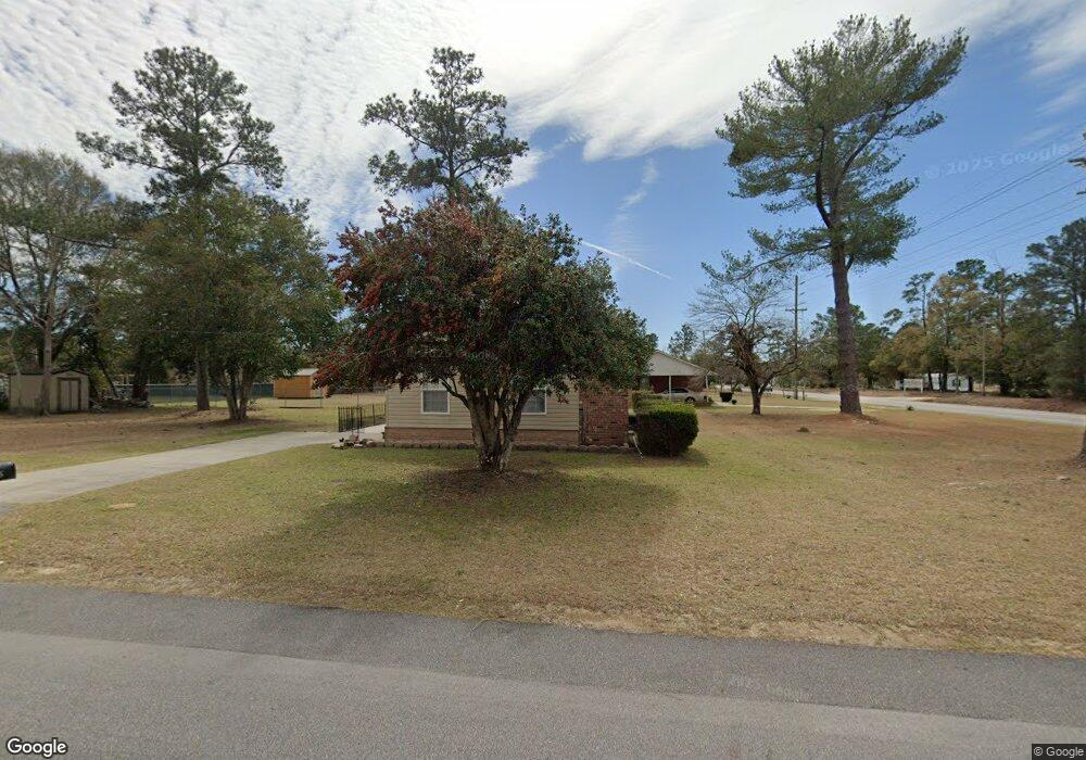
2005 Cannon Bridge Rd Cordova, SC 29039
Estimated Value: $137,000 - $158,000
3
Beds
1
Bath
1,290
Sq Ft
$113/Sq Ft
Est. Value
About This Home
This home is located at 2005 Cannon Bridge Rd, Cordova, SC 29039 and is currently estimated at $146,252, approximately $113 per square foot. 2005 Cannon Bridge Rd is a home located in Orangeburg County with nearby schools including Edisto Primary, Edisto Primary School, and Edisto Elementary School.
Ownership History
Date
Name
Owned For
Owner Type
Purchase Details
Closed on
Nov 7, 2006
Sold by
Frazier Roosevelt L and Frazier Maggie
Bought by
Felder Sandra
Current Estimated Value
Home Financials for this Owner
Home Financials are based on the most recent Mortgage that was taken out on this home.
Original Mortgage
$67,500
Outstanding Balance
$47,130
Interest Rate
9.69%
Mortgage Type
Adjustable Rate Mortgage/ARM
Estimated Equity
$99,122
Purchase Details
Closed on
Jul 2, 2004
Sold by
Foxworth Donald M
Bought by
Frazier Roosevelt L and Frazier Maggie
Purchase Details
Closed on
Oct 30, 2003
Sold by
Foxworth Darrell L and Foxworth Donald M
Bought by
Foxworth Donald M
Create a Home Valuation Report for This Property
The Home Valuation Report is an in-depth analysis detailing your home's value as well as a comparison with similar homes in the area
Home Values in the Area
Average Home Value in this Area
Purchase History
| Date | Buyer | Sale Price | Title Company |
|---|---|---|---|
| Felder Sandra | -- | Superior Title Services | |
| Frazier Roosevelt L | $63,000 | -- | |
| Foxworth Donald M | $45,120 | -- |
Source: Public Records
Mortgage History
| Date | Status | Borrower | Loan Amount |
|---|---|---|---|
| Open | Felder Sandra | $67,500 |
Source: Public Records
Tax History Compared to Growth
Tax History
| Year | Tax Paid | Tax Assessment Tax Assessment Total Assessment is a certain percentage of the fair market value that is determined by local assessors to be the total taxable value of land and additions on the property. | Land | Improvement |
|---|---|---|---|---|
| 2024 | $602 | $4,016 | $400 | $3,616 |
| 2023 | $481 | $2,891 | $335 | $2,556 |
| 2022 | $467 | $2,891 | $335 | $2,556 |
| 2021 | $462 | $2,891 | $335 | $2,556 |
| 2020 | $451 | $2,891 | $335 | $2,556 |
| 2019 | $454 | $2,891 | $335 | $2,556 |
| 2018 | $417 | $2,811 | $335 | $2,476 |
| 2017 | $414 | $2,811 | $0 | $0 |
| 2016 | $415 | $2,811 | $0 | $0 |
| 2015 | $379 | $2,811 | $0 | $0 |
| 2014 | $379 | $2,812 | $336 | $2,476 |
| 2013 | -- | $2,759 | $335 | $2,424 |
Source: Public Records
Map
Nearby Homes
- 118 Highland Park Cir
- 1983 Cannon Bridge Rd
- 136 Highland Park Cir
- 147 Podium Rd
- 1811 Cannon Bridge Rd
- 128 Buster Ln
- 1609 Cannon Bridge Rd
- 183 Baycreek Ln
- 123 Dawsey St
- 123 Peaceful Dr
- 115 Williams St
- 137 Williams St
- 110 Red Cedar Dr
- 219 Cannon Bridge Rd
- 29 Meadowcrest Dr
- 17 Knotty Pine
- 2953 Cordova Rd
- 2099 Legrand Smoak St
- 2655 Cordova Rd
- 2636 Cordova Rd SW
- 2009 Cannon Bridge Rd
- 1995 Cannon Bridge Rd
- 112 Highland Park Cir
- 2013 Cannon Bridge Rd
- 118 State Road S-38-1224
- 113 Highland Park Cir
- 1991 Cannon Bridge Rd
- 2006 Cannon Bridge Rd
- 196 Highland Park Cir
- 2017 Cannon Bridge Rd
- 119 Highland Park Cir
- 122 Highland Park Cir
- 192 State Road S-38-1224
- 192 Highland Park Cir
- 111 End Result Rd
- 123 Highland Park Cir
- 2010 Cannon Bridge Rd
- 2010 Cannon Bridge Rd
- 186 Highland Park Cir
- 126 Highland Park Cir