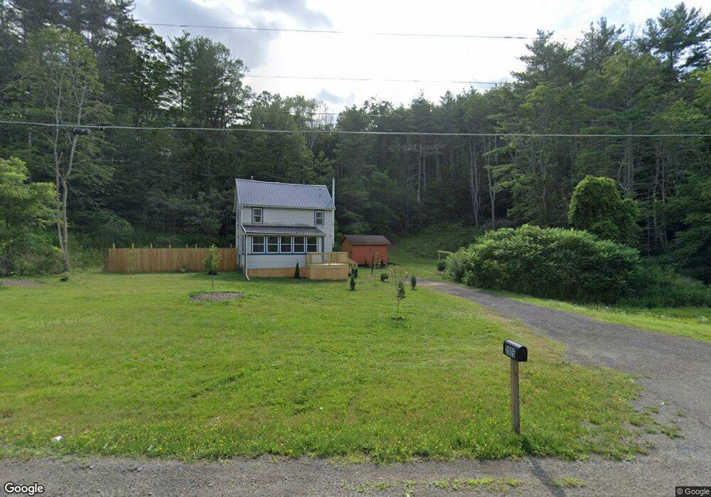
2005 Caton Rd Corning, NY 14830
Estimated Value: $156,000 - $222,000
3
Beds
1
Bath
1,376
Sq Ft
$140/Sq Ft
Est. Value
About This Home
This home is located at 2005 Caton Rd, Corning, NY 14830 and is currently estimated at $192,669, approximately $140 per square foot. 2005 Caton Rd is a home located in Steuben County with nearby schools including Frederick Carder Elementary School, Corning-Painted Post Middle School, and Corning-Painted Post High School.
Ownership History
Date
Name
Owned For
Owner Type
Purchase Details
Closed on
Sep 30, 2011
Sold by
Mayer Michele
Bought by
Brown Jason
Current Estimated Value
Home Financials for this Owner
Home Financials are based on the most recent Mortgage that was taken out on this home.
Original Mortgage
$117,325
Outstanding Balance
$76,149
Interest Rate
4.2%
Mortgage Type
Purchase Money Mortgage
Estimated Equity
$116,520
Purchase Details
Closed on
Jan 13, 2011
Sold by
Mayer Michele
Bought by
Mayer Michele
Create a Home Valuation Report for This Property
The Home Valuation Report is an in-depth analysis detailing your home's value as well as a comparison with similar homes in the area
Home Values in the Area
Average Home Value in this Area
Purchase History
| Date | Buyer | Sale Price | Title Company |
|---|---|---|---|
| Brown Jason | $123,500 | -- | |
| Mayer Michele | $19,000 | -- |
Source: Public Records
Mortgage History
| Date | Status | Borrower | Loan Amount |
|---|---|---|---|
| Open | Brown Jason | $117,325 |
Source: Public Records
Tax History
| Year | Tax Paid | Tax Assessment Tax Assessment Total Assessment is a certain percentage of the fair market value that is determined by local assessors to be the total taxable value of land and additions on the property. | Land | Improvement |
|---|---|---|---|---|
| 2024 | $4,701 | $144,700 | $66,400 | $78,300 |
| 2023 | $4,745 | $144,700 | $66,400 | $78,300 |
| 2022 | $4,680 | $144,700 | $66,400 | $78,300 |
| 2021 | $4,539 | $125,000 | $62,400 | $62,600 |
| 2020 | $2,592 | $125,000 | $62,400 | $62,600 |
| 2019 | $3,790 | $125,000 | $62,400 | $62,600 |
| 2018 | $3,790 | $125,000 | $62,400 | $62,600 |
| 2017 | $3,203 | $97,900 | $54,200 | $43,700 |
| 2016 | $3,177 | $97,900 | $54,200 | $43,700 |
| 2015 | -- | $97,900 | $54,200 | $43,700 |
| 2014 | -- | $97,900 | $54,200 | $43,700 |
Source: Public Records
Map
Nearby Homes
- 0 Caton Rd Unit R1637646
- 0 Caton Rd Unit R1640864
- 1653 Caton Rd
- 2357 Caton Rd
- 10806 W Caton Rd
- 2497 Caton Rd
- 10712B Skyline Dr Unit B
- 2213 Brown Hollow Rd
- 10880 Hidden Meadow Trail
- 10861 Hidden Meadow Trail
- 33-35 Roberts Ave
- 46 Roberts Ave
- 8 Wicks Blvd
- 2489 Spaulding Dr
- 53 Mcmahon Ave
- 51 Mcmahon Ave
- 11109 Caton Center Cross Rd
- 0 Welch Rd
- 1108 Caton Bypass Rd
- 11461 Green Pkwy
Your Personal Tour Guide
Ask me questions while you tour the home.