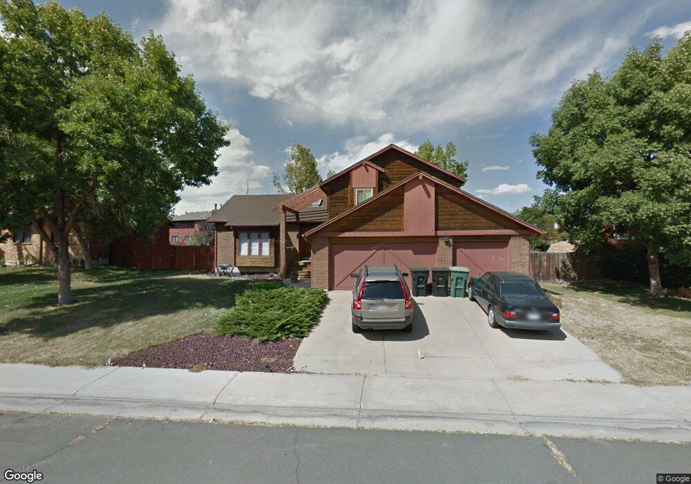
2005 E 128th Dr Thornton, CO 80241
Estimated Value: $625,323 - $662,000
4
Beds
3
Baths
3,073
Sq Ft
$210/Sq Ft
Est. Value
About This Home
This home is located at 2005 E 128th Dr, Thornton, CO 80241 and is currently estimated at $644,331, approximately $209 per square foot. 2005 E 128th Dr is a home located in Adams County with nearby schools including Hunters Glen Elementary School, Century Middle School, and Mountain Range High School.
Ownership History
Date
Name
Owned For
Owner Type
Purchase Details
Closed on
Jul 15, 2019
Sold by
Wright Kenneth D and Wright Janice D
Bought by
Gill Benjamin and Gill Kyli
Current Estimated Value
Home Financials for this Owner
Home Financials are based on the most recent Mortgage that was taken out on this home.
Original Mortgage
$342,000
Outstanding Balance
$297,036
Interest Rate
3.82%
Mortgage Type
New Conventional
Estimated Equity
$347,295
Purchase Details
Closed on
Oct 4, 2016
Sold by
Wrihtg Kenneth D
Bought by
Wright Kenneth D and Wright Janice D
Purchase Details
Closed on
Mar 6, 2003
Sold by
Wright Kenneth and Wright Tonia
Bought by
Wright Kenneth
Home Financials for this Owner
Home Financials are based on the most recent Mortgage that was taken out on this home.
Original Mortgage
$159,000
Interest Rate
4.75%
Mortgage Type
Unknown
Purchase Details
Closed on
May 27, 1992
Purchase Details
Closed on
Jul 1, 1991
Create a Home Valuation Report for This Property
The Home Valuation Report is an in-depth analysis detailing your home's value as well as a comparison with similar homes in the area
Purchase History
| Date | Buyer | Sale Price | Title Company |
|---|---|---|---|
| Gill Benjamin | $435,000 | Land Title Guarantee Co | |
| Wright Kenneth D | -- | None Available | |
| Wright Kenneth | -- | -- | |
| -- | $150,000 | -- | |
| -- | -- | -- |
Source: Public Records
Mortgage History
| Date | Status | Borrower | Loan Amount |
|---|---|---|---|
| Open | Gill Benjamin | $342,000 | |
| Previous Owner | Wright Kenneth | $159,000 |
Source: Public Records
Tax History
| Year | Tax Paid | Tax Assessment Tax Assessment Total Assessment is a certain percentage of the fair market value that is determined by local assessors to be the total taxable value of land and additions on the property. | Land | Improvement |
|---|---|---|---|---|
| 2025 | $4,217 | $42,500 | $8,840 | $33,660 |
| 2024 | $4,217 | $39,070 | $8,130 | $30,940 |
| 2023 | $4,174 | $44,440 | $8,590 | $35,850 |
| 2022 | $3,475 | $31,550 | $8,830 | $22,720 |
| 2021 | $3,592 | $31,550 | $8,830 | $22,720 |
| 2020 | $3,509 | $31,450 | $9,080 | $22,370 |
| 2019 | $3,516 | $31,450 | $9,080 | $22,370 |
| 2018 | $2,922 | $25,390 | $7,490 | $17,900 |
| 2017 | $2,656 | $25,390 | $7,490 | $17,900 |
| 2016 | $2,205 | $20,520 | $4,940 | $15,580 |
| 2015 | $2,202 | $20,520 | $4,940 | $15,580 |
| 2014 | -- | $20,100 | $3,980 | $16,120 |
Source: Public Records
Map
Nearby Homes
- 12885 Vine St
- 2066 E 129th Ave
- 2297 E 128th Ave
- 2275 E 129th Ave
- 12905 Lafayette St Unit H
- 7 Sandpiper Cir
- 1672 E 131st Ct
- 12560 Josephine St
- 58 Blue Heron Dr
- 1162 E 130th Ave Unit B
- 2746 E 132nd Place
- 1174 E 130th Dr
- 12380 York St
- 12380 Irma Dr
- 12350 Farmview St
- 12453 Clayton Ct
- 12335 Festival Ln
- 12314 Hayloft Ln
- 13337 Elizabeth Ct
- 12261 Karl's Ln
- 2045 E 128th Dr
- 1985 E 128th Dr
- 2002 E 129th Dr
- 2042 E 129th Dr
- 2006 E 128th Dr
- 2085 E 128th Dr
- 1986 E 128th Dr
- 2046 E 128th Dr
- 1935 E 128th Dr
- 2082 E 129th Dr
- 1946 E 128th Dr
- 1962 E 129th Dr
- 2086 E 128th Dr
- 12836 Vine St
- 2001 E 129th Dr
- 2041 E 129th Dr
- 1981 E 129th Dr
- 1942 E 129th Dr
- 1906 E 128th Dr
- 12856 Vine St
Your Personal Tour Guide
Ask me questions while you tour the home.