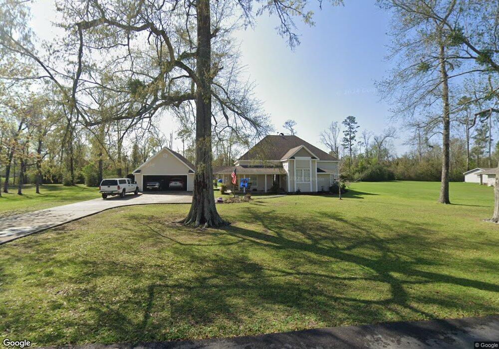
2005 Forest Way Blvd Westlake, LA 70669
Estimated Value: $269,095 - $537,000
--
Bed
--
Bath
--
Sq Ft
2,439
Sq Ft Lot
About This Home
This home is located at 2005 Forest Way Blvd, Westlake, LA 70669 and is currently estimated at $344,774. 2005 Forest Way Blvd is a home located in Calcasieu Parish with nearby schools including Westwood Elementary School, Western Heights Elementary School, and S.P. Arnett Middle School.
Ownership History
Date
Name
Owned For
Owner Type
Purchase Details
Closed on
May 12, 2014
Sold by
Highland Forest Subdivision Part 2 Llc
Bought by
Leblanc Keenan Bruce and Leblanc Kathryn Sue
Current Estimated Value
Home Financials for this Owner
Home Financials are based on the most recent Mortgage that was taken out on this home.
Original Mortgage
$44,100
Outstanding Balance
$13,660
Interest Rate
4.5%
Mortgage Type
Adjustable Rate Mortgage/ARM
Estimated Equity
$331,114
Create a Home Valuation Report for This Property
The Home Valuation Report is an in-depth analysis detailing your home's value as well as a comparison with similar homes in the area
Home Values in the Area
Average Home Value in this Area
Purchase History
| Date | Buyer | Sale Price | Title Company |
|---|---|---|---|
| Leblanc Keenan Bruce | $49,000 | None Available |
Source: Public Records
Mortgage History
| Date | Status | Borrower | Loan Amount |
|---|---|---|---|
| Open | Leblanc Keenan Bruce | $44,100 |
Source: Public Records
Tax History Compared to Growth
Tax History
| Year | Tax Paid | Tax Assessment Tax Assessment Total Assessment is a certain percentage of the fair market value that is determined by local assessors to be the total taxable value of land and additions on the property. | Land | Improvement |
|---|---|---|---|---|
| 2024 | $1,209 | $18,510 | $2,590 | $15,920 |
| 2023 | $1,209 | $18,510 | $2,590 | $15,920 |
| 2022 | $1,237 | $18,510 | $2,590 | $15,920 |
| 2021 | $1,207 | $18,510 | $2,590 | $15,920 |
| 2020 | $1,878 | $16,820 | $2,490 | $14,330 |
| 2019 | $2,117 | $18,320 | $2,400 | $15,920 |
| 2018 | $1,159 | $18,320 | $2,400 | $15,920 |
| 2017 | $2,021 | $18,320 | $2,400 | $15,920 |
| 2016 | $1,366 | $18,320 | $2,400 | $15,920 |
| 2015 | $1,366 | $18,320 | $2,400 | $15,920 |
Source: Public Records
Map
Nearby Homes
- 0 Mims Rd Unit SWL24003447
- 0 Mims Rd Unit Mims Rd 26-4577
- 1951 Riviera Dr
- 16 Riviera Dr
- 0 Riviera Dr Unit 26-4895
- 0 Tbd Bagdad Rd
- 12 River Rd
- 601 River Rd
- 625 River Rd
- 649 River Rd
- 0 River Rd Unit SWL24005170
- 637 River Rd
- 345 Fred Lutz Rd
- 1931 Miller Ave
- 2406 Miller Ave
- 0 Dewitt St
- 0 River Road Island
- 2034 Gus St
- 1416 Miller Ave
- 2502 & 2504 German Rd
- 2011 Forest Way Blvd
- 2009 Forest Way Blvd
- 2004 Forest Way Blvd
- 0 Mims Rd Unit 185542
- 0 Mims Rd Unit 190858
- 0 Mims Rd Unit 124760
- 0 Mims Rd Unit 124759
- 0 Mims Rd Unit 124756
- 0 Mims Rd Unit 127259
- 0 Mims Rd Unit 136005
- 0 Mims Rd Unit 146030
- 0 Mims Rd Unit 159061
- 0 Mims Rd Unit 161130
- 0 Mims Rd Unit 60584
- 0 Mims Rd Unit 57088
- 0 Mims Rd Unit 101961
- 0 Mims Rd Unit 104426
- 0 Mims Rd Unit 107628
- 0 Mims Rd Unit 121780
- 0 Mims Rd Unit 49739