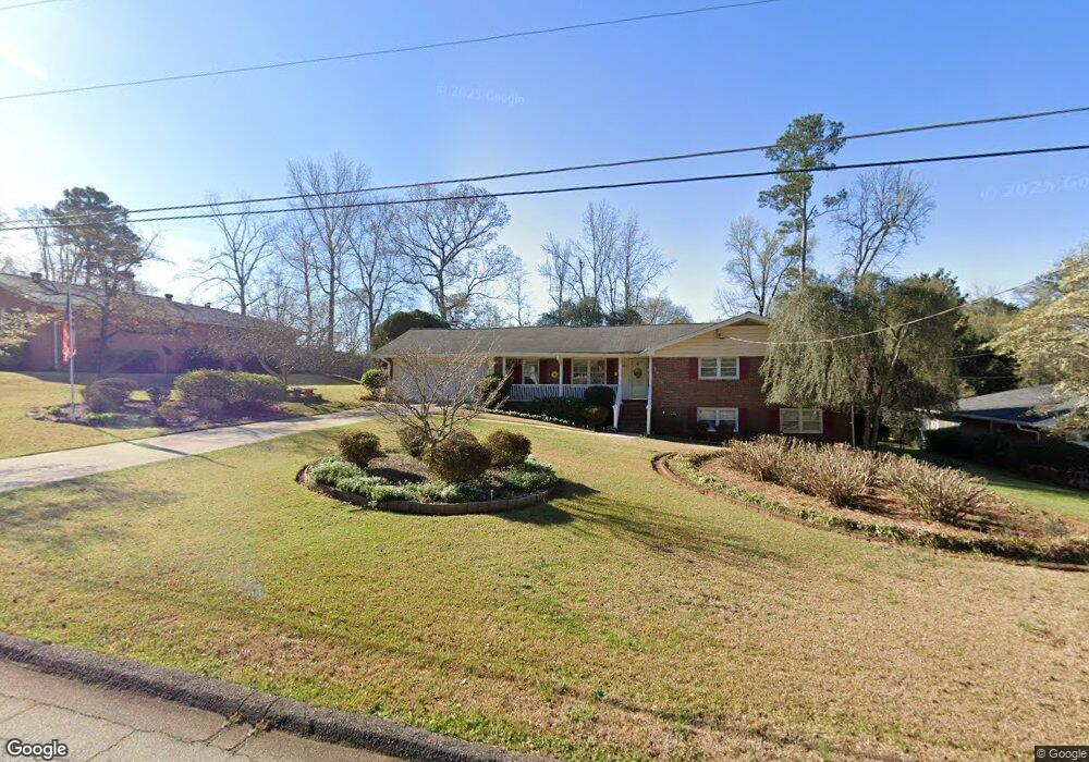
2005 Gherry Dr Austell, GA 30106
Estimated Value: $288,000 - $341,000
3
Beds
2
Baths
1,447
Sq Ft
$213/Sq Ft
Est. Value
About This Home
This home is located at 2005 Gherry Dr, Austell, GA 30106 and is currently estimated at $308,666, approximately $213 per square foot. 2005 Gherry Dr is a home located in Cobb County with nearby schools including Deerwood Elementary School, Austell Elementary School, and Garrett Middle School.
Ownership History
Date
Name
Owned For
Owner Type
Purchase Details
Closed on
May 30, 2019
Sold by
Mccrary Kenneth Lamar
Bought by
Allbritton Deborah M
Current Estimated Value
Home Financials for this Owner
Home Financials are based on the most recent Mortgage that was taken out on this home.
Original Mortgage
$191,468
Outstanding Balance
$167,997
Interest Rate
4.1%
Mortgage Type
FHA
Estimated Equity
$140,669
Purchase Details
Closed on
Nov 2, 2017
Sold by
Keyros Virginia P
Bought by
Keyros Gabriel Pete and Mccrary Kenneth Lamar
Create a Home Valuation Report for This Property
The Home Valuation Report is an in-depth analysis detailing your home's value as well as a comparison with similar homes in the area
Home Values in the Area
Average Home Value in this Area
Purchase History
| Date | Buyer | Sale Price | Title Company |
|---|---|---|---|
| Allbritton Deborah M | $195,000 | -- | |
| Keyros Gabriel Pete | -- | -- |
Source: Public Records
Mortgage History
| Date | Status | Borrower | Loan Amount |
|---|---|---|---|
| Open | Allbritton Deborah M | $191,468 |
Source: Public Records
Tax History Compared to Growth
Tax History
| Year | Tax Paid | Tax Assessment Tax Assessment Total Assessment is a certain percentage of the fair market value that is determined by local assessors to be the total taxable value of land and additions on the property. | Land | Improvement |
|---|---|---|---|---|
| 2025 | $2,860 | $122,868 | $30,000 | $92,868 |
| 2024 | $2,862 | $122,868 | $30,000 | $92,868 |
| 2023 | $2,639 | $137,588 | $20,000 | $117,588 |
| 2022 | $2,541 | $107,192 | $10,000 | $97,192 |
| 2021 | $1,824 | $74,412 | $10,000 | $64,412 |
| 2020 | $2,258 | $74,412 | $10,000 | $64,412 |
| 2019 | $1,681 | $55,388 | $6,000 | $49,388 |
| 2018 | $364 | $55,388 | $6,000 | $49,388 |
| 2017 | $330 | $55,388 | $6,000 | $49,388 |
| 2016 | $265 | $33,964 | $6,000 | $27,964 |
| 2015 | $282 | $33,964 | $6,000 | $27,964 |
| 2014 | $153 | $21,152 | $0 | $0 |
Source: Public Records
Map
Nearby Homes
- 1803 Gherry Dr
- 1971 Annette Ln
- 1943 Arnold Dr
- 1841 Mobley St
- 5025 Bishops Row SW
- 1 Perkerson Mill Rd SW
- 0 Harris St Unit 7661273
- 5466 Davis Dr
- 2136 Perkerson Mill Rd SW
- 2070 Ravencliff Dr
- 5410 Beth Dr
- 5164 Medford Ln
- 5154 Medford Ln
- 5425 Davis Dr
- 5320 Beth Dr
- 2060 Sanders Dr
- 0 Dogwood Cir Unit 7671035
- 0 Dogwood Cir Unit 10630776
- 2335 Ravencliff Dr
- 2335 Ravencliff Dr Unit 91
- 2017 Gherry Dr
- 1993 Gherry Dr
- 2029 Gherry Dr
- 5430 Ledford Dr
- 5440 Ledford Dr
- 5420 Ledford Dr
- 5450 Ledford Dr
- 2008 Gherry Dr
- 1996 Gherry Dr
- 1971 Gherry Dr
- 2020 Gherry Dr
- 1984 Gherry Dr
- 0 Ledford Dr Unit 7405803
- 0 Ledford Dr Unit 7577375
- 5411 Ledford Dr
- 1972 Gherry Dr
- 5460 Ledford Dr
- 2041 Gherry Dr
- 1959 Gherry Dr Unit 2
- 5421 Ledford Dr