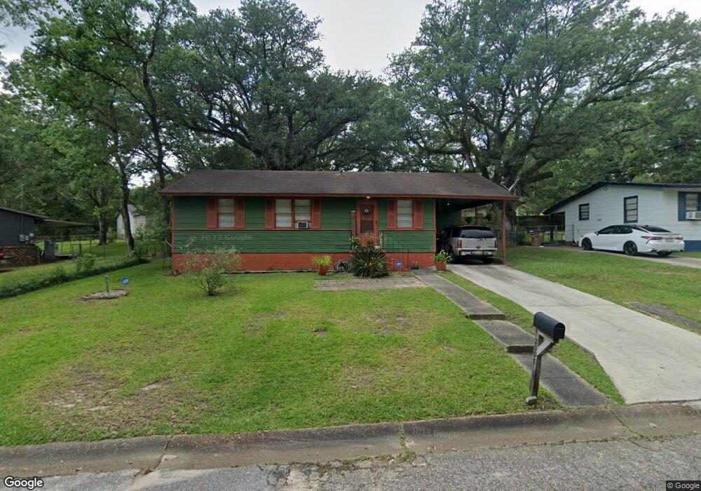
2005 Hamilton Rd Mobile, AL 36618
Autumndale NeighborhoodEstimated Value: $74,546 - $103,000
Studio
1
Bath
988
Sq Ft
$94/Sq Ft
Est. Value
About This Home
This home is located at 2005 Hamilton Rd, Mobile, AL 36618 and is currently estimated at $92,387, approximately $93 per square foot. 2005 Hamilton Rd is a home located in Mobile County with nearby schools including Forest Hill Elementary School, CL Scarborough Middle School, and Mattie T Blount High School.
Ownership History
Date
Name
Owned For
Owner Type
Purchase Details
Closed on
Aug 1, 2001
Sold by
Hudson Emery E and Hudson Lily O
Bought by
Smith Paula D
Current Estimated Value
Home Financials for this Owner
Home Financials are based on the most recent Mortgage that was taken out on this home.
Original Mortgage
$42,335
Outstanding Balance
$15,878
Interest Rate
7.09%
Mortgage Type
FHA
Estimated Equity
$76,509
Create a Home Valuation Report for This Property
The Home Valuation Report is an in-depth analysis detailing your home's value as well as a comparison with similar homes in the area
Home Values in the Area
Average Home Value in this Area
Purchase History
| Date | Buyer | Sale Price | Title Company |
|---|---|---|---|
| Smith Paula D | -- | -- |
Source: Public Records
Mortgage History
| Date | Status | Borrower | Loan Amount |
|---|---|---|---|
| Open | Smith Paula D | $42,335 |
Source: Public Records
Tax History
| Year | Tax Paid | Tax Assessment Tax Assessment Total Assessment is a certain percentage of the fair market value that is determined by local assessors to be the total taxable value of land and additions on the property. | Land | Improvement |
|---|---|---|---|---|
| 2025 | -- | $4,220 | $1,000 | $3,220 |
| 2024 | -- | $3,880 | $1,000 | $2,880 |
| 2023 | $179 | $3,830 | $1,000 | $2,830 |
| 2022 | $169 | $3,670 | $1,000 | $2,670 |
| 2021 | $152 | $3,370 | $800 | $2,570 |
| 2020 | $140 | $3,170 | $600 | $2,570 |
| 2019 | $135 | $3,080 | $600 | $2,480 |
| 2018 | $135 | $3,080 | $0 | $0 |
| 2017 | $127 | $2,940 | $0 | $0 |
| 2016 | $238 | $4,800 | $0 | $0 |
| 2013 | $264 | $4,720 | $0 | $0 |
Source: Public Records
Map
Nearby Homes
- 1930 Le Jeune Dr
- 2004 Beau Terra Dr W
- 2205 Beau Terra Dr W
- 4060 Dickson Ln
- 1758 La Pine Dr
- 1757 Le Grande Dr
- 2210 Wolf Ridge Rd
- 0 Junius Ln
- 4409 Eastview Dr
- 1561 Phillips Ln
- 1701 Phillips Ln
- 1553 Phillips Ln
- 6632 Monarch Cir
- 4636 Saint Charles Ct
- 4900 Leruth Rd
- 1121 Stevens Ln
- 3531 Anton St
- 1724 Sandalwood Dr
- 6 Brucewood Dr W
- 3514 Anton St
- 2009 Hamilton Rd
- 2001 Hamilton Rd
- 2004 Wolf Ridge Rd
- 2008 Wolf Ridge Rd
- 2000 Wolf Ridge Rd
- 2101 Hamilton Rd
- 2004 Hamilton Rd
- 2000 Hamilton Rd
- 2100 Wolf Ridge Rd
- 2103 Hamilton Rd
- 4051 Holleman Dr
- 2104 Wolf Ridge Rd
- 2102 Hamilton Rd
- 4024 Holleman Dr
- 4059 Holleman Dr
- 4035 Holleman Dr
- 4031 Holleman Dr
- 2105 Hamilton Rd
- 4020 Holleman Dr
- 2108 Wolf Ridge Rd
Your Personal Tour Guide
Ask me questions while you tour the home.