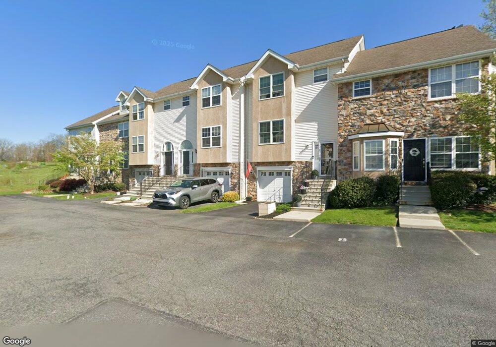
2005 Hampton Ct Morgantown, PA 19543
Estimated Value: $282,000 - $320,000
3
Beds
4
Baths
1,710
Sq Ft
$177/Sq Ft
Est. Value
About This Home
This home is located at 2005 Hampton Ct, Morgantown, PA 19543 and is currently estimated at $303,374, approximately $177 per square foot. 2005 Hampton Ct is a home located in Berks County with nearby schools including Twin Valley Elementary Center, Twin Valley Middle School, and Twin Valley High School.
Ownership History
Date
Name
Owned For
Owner Type
Purchase Details
Closed on
Jul 31, 2008
Sold by
Mccorkell Andrew N
Bought by
Connell Brian P
Current Estimated Value
Purchase Details
Closed on
Jul 11, 2005
Sold by
Massafra Randel M and Massafra Netisha H
Bought by
Mccorkell Andrew N
Home Financials for this Owner
Home Financials are based on the most recent Mortgage that was taken out on this home.
Original Mortgage
$176,000
Interest Rate
5.81%
Mortgage Type
Fannie Mae Freddie Mac
Purchase Details
Closed on
Jun 27, 2002
Sold by
Penn Wynne Homes Ltd Partnership
Bought by
Massafra Randel M and Massafra Netisha H
Home Financials for this Owner
Home Financials are based on the most recent Mortgage that was taken out on this home.
Original Mortgage
$143,450
Interest Rate
6.82%
Create a Home Valuation Report for This Property
The Home Valuation Report is an in-depth analysis detailing your home's value as well as a comparison with similar homes in the area
Home Values in the Area
Average Home Value in this Area
Purchase History
| Date | Buyer | Sale Price | Title Company |
|---|---|---|---|
| Connell Brian P | $229,000 | None Available | |
| Mccorkell Andrew N | $220,000 | -- | |
| Massafra Randel M | $159,406 | -- |
Source: Public Records
Mortgage History
| Date | Status | Borrower | Loan Amount |
|---|---|---|---|
| Previous Owner | Mccorkell Andrew N | $176,000 | |
| Previous Owner | Massafra Randel M | $143,450 |
Source: Public Records
Tax History Compared to Growth
Tax History
| Year | Tax Paid | Tax Assessment Tax Assessment Total Assessment is a certain percentage of the fair market value that is determined by local assessors to be the total taxable value of land and additions on the property. | Land | Improvement |
|---|---|---|---|---|
| 2025 | $1,586 | $129,000 | $14,900 | $114,100 |
| 2024 | $5,047 | $129,000 | $14,900 | $114,100 |
| 2023 | $5,052 | $129,000 | $14,900 | $114,100 |
| 2022 | $4,928 | $129,000 | $14,900 | $114,100 |
| 2021 | $4,778 | $129,000 | $14,900 | $114,100 |
| 2020 | $4,863 | $129,000 | $14,900 | $114,100 |
| 2019 | $4,861 | $129,000 | $14,900 | $114,100 |
| 2018 | $4,861 | $129,000 | $14,900 | $114,100 |
| 2017 | $4,724 | $129,000 | $14,900 | $114,100 |
| 2016 | $1,246 | $129,000 | $14,900 | $114,100 |
| 2015 | $1,246 | $129,000 | $14,900 | $114,100 |
| 2014 | $1,246 | $129,000 | $14,900 | $114,100 |
Source: Public Records
Map
Nearby Homes
- 24 Wexford Ct
- 44 Wexford Ct
- 1520 Lexington Way
- 102 Country Ln
- 3511 Main St
- 0 Heritage Dr Unit 4A PABK2058798
- 1 Senn Ln
- 28 W Main St
- 619 Homestead Dr
- 59 E Main St
- 112 Maxwell Hill Rd
- 242 Steeplechase Dr
- 601 Briarwood Dr
- 10 Woods Rd
- 1250 Chestnut Tree Rd
- 20 Broad ax Pass
- 80 Trappers Run
- 319 Ironstone Ln
- 0 Westbrook Dr
- 0 Westbrook Dr
- 2004 Hampton Ct
- 2006 Hampton Ct
- 2003 Hampton Ct
- 2002 Hampton Ct
- 2001 Hampton Ct
- 50 Dover Ct
- 40 Dover Ct
- 30 Dover Ct
- 20 Dover Ct
- 2012 Hampton Ct Unit 2012
- 4906 Dover Ct
- 10 Dover Ct Unit 4701
- 2011 Hampton Ct
- 2010 Hampton Ct Unit 2010
- 2009 Hampton Ct Unit 2009
- 20 Wexford Ct Unit 1
- 2007 Hampton Ct Unit 200
- 21 Wexford Ct
- 130 Dover Ct
- 31 Wexford Ct