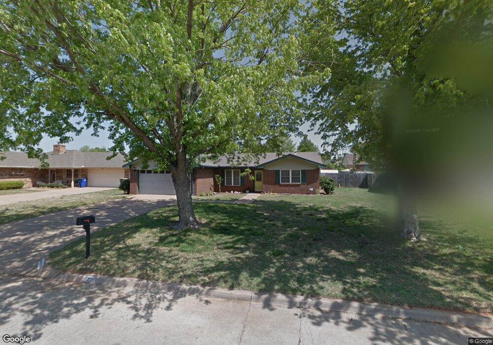
2005 High Meadow Dr Duncan, OK 73533
Estimated Value: $159,000 - $178,000
3
Beds
1
Bath
1,694
Sq Ft
$100/Sq Ft
Est. Value
About This Home
This home is located at 2005 High Meadow Dr, Duncan, OK 73533 and is currently estimated at $169,958, approximately $100 per square foot. 2005 High Meadow Dr is a home with nearby schools including Horace Mann Elementary School, Duncan Middle School, and Duncan High School.
Ownership History
Date
Name
Owned For
Owner Type
Purchase Details
Closed on
Sep 25, 2025
Sold by
Lewis Savannah Jayne and Lewis Michael Wayne
Bought by
Nielsen Kenneth Shane
Current Estimated Value
Purchase Details
Closed on
May 3, 2011
Sold by
Sink Randy M and Sink Teri L
Bought by
Lewis Michael Wayne and Lewis Savannah
Home Financials for this Owner
Home Financials are based on the most recent Mortgage that was taken out on this home.
Original Mortgage
$98,926
Interest Rate
4.5%
Mortgage Type
FHA
Purchase Details
Closed on
May 22, 2003
Sold by
Bentley Robert L and Bentley Jenna
Purchase Details
Closed on
Jan 18, 1999
Sold by
Tawney Bryce L and Tawney Mary
Purchase Details
Closed on
Jun 15, 1990
Create a Home Valuation Report for This Property
The Home Valuation Report is an in-depth analysis detailing your home's value as well as a comparison with similar homes in the area
Purchase History
| Date | Buyer | Sale Price | Title Company |
|---|---|---|---|
| Nielsen Kenneth Shane | $170,000 | Stephens County Abstract | |
| Lewis Michael Wayne | $101,500 | None Available | |
| -- | $88,000 | -- | |
| -- | $77,500 | -- | |
| -- | $3,500 | -- |
Source: Public Records
Mortgage History
| Date | Status | Borrower | Loan Amount |
|---|---|---|---|
| Previous Owner | Lewis Michael Wayne | $98,926 |
Source: Public Records
Tax History
| Year | Tax Paid | Tax Assessment Tax Assessment Total Assessment is a certain percentage of the fair market value that is determined by local assessors to be the total taxable value of land and additions on the property. | Land | Improvement |
|---|---|---|---|---|
| 2025 | $1,422 | $16,862 | $1,195 | $15,667 |
| 2024 | $1,046 | $13,281 | $1,195 | $12,086 |
| 2023 | $1,046 | $13,280 | $1,195 | $12,085 |
| 2022 | $979 | $12,893 | $1,195 | $11,698 |
| 2021 | $949 | $12,153 | $1,195 | $10,958 |
| 2020 | $948 | $11,976 | $1,195 | $10,781 |
| 2019 | $919 | $11,628 | $1,195 | $10,433 |
| 2018 | $1,021 | $12,511 | $1,195 | $11,316 |
| 2017 | $954 | $12,105 | $1,195 | $10,910 |
| 2016 | $983 | $12,565 | $1,169 | $11,396 |
| 2015 | $894 | $12,199 | $1,145 | $11,054 |
| 2014 | $894 | $11,844 | $1,122 | $10,722 |
Source: Public Records
Map
Nearby Homes
- 2021 Overland Dr
- 2024 N Woodrock Dr
- 1923 Windsor Dr
- 3990 N Ridgeview Dr
- 3885 N Ridgeview Dr
- 1829 Terrace Dr
- NO ADDRESS W Plato Rd
- 2363 Rockwell Dr
- 2375 Rockwell Dr
- 2387 Rockwell Dr
- 2345 Rockwell Dr
- 2318 Rockwell Dr
- 2330 Rockwell Dr
- 2346 Rockwell Dr
- 2333 Rockwell Dr
- 2360 Rockwell Dr
- 2321 Rockwell Dr
- 2310 Rockwell Dr
- 1713 Wilshire Dr
- 2201 Mallard
- 302103 E 1790 Rd
- 2009 High Meadow Dr
- 2001 High Meadow Dr
- 2018 2018 Crestline Dr
- 2018 Crestline Dr
- 2013 High Meadow Dr
- 2117 Overland Dr
- 1935 High Meadow Dr
- 2014 Crestline Dr
- 2022 Crestline Dr
- 2118 Westbriar Rd
- 2010 Crestline Dr
- 2026 Crestline Dr
- 2101 High Meadow Dr
- 2026 2026 Crestline Dr
- 1931 High Meadow Dr
- 2113 Overland Dr
- 2114 Westbriar Rd
- 1934 High Meadow Dr
- 2006 Crestline Dr
Your Personal Tour Guide
Ask me questions while you tour the home.