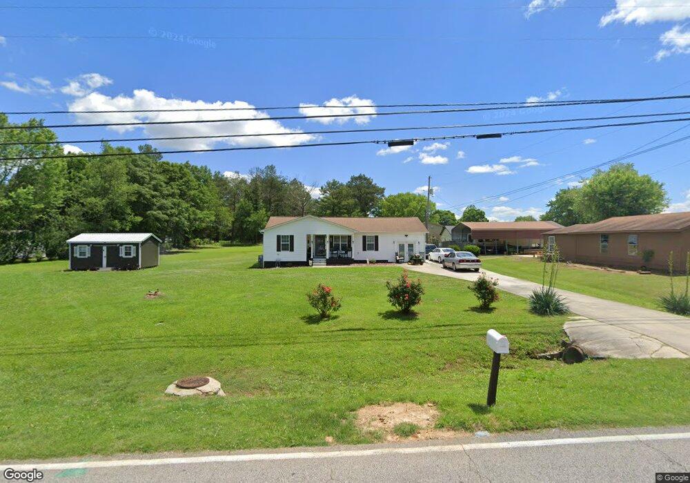
2005 Hine St S Athens, AL 35611
Estimated Value: $144,000 - $178,000
--
Bed
--
Bath
984
Sq Ft
$164/Sq Ft
Est. Value
About This Home
This home is located at 2005 Hine St S, Athens, AL 35611 and is currently estimated at $161,014, approximately $163 per square foot. 2005 Hine St S is a home with nearby schools including Julian Newman Elementary School, Athens Intermediate School, and Athens Middle School.
Ownership History
Date
Name
Owned For
Owner Type
Purchase Details
Closed on
Jul 20, 2021
Sold by
Benford Walter L and Benford Annette P
Bought by
Burruss Angela Nicole
Current Estimated Value
Home Financials for this Owner
Home Financials are based on the most recent Mortgage that was taken out on this home.
Original Mortgage
$105,000
Outstanding Balance
$95,358
Interest Rate
2.96%
Mortgage Type
New Conventional
Estimated Equity
$65,656
Purchase Details
Closed on
Jun 18, 2013
Sold by
Coffee Brenda Yvonne and Claybrooks Delana L
Bought by
Benford Walter L and Benford Annette P
Create a Home Valuation Report for This Property
The Home Valuation Report is an in-depth analysis detailing your home's value as well as a comparison with similar homes in the area
Home Values in the Area
Average Home Value in this Area
Purchase History
| Date | Buyer | Sale Price | Title Company |
|---|---|---|---|
| Burruss Angela Nicole | $105,000 | None Available | |
| Benford Walter L | $43,000 | -- |
Source: Public Records
Mortgage History
| Date | Status | Borrower | Loan Amount |
|---|---|---|---|
| Open | Burruss Angela Nicole | $105,000 |
Source: Public Records
Tax History Compared to Growth
Tax History
| Year | Tax Paid | Tax Assessment Tax Assessment Total Assessment is a certain percentage of the fair market value that is determined by local assessors to be the total taxable value of land and additions on the property. | Land | Improvement |
|---|---|---|---|---|
| 2024 | -- | $15,660 | $0 | $0 |
| 2023 | $0 | $14,700 | $0 | $0 |
| 2022 | $0 | $11,020 | $0 | $0 |
| 2021 | $400 | $10,000 | $0 | $0 |
| 2020 | $392 | $9,800 | $0 | $0 |
| 2019 | $789 | $19,720 | $0 | $0 |
| 2018 | $470 | $11,760 | $0 | $0 |
| 2017 | $470 | $11,760 | $0 | $0 |
| 2016 | $470 | $58,800 | $0 | $0 |
| 2015 | $470 | $11,760 | $0 | $0 |
| 2014 | $463 | $0 | $0 | $0 |
Source: Public Records
Map
Nearby Homes
- 1925 Cain Dr Unit 280
- 1817 Hine St S
- 325 Hine St S
- 1112 Hine St S
- 28.35 Hine St S
- 8336 Us Highway 72 W
- 1505 Nella Dr
- 1509 Nella Dr
- 1709 Lillian Dr
- 15287 Lapwing Cove
- 15279 Lapwing Cove
- 15307 Lapwing Cove
- 15271 Lapwing Cove
- 15327 Lapwing Cove
- 15261 Lapwing Cove
- 15503 Lapwing Cove
- 15480 Lapwing Cove
- 15462 Lapwing Cove
- 15500 Lapwing Cove
- 15472 Lapwing Cove
- 1201 Sommerest Dr
- 2001 Hine St S
- 2003 Hine St S
- 1929 Cain Dr
- 2004 Hine St S
- 1205 Sommerest Dr
- 1000 Sommerest Dr
- 1201 W Cain Dr
- 1919 Hine St S
- 1002 Sommerest Dr
- 1921 Cain Dr
- 1931 Cain Dr
- 1202 Sommerest Dr
- 1200 Sommerest Dr
- 2100 Hine St S
- 0 W Cain Dr Unit 3503404
- 0 W Cain Dr Unit 1139373
- 0 W Cain Dr
- 1204 Sommerest Dr
- 1004 Sommerest Dr