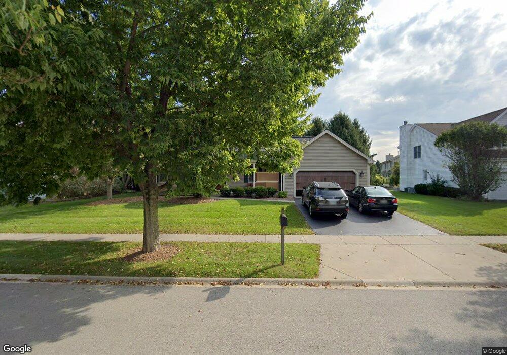
2005 Kittridge Dr West Dundee, IL 60118
Estimated Value: $436,008 - $479,000
4
Beds
3
Baths
2,346
Sq Ft
$198/Sq Ft
Est. Value
About This Home
This home is located at 2005 Kittridge Dr, West Dundee, IL 60118 and is currently estimated at $465,002, approximately $198 per square foot. 2005 Kittridge Dr is a home located in Kane County with nearby schools including Dundee Highlands Elementary School, Dundee Middle School, and Harry D Jacobs High School.
Ownership History
Date
Name
Owned For
Owner Type
Purchase Details
Closed on
Sep 15, 2006
Sold by
Andersen Christopher A and Andersen Kelly A
Bought by
Odell Sean and Odell Kathryn
Current Estimated Value
Home Financials for this Owner
Home Financials are based on the most recent Mortgage that was taken out on this home.
Original Mortgage
$306,400
Interest Rate
6.59%
Mortgage Type
Purchase Money Mortgage
Purchase Details
Closed on
Oct 5, 1994
Sold by
Johnson Frederick James and Johnson Kerry F
Bought by
Andersen Christopher A and Andersen Kelly A
Home Financials for this Owner
Home Financials are based on the most recent Mortgage that was taken out on this home.
Original Mortgage
$127,000
Interest Rate
8.55%
Create a Home Valuation Report for This Property
The Home Valuation Report is an in-depth analysis detailing your home's value as well as a comparison with similar homes in the area
Home Values in the Area
Average Home Value in this Area
Purchase History
| Date | Buyer | Sale Price | Title Company |
|---|---|---|---|
| Odell Sean | $383,000 | None Available | |
| Andersen Christopher A | $220,000 | Chicago Title Insurance Co |
Source: Public Records
Mortgage History
| Date | Status | Borrower | Loan Amount |
|---|---|---|---|
| Closed | Odell Sean | $306,400 | |
| Previous Owner | Andersen Christopher A | $127,000 |
Source: Public Records
Tax History Compared to Growth
Tax History
| Year | Tax Paid | Tax Assessment Tax Assessment Total Assessment is a certain percentage of the fair market value that is determined by local assessors to be the total taxable value of land and additions on the property. | Land | Improvement |
|---|---|---|---|---|
| 2024 | $9,774 | $127,907 | $25,730 | $102,177 |
| 2023 | $9,164 | $115,086 | $23,151 | $91,935 |
| 2022 | $8,932 | $107,390 | $23,151 | $84,239 |
| 2021 | $8,932 | $101,397 | $21,859 | $79,538 |
| 2020 | $8,461 | $99,118 | $21,368 | $77,750 |
| 2019 | $8,189 | $94,094 | $20,285 | $73,809 |
| 2018 | $8,472 | $94,827 | $19,883 | $74,944 |
| 2017 | $8,069 | $88,707 | $18,600 | $70,107 |
| 2016 | $8,478 | $88,356 | $23,811 | $64,545 |
| 2015 | -- | $82,793 | $22,312 | $60,481 |
| 2014 | -- | $80,507 | $21,696 | $58,811 |
| 2013 | -- | $82,971 | $22,360 | $60,611 |
Source: Public Records
Map
Nearby Homes
- 812 Lindsay Ln
- 816 Lindsay Ln
- 822 Lindsay Ln
- 825 Lindsay Ln
- 818 Lindsay Ln
- 814 Lindsay Ln
- Charlotte Plan at Hickory Glen
- Marianne Plan at Hickory Glen
- 829 Lindsay Ln
- 906 Shagbark Ln
- 902 Shagbark Ln
- 916 Shagbark Ln
- 823 Lindsay Ln
- 904 Shagbark Ln
- 910 Shagbark Ln Unit 1601
- 315 Spring Point Dr Unit 18315
- 496 Edinburgh Ln
- 1715 W Main St
- 503 Edinburgh Ln
- Lots 24-133 Walnut Spruce Ash Oak Dr
- 2001 Kittridge Dr
- 2011 Kittridge Dr
- 904 Pember Cir
- 2000 Spaulding Ave Unit 2
- 2006 Spaulding Ave
- 2008 Kittridge Dr Unit 2
- 2016 Kittridge Dr
- 2002 Kittridge Dr
- 2014 Spaulding Ave
- 912 Pember Cir
- 2028 Kittridge Dr Unit 2
- 901 Pember Cir
- 2024 Spaulding Ave
- 2027 Waterbury Ct Unit 2
- 918 Pember Cir Unit 2
- 860 Tartans Dr
- 2017 Waterbury Ct
- 913 Pember Cir Unit 2
- 2034 Kittridge Dr
- 2033 Waterbury Ct