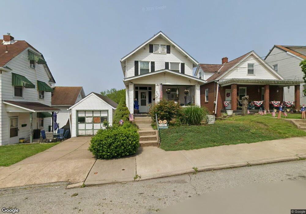
2005 Leishman Ave New Kensington, PA 15068
Estimated Value: $65,965 - $113,000
--
Bed
--
Bath
1,236
Sq Ft
$75/Sq Ft
Est. Value
About This Home
This home is located at 2005 Leishman Ave, New Kensington, PA 15068 and is currently estimated at $92,241, approximately $74 per square foot. 2005 Leishman Ave is a home located in Westmoreland County with nearby schools including Mary Queen of Apostles School.
Ownership History
Date
Name
Owned For
Owner Type
Purchase Details
Closed on
Sep 16, 2020
Sold by
8 Dunnugan Llc
Bought by
Mckinley Philip and Mckinley Dawn
Current Estimated Value
Purchase Details
Closed on
May 17, 2007
Sold by
Mckinley Philip
Bought by
Mckinley Philip
Home Financials for this Owner
Home Financials are based on the most recent Mortgage that was taken out on this home.
Original Mortgage
$23,200
Interest Rate
6.24%
Mortgage Type
Credit Line Revolving
Create a Home Valuation Report for This Property
The Home Valuation Report is an in-depth analysis detailing your home's value as well as a comparison with similar homes in the area
Home Values in the Area
Average Home Value in this Area
Purchase History
| Date | Buyer | Sale Price | Title Company |
|---|---|---|---|
| Mckinley Philip | $8,000 | None Available | |
| Mckinley Philip | -- | None Available |
Source: Public Records
Mortgage History
| Date | Status | Borrower | Loan Amount |
|---|---|---|---|
| Previous Owner | Mckinley Philip | $23,200 |
Source: Public Records
Tax History Compared to Growth
Tax History
| Year | Tax Paid | Tax Assessment Tax Assessment Total Assessment is a certain percentage of the fair market value that is determined by local assessors to be the total taxable value of land and additions on the property. | Land | Improvement |
|---|---|---|---|---|
| 2025 | $1,694 | $9,900 | $2,100 | $7,800 |
| 2024 | $1,679 | $9,900 | $2,100 | $7,800 |
| 2023 | $1,595 | $9,900 | $2,100 | $7,800 |
| 2022 | $1,550 | $9,900 | $2,100 | $7,800 |
| 2021 | $1,517 | $9,900 | $2,100 | $7,800 |
| 2020 | $1,488 | $9,900 | $2,100 | $7,800 |
| 2019 | $1,483 | $9,900 | $2,100 | $7,800 |
| 2018 | $1,463 | $9,900 | $2,100 | $7,800 |
| 2017 | $1,463 | $9,900 | $2,100 | $7,800 |
| 2016 | $1,701 | $12,760 | $2,100 | $10,660 |
| 2015 | $1,885 | $12,760 | $2,100 | $10,660 |
| 2014 | $1,820 | $12,760 | $2,100 | $10,660 |
Source: Public Records
Map
Nearby Homes
- 2016 Kenneth Ave
- 2015 Kenneth Ave
- 2014 Constitution Blvd
- 2112 Kenneth Ave
- 2105 Victoria Ave
- 2004 Victoria Ave
- 1919 Victoria Ave
- 2004 Woodmont Ave
- 1915 Woodmont Ave
- 1909 Woodmont Ave
- 1818 Kenneth Ave
- 344 Iroquois Dr
- 170 Esther Ave
- 1807 4th Ave
- 381 Camp Ave
- 1802 Alcoa Dr
- 1734 Constitution Blvd
- 1810 Ridge Ave
- 1407 Drey St Unit 29
- 1809 Kimball Ave
- 2007 Leishman Ave
- 303 Moore St
- 2001 Leishman Ave
- 2009 Leishman Ave
- 301 Moore St
- 2011 Leishman Ave
- 2013 Leishman Ave
- 2004 Kenneth Ave Unit 2
- 2004 Kenneth Ave Unit 1
- 2004 Kenneth Ave
- 2006 Kenneth Ave
- 1945 Leishman Ave
- 2008 Kenneth Ave
- 2015 Leishman Ave
- 2000 Kenneth Ave
- 2010 Kenneth Ave
- 1943 Leishman Ave
- 2004 Leishman Ave
- 2004 Leishman Ave
- 2002 Leishman Ave