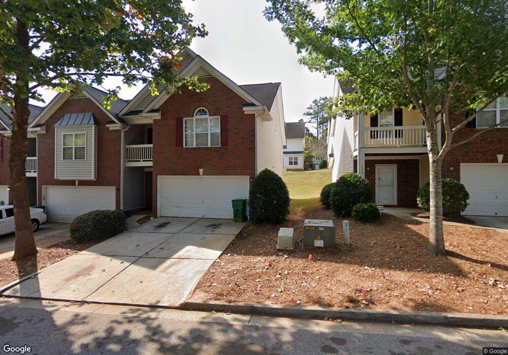
2005 Manhattan Pkwy Unit 149 Decatur, GA 30035
Estimated Value: $243,000 - $257,000
3
Beds
3
Baths
1,814
Sq Ft
$137/Sq Ft
Est. Value
About This Home
This home is located at 2005 Manhattan Pkwy Unit 149, Decatur, GA 30035 and is currently estimated at $249,302, approximately $137 per square foot. 2005 Manhattan Pkwy Unit 149 is a home located in DeKalb County with nearby schools including Rowland Elementary School, Mary McLeod Bethune Middle School, and Towers High School.
Ownership History
Date
Name
Owned For
Owner Type
Purchase Details
Closed on
May 11, 2020
Sold by
Tejani Mukesh R
Bought by
Dillard Veronica
Current Estimated Value
Home Financials for this Owner
Home Financials are based on the most recent Mortgage that was taken out on this home.
Original Mortgage
$145,146
Outstanding Balance
$128,498
Interest Rate
3.25%
Mortgage Type
FHA
Estimated Equity
$120,804
Purchase Details
Closed on
Sep 21, 2007
Sold by
Hud-Housing Of Urban Dev
Bought by
Tejani Mukesh R
Purchase Details
Closed on
Mar 6, 2007
Sold by
Suntrust Mortgage Inc
Bought by
Hud
Purchase Details
Closed on
May 28, 2004
Sold by
Starks Ronald
Bought by
Starks Ronald
Home Financials for this Owner
Home Financials are based on the most recent Mortgage that was taken out on this home.
Original Mortgage
$136,800
Interest Rate
6.19%
Mortgage Type
VA
Create a Home Valuation Report for This Property
The Home Valuation Report is an in-depth analysis detailing your home's value as well as a comparison with similar homes in the area
Home Values in the Area
Average Home Value in this Area
Purchase History
| Date | Buyer | Sale Price | Title Company |
|---|---|---|---|
| Dillard Veronica | $150,000 | -- | |
| Tejani Mukesh R | -- | -- | |
| Tejani Mukesh R | -- | -- | |
| Hud | -- | -- | |
| Suntrust Mortgage Inc | $144,163 | -- | |
| Starks Ronald | -- | -- | |
| Starks Ronald | $138,000 | -- |
Source: Public Records
Mortgage History
| Date | Status | Borrower | Loan Amount |
|---|---|---|---|
| Open | Dillard Veronica | $145,146 | |
| Previous Owner | Starks Ronald | $136,800 |
Source: Public Records
Tax History Compared to Growth
Tax History
| Year | Tax Paid | Tax Assessment Tax Assessment Total Assessment is a certain percentage of the fair market value that is determined by local assessors to be the total taxable value of land and additions on the property. | Land | Improvement |
|---|---|---|---|---|
| 2024 | $4,708 | $98,080 | $22,000 | $76,080 |
| 2023 | $4,708 | $98,800 | $22,000 | $76,800 |
| 2022 | $3,585 | $74,560 | $11,000 | $63,560 |
| 2021 | $2,946 | $60,000 | $10,480 | $49,520 |
| 2020 | $2,506 | $49,960 | $8,993 | $40,967 |
| 2019 | $2,506 | $49,960 | $8,993 | $40,967 |
| 2018 | $1,930 | $49,960 | $8,800 | $41,160 |
| 2017 | $2,192 | $41,440 | $8,800 | $32,640 |
| 2016 | $1,741 | $32,320 | $4,280 | $28,040 |
| 2014 | $1,299 | $21,760 | $4,280 | $17,480 |
Source: Public Records
Map
Nearby Homes
- 4658 Grand Central Pkwy
- 4643 Grand Central Pkwy
- 2086 Manhattan Pkwy
- 2109 Manhattan Pkwy
- 4617 Grand Central Pkwy
- 4616 Grand Central Pkwy
- 4612 Grand Central Pkwy
- 2127 Manhattan Pkwy
- 1830 Broadway St
- 1923 Manhattan Pkwy Unit 183
- 5148 Covington Hwy
- 5181 Covington Hwy
- 1764 Big Valley Way Unit 3
- 5169 Covington Hwy
- 1984 Wedgewood Dr Unit 17C
- 5160 Covington Hwy
- 5160 Covington Hwy Unit 18
- 5159 Covington Hwy
- 4665 Big Valley Rd
- 2007 Manhattan Pkwy Unit 148
- 2001 Manhattan Pkwy
- 2009 Manhattan Pkwy
- 1999 Manhattan Pkwy
- 2011 Manhattan Pkwy
- 1997 Manhattan Pkwy
- 2013 Manhattan Pkwy
- 2013 Manhattan Pkwy Unit 2013
- 1995 Manhattan Pkwy Unit 153
- 4648 Grand Central Pkwy
- 4648 Grand Central Pkwy Unit 4648
- 4650 Grand Central Pkwy
- 4652 Grand Central Pkwy
- 4646 Grand Central Pkwy Unit 131
- 2015 Manhattan Pkwy
- 2002 Manhattan Pkwy
- 4654 Grand Central Pkwy
- 1993 Manhattan Pkwy
- 4644 Grand Central Pkwy
- 2008 Manhattan Pkwy