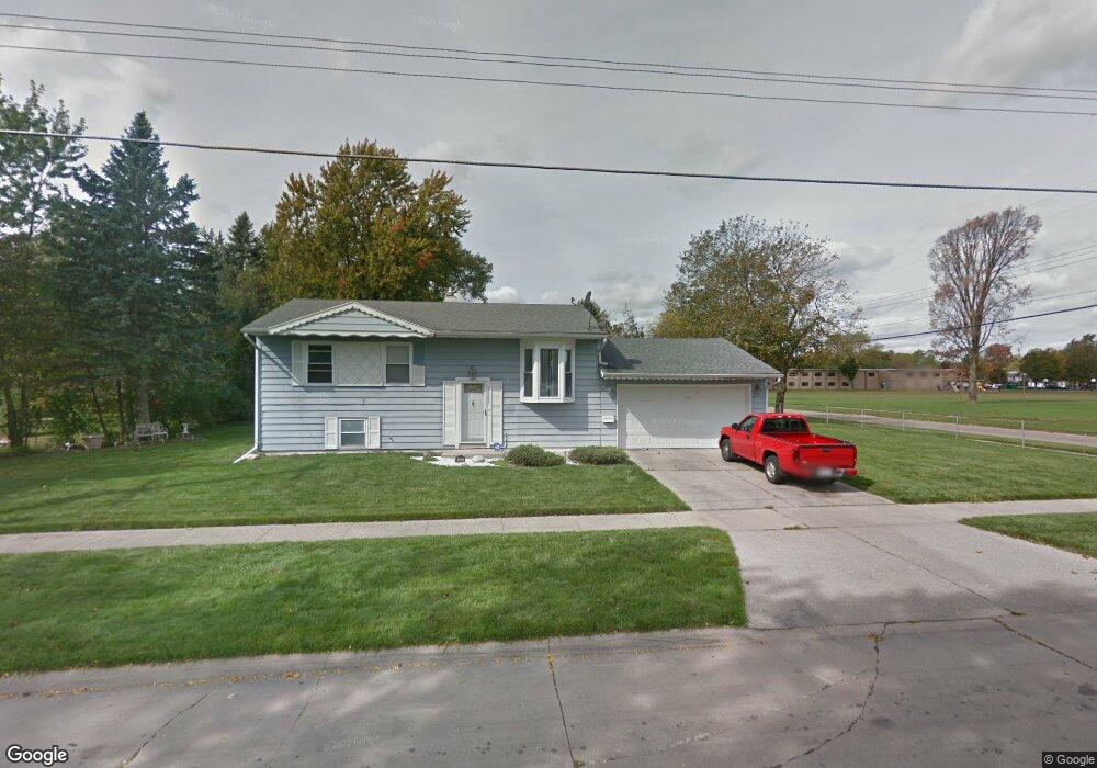
2005 Maple St Saginaw, MI 48602
Southwest NeighborhoodEstimated Value: $66,800 - $80,000
--
Bed
1
Bath
1,260
Sq Ft
$59/Sq Ft
Est. Value
About This Home
This home is located at 2005 Maple St, Saginaw, MI 48602 and is currently estimated at $74,950, approximately $59 per square foot. 2005 Maple St is a home located in Saginaw County with nearby schools including Merrill Park Elementary School, Thompson Middle School, and Arthur Hill High School.
Ownership History
Date
Name
Owned For
Owner Type
Purchase Details
Closed on
Sep 10, 2024
Sold by
Haynes L J
Bought by
Haynes L J L and Haynes J L
Current Estimated Value
Purchase Details
Closed on
May 20, 2003
Sold by
Haynes Haynes L and Haynes Thelma L
Bought by
Haynes L J
Home Financials for this Owner
Home Financials are based on the most recent Mortgage that was taken out on this home.
Original Mortgage
$40,500
Interest Rate
5.36%
Mortgage Type
Purchase Money Mortgage
Purchase Details
Closed on
Sep 15, 1994
Sold by
Burback Mary L
Bought by
Haynes Haynes L and Haynes Thelma L
Create a Home Valuation Report for This Property
The Home Valuation Report is an in-depth analysis detailing your home's value as well as a comparison with similar homes in the area
Home Values in the Area
Average Home Value in this Area
Purchase History
| Date | Buyer | Sale Price | Title Company |
|---|---|---|---|
| Haynes L J L | -- | None Listed On Document | |
| Haynes L J | -- | -- | |
| Haynes L J | -- | Ltic | |
| Haynes Haynes L | $47,500 | -- |
Source: Public Records
Mortgage History
| Date | Status | Borrower | Loan Amount |
|---|---|---|---|
| Previous Owner | Haynes L J | $40,500 |
Source: Public Records
Tax History Compared to Growth
Tax History
| Year | Tax Paid | Tax Assessment Tax Assessment Total Assessment is a certain percentage of the fair market value that is determined by local assessors to be the total taxable value of land and additions on the property. | Land | Improvement |
|---|---|---|---|---|
| 2025 | $1,599 | $31,800 | $0 | $0 |
| 2024 | $1,277 | $29,200 | $0 | $0 |
| 2023 | $1,240 | $25,700 | $0 | $0 |
| 2022 | $1,482 | $23,500 | $0 | $0 |
| 2021 | $1,388 | $20,700 | $0 | $0 |
| 2020 | $1,253 | $21,000 | $0 | $0 |
| 2019 | $1,254 | $20,500 | $800 | $19,700 |
| 2018 | $959 | $19,982 | $0 | $0 |
| 2017 | $1,156 | $20,100 | $0 | $0 |
| 2016 | $1,121 | $19,982 | $0 | $0 |
| 2014 | -- | $20,204 | $0 | $19,399 |
| 2013 | -- | $21,938 | $0 | $0 |
Source: Public Records
Map
Nearby Homes
- 1919 Grout St
- 1652 Stanley St
- 1716 Maple St
- 1531 Gilbert St
- 1918 Stanley St
- 1521 Stanley St
- 1517 Stanley St
- 2500 Salt St
- 1914 Joslin St
- 1916 Joslin St
- 2259 King St
- 1924 Wood St
- 2300 Jerome St
- 2236 King St
- 1817 Ring St
- 1823 Ring St
- 2221 Salt St
- 2219 S Michigan Ave
- 2201 S Niagara St
- 2116 W Michigan Ave