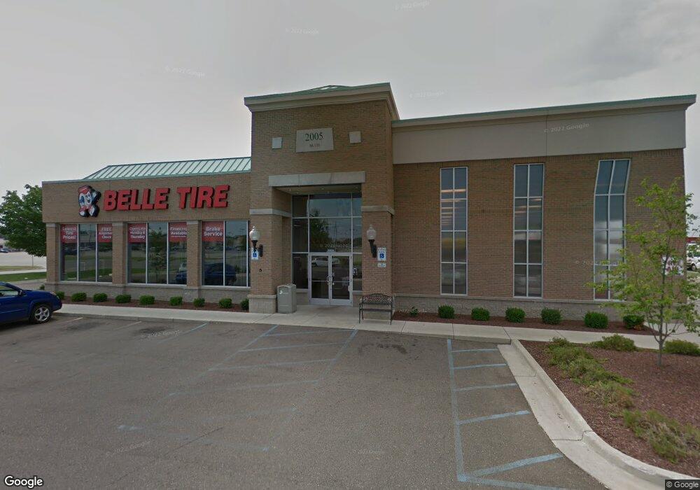
2005 Michigan 139 Benton Harbor, MI 49022
--
Bed
--
Bath
9,976
Sq Ft
0.53
Acres
About This Home
This home is located at 2005 Michigan 139, Benton Harbor, MI 49022. 2005 Michigan 139 is a home located in Berrien County with nearby schools including Fair Plain Middle School, Benton Harbor High School, and Brookview Montessori School.
Ownership History
Date
Name
Owned For
Owner Type
Purchase Details
Closed on
Sep 9, 2025
Sold by
Barnes Development Company Llc
Bought by
Nnn Reit Lp
Purchase Details
Closed on
Oct 26, 2011
Sold by
Silver Beach Partners Ii Llc
Bought by
Barnes Development Company
Purchase Details
Closed on
Apr 13, 2007
Sold by
Bovo Frank R
Bought by
Silver Beach Partners Ii Llc
Home Financials for this Owner
Home Financials are based on the most recent Mortgage that was taken out on this home.
Original Mortgage
$240,000
Interest Rate
6.2%
Mortgage Type
Commercial
Purchase Details
Closed on
Mar 22, 2000
Purchase Details
Closed on
Mar 18, 2000
Purchase Details
Closed on
Sep 26, 1995
Purchase Details
Closed on
Sep 8, 1995
Purchase Details
Closed on
Nov 20, 1992
Purchase Details
Closed on
Jun 19, 1968
Create a Home Valuation Report for This Property
The Home Valuation Report is an in-depth analysis detailing your home's value as well as a comparison with similar homes in the area
Home Values in the Area
Average Home Value in this Area
Purchase History
| Date | Buyer | Sale Price | Title Company |
|---|---|---|---|
| Nnn Reit Lp | -- | None Listed On Document | |
| Nnn Reit Lp | -- | None Listed On Document | |
| Barnes Development Company | -- | None Available | |
| Silver Beach Partners Ii Llc | $275,000 | None Available | |
| -- | -- | -- | |
| -- | -- | -- | |
| -- | -- | -- | |
| -- | $125,000 | -- | |
| -- | -- | -- | |
| -- | $50,000 | -- |
Source: Public Records
Mortgage History
| Date | Status | Borrower | Loan Amount |
|---|---|---|---|
| Previous Owner | Silver Beach Partners Ii Llc | $240,000 |
Source: Public Records
Tax History Compared to Growth
Tax History
| Year | Tax Paid | Tax Assessment Tax Assessment Total Assessment is a certain percentage of the fair market value that is determined by local assessors to be the total taxable value of land and additions on the property. | Land | Improvement |
|---|---|---|---|---|
| 2025 | $30,077 | $686,400 | $0 | $0 |
| 2024 | $20,384 | $644,600 | $0 | $0 |
| 2023 | $19,413 | $689,300 | $0 | $0 |
| 2022 | $18,488 | $554,600 | $0 | $0 |
| 2021 | $26,477 | $535,900 | $12,200 | $523,700 |
| 2020 | $26,104 | $535,200 | $0 | $0 |
| 2019 | $25,669 | $473,100 | $11,300 | $461,800 |
| 2018 | $25,095 | $473,100 | $0 | $0 |
| 2017 | $25,374 | $480,900 | $0 | $0 |
| 2016 | $25,024 | $482,600 | $0 | $0 |
| 2015 | $24,890 | $476,700 | $0 | $0 |
| 2014 | $17,332 | $492,000 | $0 | $0 |
Source: Public Records
Map
Nearby Homes
- 0 Fairplain Dr Unit 24044760
- 682 Waverly Dr
- 1613 Norton Ave
- 1608 Reeder Ave
- 1913 E Ogden Ave
- 00 Michigan 139 Unit B
- 00 Michigan 139 Unit A
- 1549 Reeder Ave
- 1591 Union Ave
- V/L Nickerson Ave
- 1504 Michigan 139
- 00 Alanar Court Lot 32 Rd
- 1483 Rose Ave
- 719 Manorwood Cir Unit 27
- integrity 1800 Plan at Manorwood
- Integrity 2060 Plan at Manorwood
- Integrity 2080 Plan at Manorwood
- Integrity 1610 Plan at Manorwood
- Integrity 1560 Plan at Manorwood
- Integrity 1880 Plan at Manorwood
- 1963 Michigan 139
- 2004 M 139 Unit C
- 2004 M 139 Unit D
- 2004 M 139 Unit B
- 2004 Michigan 139 Unit B
- 2004 Michigan 139
- 2004 Michigan 139 Unit D
- 2004 Michigan 139
- 2004 Michigan 139 Unit 4
- 2061 Michigan 139
- 2061 Michigan 139
- 1849 M 139
- 1849 Michigan 139
- 2061 M 139 Unit C
- 2061 M 139 Unit B
- 2061 M 139
- 1835 Michigan 139
- 2106 Michigan 139
- 1804 Michigan 139
- 1903 Union St