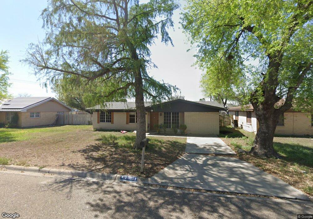
2005 N Dunlap Ave Mission, TX 78572
Estimated Value: $124,000 - $200,000
3
Beds
2
Baths
1,315
Sq Ft
$132/Sq Ft
Est. Value
About This Home
This home is located at 2005 N Dunlap Ave, Mission, TX 78572 and is currently estimated at $173,287, approximately $131 per square foot. 2005 N Dunlap Ave is a home located in Hidalgo County with nearby schools including Ollie O'Grady Elementary School, White Junior High School, and Mission High School.
Ownership History
Date
Name
Owned For
Owner Type
Purchase Details
Closed on
Apr 16, 2013
Sold by
Pollock Jack K and Frontera Homes
Bought by
Mendez Andres and Mendez Roxanne
Current Estimated Value
Home Financials for this Owner
Home Financials are based on the most recent Mortgage that was taken out on this home.
Original Mortgage
$166,500
Interest Rate
3.58%
Mortgage Type
Purchase Money Mortgage
Purchase Details
Closed on
Aug 10, 2009
Sold by
Salinas Teresa G
Bought by
Sanchez Mendez Roxanne
Purchase Details
Closed on
Oct 28, 2005
Sold by
Sanchez Rogelio
Bought by
Salinas Teresa G
Create a Home Valuation Report for This Property
The Home Valuation Report is an in-depth analysis detailing your home's value as well as a comparison with similar homes in the area
Home Values in the Area
Average Home Value in this Area
Purchase History
| Date | Buyer | Sale Price | Title Company |
|---|---|---|---|
| Mendez Andres | -- | None Available | |
| Sanchez Mendez Roxanne | -- | None Available | |
| Salinas Teresa G | -- | None Available |
Source: Public Records
Mortgage History
| Date | Status | Borrower | Loan Amount |
|---|---|---|---|
| Closed | Mendez Andres | $166,500 |
Source: Public Records
Tax History Compared to Growth
Tax History
| Year | Tax Paid | Tax Assessment Tax Assessment Total Assessment is a certain percentage of the fair market value that is determined by local assessors to be the total taxable value of land and additions on the property. | Land | Improvement |
|---|---|---|---|---|
| 2025 | $3,304 | $154,939 | $52,650 | $102,289 |
| 2024 | $3,304 | $128,597 | $52,650 | $75,947 |
| 2023 | $2,753 | $108,590 | $32,643 | $75,947 |
| 2022 | $2,489 | $97,736 | $30,186 | $67,550 |
| 2021 | $2,208 | $85,402 | $30,186 | $55,216 |
| 2020 | $1,993 | $74,846 | $24,570 | $50,276 |
| 2019 | $1,734 | $63,564 | $24,570 | $38,994 |
| 2018 | $1,589 | $57,871 | $16,848 | $41,023 |
| 2017 | $1,664 | $59,987 | $16,848 | $43,139 |
| 2016 | $1,703 | $61,397 | $16,848 | $44,549 |
| 2015 | $1,551 | $59,449 | $15,444 | $44,005 |
Source: Public Records
Map
Nearby Homes
- 2203 N Dunlap Ave
- 2205 N Conway Ave
- 1812 Peace Ave
- 2215 N Conway Ave
- 405 W Griffin Pkwy
- 1807 Thornton St
- 320 Violet Ave
- 408 E Griffin Pkwy
- 1816 N Holland Ave
- 408 Violet St
- 1518 N Holland Ave
- 1615 Oblate Ave
- 1605 Oblate Ave
- 219 Bundle Wagon Dr
- 1600 Oblate Ave
- 114 Bundle Wagon Dr
- 410 Stacie Ln
- 803 W 24th St
- 00 N Conway Ave
- 2611 Tack Dr
- 2007 N Dunlap Ave
- 2001 N Dunlap Ave
- 2009 N Dunlap Ave
- 2006 Perkins Ave
- 2004 Perkins Ave
- 2008 Perkins Ave
- 2004 N Dunlap Ave
- 2006 N Dunlap Ave
- 2011 N Dunlap Ave
- 204 W 20th St
- 2010 Perkins Ave
- 2002 N Dunlap Ave
- 2008 N Dunlap Ave
- 2000 N Dunlap Ave
- 2012 Perkins Ave
- 2013 N Dunlap Ave
- 2010 N Dunlap Ave
- 203 W 20th St
- 2012 N Dunlap Ave
- 2016 1/2 Perkins Ave