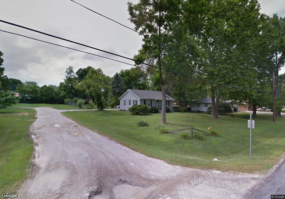
2005 N Lehman Rd Peoria, IL 61604
Sterling Oaks NeighborhoodEstimated Value: $85,000 - $146,000
3
Beds
1
Bath
918
Sq Ft
$117/Sq Ft
Est. Value
About This Home
This home is located at 2005 N Lehman Rd, Peoria, IL 61604 and is currently estimated at $107,033, approximately $116 per square foot. 2005 N Lehman Rd is a home located in Peoria County with nearby schools including Dr Maude A Sanders Primary School, Sterling Middle School, and Peoria High School.
Ownership History
Date
Name
Owned For
Owner Type
Purchase Details
Closed on
Apr 11, 2017
Sold by
Siebert Group I Llc & Series 4
Bought by
Newton Shad Michael
Current Estimated Value
Purchase Details
Closed on
Mar 22, 2017
Sold by
Siebert Group I Llc & Series 4
Bought by
Newton Shad Michael
Purchase Details
Closed on
Jul 29, 2010
Bought by
Cayson Clinton M
Create a Home Valuation Report for This Property
The Home Valuation Report is an in-depth analysis detailing your home's value as well as a comparison with similar homes in the area
Home Values in the Area
Average Home Value in this Area
Purchase History
| Date | Buyer | Sale Price | Title Company |
|---|---|---|---|
| Newton Shad Michael | -- | K&M Title | |
| Newton Shad Michael | -- | K&M Title | |
| Cayson Clinton M | $104,900 | -- |
Source: Public Records
Tax History Compared to Growth
Tax History
| Year | Tax Paid | Tax Assessment Tax Assessment Total Assessment is a certain percentage of the fair market value that is determined by local assessors to be the total taxable value of land and additions on the property. | Land | Improvement |
|---|---|---|---|---|
| 2024 | $2,027 | $28,410 | $4,510 | $23,900 |
| 2023 | $1,888 | $26,070 | $4,140 | $21,930 |
| 2022 | $1,782 | $24,470 | $4,100 | $20,370 |
| 2021 | $1,720 | $23,300 | $3,900 | $19,400 |
| 2020 | $1,710 | $23,070 | $3,860 | $19,210 |
| 2019 | $1,747 | $23,540 | $3,940 | $19,600 |
| 2018 | $1,813 | $24,620 | $3,980 | $20,640 |
| 2017 | $1,819 | $24,870 | $4,020 | $20,850 |
| 2016 | $1,757 | $24,870 | $4,020 | $20,850 |
| 2015 | $1,738 | $24,380 | $3,940 | $20,440 |
| 2014 | $1,745 | $24,880 | $3,880 | $21,000 |
| 2013 | -- | $25,180 | $3,930 | $21,250 |
Source: Public Records
Map
Nearby Homes
- 1908 N Idaho St
- 2230 N Idaho St
- 2407 N Northcrest Dr
- 2530 W Magnolia Ave
- 2523 N Rockwood Dr
- 2905 W Kingston Ct
- 2602 N Woodhaven Dr
- 2635 N Kingston Dr
- 1320 N Rhodora Ave
- 2021 W Newman Pkwy
- 2112 W Colorado St
- 1325 N Park Rd
- 2626 W Heading Ave
- 3018 W Wardcliffe Dr
- 809 N Idaho St
- 807 N Ashland Ave
- 3012 W Alice Ave
- 2829 N Harper Terrace
- 2822 N Easton Place
- 2505 N Hilltop Ct
- 2011 N Lehman Rd
- 2015 N Lehman Rd
- 2816 W Flint St
- 2814 W Kansas St
- 1919 N Lehman Rd
- 2019 N Lehman Rd
- 2725 W Kansas St
- 2010 N Lehman Rd
- 1918 N Lehman Rd
- 1918 N Lehman Round
- 2717 W Kansas St
- 2016 N Lehman Rd
- 2710 W Flint St
- 1914 N Lehman Rd
- 2817 W Nebraska Ave
- 2813 W Nebraska Ave
- 1905 N Lehman Rd
- 2807 W Flint St
- 1910 N Lehman Rd
- 2715 W Kansas St