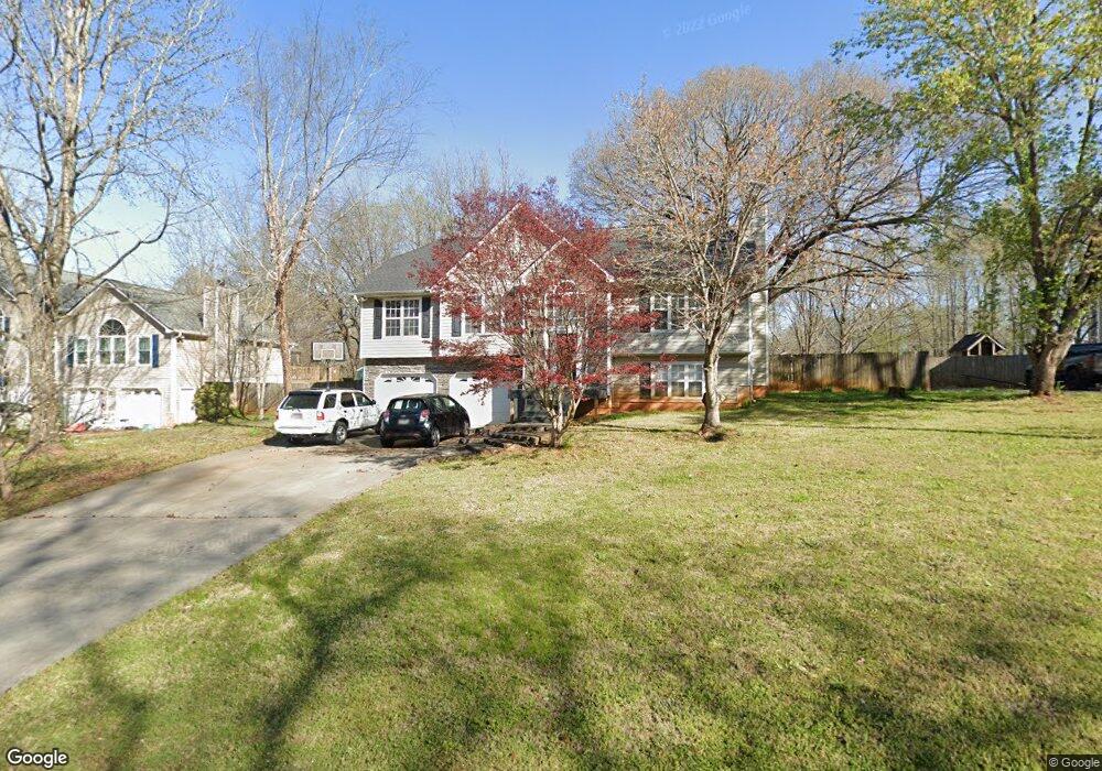
2005 Queensbury Dr Unit 1 Acworth, GA 30102
Oak Grove NeighborhoodEstimated Value: $416,845 - $419,000
3
Beds
3
Baths
2,350
Sq Ft
$178/Sq Ft
Est. Value
About This Home
This home is located at 2005 Queensbury Dr Unit 1, Acworth, GA 30102 and is currently estimated at $417,923, approximately $177 per square foot. 2005 Queensbury Dr Unit 1 is a home located in Cherokee County with nearby schools including Oak Grove Elementary School, E. T. Booth Middle School, and Etowah High School.
Ownership History
Date
Name
Owned For
Owner Type
Purchase Details
Closed on
Jun 2, 2017
Sold by
Wichers Cale C
Bought by
Wichers Cale C and Wichers Maura L
Current Estimated Value
Home Financials for this Owner
Home Financials are based on the most recent Mortgage that was taken out on this home.
Original Mortgage
$168,000
Outstanding Balance
$139,068
Interest Rate
4.02%
Mortgage Type
New Conventional
Estimated Equity
$278,855
Purchase Details
Closed on
Nov 1, 2005
Sold by
Milam Norma J
Bought by
Wichers Cale C
Home Financials for this Owner
Home Financials are based on the most recent Mortgage that was taken out on this home.
Original Mortgage
$27,750
Interest Rate
6%
Mortgage Type
Unknown
Purchase Details
Closed on
Dec 21, 1998
Sold by
Bobo Leasing
Bought by
Milam Gary W and Milam Norma J
Home Financials for this Owner
Home Financials are based on the most recent Mortgage that was taken out on this home.
Original Mortgage
$104,880
Interest Rate
6.87%
Mortgage Type
New Conventional
Create a Home Valuation Report for This Property
The Home Valuation Report is an in-depth analysis detailing your home's value as well as a comparison with similar homes in the area
Home Values in the Area
Average Home Value in this Area
Purchase History
| Date | Buyer | Sale Price | Title Company |
|---|---|---|---|
| Wichers Cale C | -- | -- | |
| Wichers Cale C | $185,000 | -- | |
| Milam Gary W | $131,100 | -- |
Source: Public Records
Mortgage History
| Date | Status | Borrower | Loan Amount |
|---|---|---|---|
| Open | Wichers Cale C | $168,000 | |
| Previous Owner | Wichers Cale C | $27,750 | |
| Previous Owner | Wichers Cale C | $148,000 | |
| Previous Owner | Milam Gary W | $104,880 |
Source: Public Records
Tax History Compared to Growth
Tax History
| Year | Tax Paid | Tax Assessment Tax Assessment Total Assessment is a certain percentage of the fair market value that is determined by local assessors to be the total taxable value of land and additions on the property. | Land | Improvement |
|---|---|---|---|---|
| 2025 | $3,892 | $168,748 | $32,000 | $136,748 |
| 2024 | $3,704 | $159,896 | $28,000 | $131,896 |
| 2023 | $3,303 | $161,520 | $28,000 | $133,520 |
| 2022 | $2,895 | $119,868 | $18,800 | $101,068 |
| 2021 | $2,754 | $103,452 | $18,800 | $84,652 |
| 2020 | $2,613 | $97,276 | $17,600 | $79,676 |
| 2019 | $2,517 | $93,160 | $17,600 | $75,560 |
| 2018 | $2,215 | $79,760 | $14,400 | $65,360 |
| 2017 | $2,205 | $197,000 | $14,400 | $64,400 |
| 2016 | $1,997 | $177,300 | $14,400 | $56,520 |
| 2015 | $2,055 | $180,500 | $14,400 | $57,800 |
| 2014 | $1,990 | $174,600 | $13,760 | $56,080 |
Source: Public Records
Map
Nearby Homes
- 222 Gallant Fox Way
- 307 Queensbury Walk
- 145 Winner St
- 756 Coventry Cove Way
- 752 Coventry Cove Way
- 6390 Woodstock Rd
- 302 Victory Commons Overlook
- 6375 Caladium Dr
- 585 Lee Dr
- 6312 Woodstock Rd
- 148 Sable Trace Trail
- 302 Seth Way
- 1216 Marlo Way
- The Fenton Plan at Buice Lake - Madison
- The Davis Plan at Buice Lake - Madison
- 400 Sable Trace Cove
- 3094 Cambridge Mill St
- 648 Devon Alley
- 3070 Cambridge Mill St
- 849 York Alley
- 2007 Queensbury Dr Unit 1
- 2003 Queensbury Dr
- 2009 Queensbury Dr Unit 1
- 6521 Woodstock Rd
- 2004 Queensbury Dr Unit 1
- 2001 Queensbury Dr Unit 1
- 2006 Queensbury Dr
- 2008 Queensbury Dr
- 2011 Queensbury Dr Unit 1
- 2002 Queensbury Dr
- 2010 Queensbury Dr
- 2013 Queensbury Dr
- 2000 Queensbury Dr
- 1000 Queensbury Run Unit 1
- 2012 Queensbury Dr
- 6569 Woodstock Rd
- 2015 Queensbury Dr Unit 1
- 6481 Woodstock Rd
- 1001 Queensbury Run
- 2014 Queensbury Dr