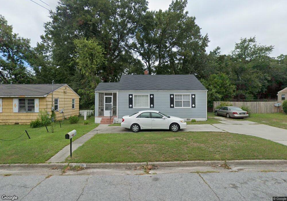
2005 Randall Rd Augusta, GA 30904
Pendleton King NeighborhoodEstimated Value: $87,969 - $169,000
2
Beds
1
Bath
1,259
Sq Ft
$105/Sq Ft
Est. Value
About This Home
This home is located at 2005 Randall Rd, Augusta, GA 30904 and is currently estimated at $131,742, approximately $104 per square foot. 2005 Randall Rd is a home located in Richmond County with nearby schools including Monte Sano Elementary School, Johnson Magnet, and Tutt Middle School.
Ownership History
Date
Name
Owned For
Owner Type
Purchase Details
Closed on
Mar 25, 2025
Sold by
Fedrick Douglas Eugene
Bought by
Fedrick Brenda Lee and Fedrick Douglas Eugene
Current Estimated Value
Purchase Details
Closed on
Nov 25, 2017
Sold by
Fedrick Douglas Eugene
Bought by
Fedrick Douglas Eugene and Fedrick Brenda Lee
Purchase Details
Closed on
Apr 27, 1990
Sold by
Johnson Birnet L Johnson Leslie R
Bought by
Fedrick Douglas E
Purchase Details
Closed on
Apr 26, 1990
Sold by
Johnson Birnet L
Bought by
Fedrick Douglas E
Purchase Details
Closed on
Dec 14, 1988
Sold by
Anderson John Henry By Atty Wiley Theodo
Bought by
Johnson Birnet L Johnson Leslie R
Purchase Details
Closed on
Nov 1, 1988
Sold by
Anderson John Henry
Bought by
Johnson Birnet L
Create a Home Valuation Report for This Property
The Home Valuation Report is an in-depth analysis detailing your home's value as well as a comparison with similar homes in the area
Home Values in the Area
Average Home Value in this Area
Purchase History
| Date | Buyer | Sale Price | Title Company |
|---|---|---|---|
| Fedrick Brenda Lee | -- | -- | |
| Fedrick Douglas Eugene | -- | -- | |
| Fedrick Douglas E | $35,900 | -- | |
| Fedrick Douglas E | $35,900 | -- | |
| Johnson Birnet L Johnson Leslie R | -- | -- | |
| Johnson Birnet L | $9,100 | -- |
Source: Public Records
Tax History
| Year | Tax Paid | Tax Assessment Tax Assessment Total Assessment is a certain percentage of the fair market value that is determined by local assessors to be the total taxable value of land and additions on the property. | Land | Improvement |
|---|---|---|---|---|
| 2025 | $566 | $30,680 | $5,200 | $25,480 |
| 2024 | $566 | $28,668 | $5,200 | $23,468 |
| 2023 | $876 | $57,976 | $5,200 | $52,776 |
| 2022 | $939 | $28,085 | $5,200 | $22,885 |
| 2021 | $799 | $21,856 | $5,200 | $16,656 |
| 2020 | $937 | $26,322 | $8,000 | $18,322 |
| 2019 | $988 | $26,322 | $8,000 | $18,322 |
| 2018 | $1,006 | $26,630 | $8,000 | $18,630 |
| 2017 | $1,001 | $26,630 | $8,000 | $18,630 |
| 2016 | $1,002 | $26,630 | $8,000 | $18,630 |
| 2015 | $986 | $26,630 | $8,000 | $18,630 |
| 2014 | $764 | $17,631 | $8,000 | $9,631 |
Source: Public Records
Map
Nearby Homes
- 1512 Heard Ave
- 1612 Cornell Dr
- 1508 Myrtle Ln
- 1430 Heard Ave
- 1447 Heard Ave
- 1717 Morgan St
- 1422 Heard Ave
- 2021 Wharton Dr
- 1823 Wrightsboro Rd
- 1802 Wilson Place
- 1409 Maddox St
- 2038 Wharton Dr
- 1834 Woodrow St
- 2014 Richmond Ave
- 1703 Holly Hill Rd
- 1316 Wilson St
- 1437 Troupe St
- 1435 Troupe St
- 1510 Pendleton Rd
- 1327 Hickman Rd
- 2007 Randall Rd
- 2003 Randall Rd
- 2002 Lanier Dr
- 2004 Lanier Dr
- 2006 Lanier Dr
- 2006 Randall Rd
- 2004 Randall Rd
- 2010 Randall Rd
- 2008 Lanier Dr
- 2002 Randall Rd
- 1539 Wilder St
- 2012 Randall Rd
- 1537 Wilder St
- 2010 Lanier Dr
- 2014 Randall Rd
- 1543 Wilder St
- 2012 Lanier Dr
- 1535 Wilder St
- 2001 Lanier Dr
- 2016 Randall Rd
Your Personal Tour Guide
Ask me questions while you tour the home.