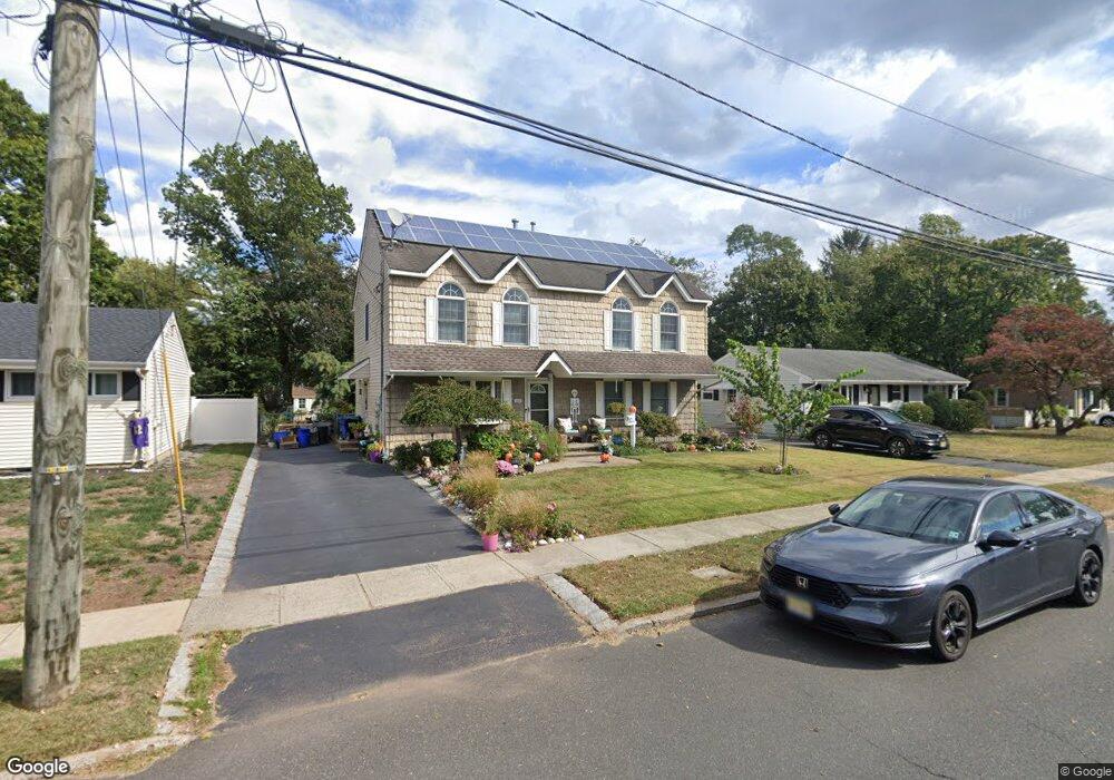
2005 S Central Ave South Plainfield, NJ 07080
Estimated Value: $604,000 - $670,000
--
Bed
--
Bath
2,080
Sq Ft
$302/Sq Ft
Est. Value
About This Home
This home is located at 2005 S Central Ave, South Plainfield, NJ 07080 and is currently estimated at $627,392, approximately $301 per square foot. 2005 S Central Ave is a home located in Middlesex County with nearby schools including South Plainfield High School and Koinonia Academy.
Ownership History
Date
Name
Owned For
Owner Type
Purchase Details
Closed on
Sep 12, 2012
Sold by
Bolesta Richard
Bought by
Bolesta Cynthia
Current Estimated Value
Home Financials for this Owner
Home Financials are based on the most recent Mortgage that was taken out on this home.
Original Mortgage
$275,000
Outstanding Balance
$190,289
Interest Rate
3.57%
Mortgage Type
New Conventional
Estimated Equity
$437,103
Purchase Details
Closed on
Jun 18, 2001
Sold by
Mason Robert
Bought by
Bolesta Richard
Home Financials for this Owner
Home Financials are based on the most recent Mortgage that was taken out on this home.
Original Mortgage
$164,450
Interest Rate
7.2%
Purchase Details
Closed on
May 13, 1999
Sold by
Thomas Shamus
Bought by
Mason Robert and Mason Susan
Home Financials for this Owner
Home Financials are based on the most recent Mortgage that was taken out on this home.
Original Mortgage
$127,800
Interest Rate
6.82%
Create a Home Valuation Report for This Property
The Home Valuation Report is an in-depth analysis detailing your home's value as well as a comparison with similar homes in the area
Home Values in the Area
Average Home Value in this Area
Purchase History
| Date | Buyer | Sale Price | Title Company |
|---|---|---|---|
| Bolesta Cynthia | -- | None Available | |
| Bolesta Richard | $182,500 | -- | |
| Mason Robert | $142,000 | -- |
Source: Public Records
Mortgage History
| Date | Status | Borrower | Loan Amount |
|---|---|---|---|
| Open | Bolesta Cynthia | $275,000 | |
| Previous Owner | Bolesta Richard | $164,450 | |
| Previous Owner | Mason Robert | $127,800 |
Source: Public Records
Tax History Compared to Growth
Tax History
| Year | Tax Paid | Tax Assessment Tax Assessment Total Assessment is a certain percentage of the fair market value that is determined by local assessors to be the total taxable value of land and additions on the property. | Land | Improvement |
|---|---|---|---|---|
| 2025 | $11,555 | $165,500 | $31,900 | $133,600 |
| 2024 | $11,052 | $165,500 | $31,900 | $133,600 |
| 2023 | $11,052 | $165,500 | $31,900 | $133,600 |
| 2022 | $10,915 | $165,500 | $31,900 | $133,600 |
| 2021 | $10,658 | $165,500 | $31,900 | $133,600 |
| 2020 | $10,503 | $165,500 | $31,900 | $133,600 |
| 2019 | $10,077 | $165,500 | $31,900 | $133,600 |
| 2018 | $9,817 | $165,500 | $31,900 | $133,600 |
| 2017 | $9,692 | $165,500 | $31,900 | $133,600 |
| 2016 | $9,594 | $165,500 | $31,900 | $133,600 |
| 2015 | $9,429 | $165,500 | $31,900 | $133,600 |
| 2014 | $9,157 | $165,500 | $31,900 | $133,600 |
Source: Public Records
Map
Nearby Homes
- 260 Merchants Ave
- 241 Van Fleet Ave
- 1726 Kenyon Ave
- 1712 Kenyon Ave
- 533 Edgar Ave
- 105 Firth St
- 1400 Kenyon Ave
- 551 Melrose Ave
- 127 Remington Ave Unit 31
- 480 Sampton Ave
- 1210 Maltby Ave
- 1210 Field Ave
- 917 Tompkins Ave
- 1221 Grant Ave Unit 23
- 132 Parkside Rd
- 1453 Tooz Place
- 77 Parkside Rd Unit 89
- 139 Palmer Ave
- 1066 Allenwood Dr
- 218 Schillaci Ln
- 2009 S Central Ave
- 2001 S Central Ave
- 2017 S Central Ave
- 2004 S Central Ave
- 197 N Madison Dr
- 2010 S Central Ave
- 2023 S Central Ave
- 2016 S Central Ave
- 2013 Wickford Rd
- 184 N Madison Dr
- 191 N Madison Dr
- 2009 Wickford Rd
- 187 N Madison Dr
- 2027 S Central Ave
- 187 S Madison Dr
- 180 N Madison Dr
- 196 S Madison Dr
- 181 S Madison Dr
- 192 S Madison Dr
- 2031 S Central Ave