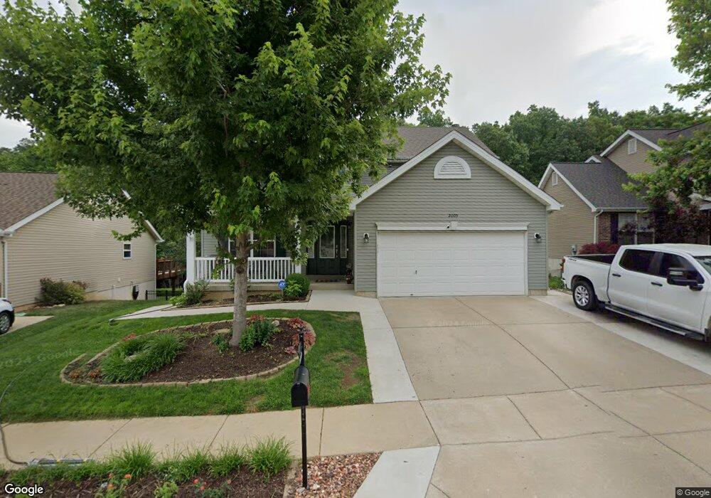
2005 Shetland Path High Ridge, MO 63049
Estimated Value: $320,401 - $443,000
Studio
--
Bath
1,133
Sq Ft
$340/Sq Ft
Est. Value
About This Home
This home is located at 2005 Shetland Path, High Ridge, MO 63049 and is currently estimated at $385,100, approximately $339 per square foot. 2005 Shetland Path is a home with nearby schools including Northwest High School and St. Anthony School.
Ownership History
Date
Name
Owned For
Owner Type
Purchase Details
Closed on
Dec 10, 2009
Sold by
Mcbride & Son Homes Inc
Bought by
George William A and George Danielle T
Current Estimated Value
Home Financials for this Owner
Home Financials are based on the most recent Mortgage that was taken out on this home.
Original Mortgage
$224,353
Outstanding Balance
$145,156
Interest Rate
5.06%
Mortgage Type
FHA
Estimated Equity
$239,944
Create a Home Valuation Report for This Property
The Home Valuation Report is an in-depth analysis detailing your home's value as well as a comparison with similar homes in the area
Home Values in the Area
Average Home Value in this Area
Purchase History
| Date | Buyer | Sale Price | Title Company |
|---|---|---|---|
| George William A | -- | Multiple |
Source: Public Records
Mortgage History
| Date | Status | Borrower | Loan Amount |
|---|---|---|---|
| Open | George William A | $224,353 |
Source: Public Records
Tax History
| Year | Tax Paid | Tax Assessment Tax Assessment Total Assessment is a certain percentage of the fair market value that is determined by local assessors to be the total taxable value of land and additions on the property. | Land | Improvement |
|---|---|---|---|---|
| 2025 | $3,791 | $57,500 | $7,700 | $49,800 |
| 2024 | $3,791 | $52,500 | $7,700 | $44,800 |
| 2023 | $3,791 | $52,500 | $7,700 | $44,800 |
| 2022 | $3,644 | $50,700 | $5,900 | $44,800 |
| 2021 | $3,622 | $50,700 | $5,900 | $44,800 |
| 2020 | $3,278 | $44,800 | $5,100 | $39,700 |
| 2019 | $3,048 | $41,700 | $5,100 | $36,600 |
| 2018 | $3,088 | $41,700 | $5,100 | $36,600 |
| 2017 | $2,822 | $41,700 | $5,100 | $36,600 |
| 2016 | $2,655 | $38,900 | $5,200 | $33,700 |
| 2015 | $2,728 | $38,900 | $5,200 | $33,700 |
| 2013 | -- | $38,500 | $5,200 | $33,300 |
Source: Public Records
Map
Nearby Homes
- 0 Mikel Ln
- 2108 Hillsboro Valley Park Rd
- 1636 S Golden Cir
- 1641 S Golden Cir
- 1635 Rockfern Dr
- 2233 Appaloosa Trail
- 4824 E Golden Cir
- 1616 Creightonwood Ct
- 18 Hawk Ct
- 1599 Paradise Valley Dr
- 1516 Cassie Ct
- 4671 Chinkapin Ln
- 2135 Linnus Dr
- 2149 Linnus Dr
- 2200 Dillon Rd
- 1705 Little Brennan Rd
- 151 Brandy Mill Cir Unit F
- 147 Brandy Mill Cir Unit B
- 104 Brandy Mill Cir Unit A
- 1570 Heritage Valley Dr
- 2001 Shetland Path
- 2009 Shetland Path
- 1997 Shetland Path
- 2013 Shetland Path
- 2008 Shetland Path
- 1993 Shetland Path
- 2017 Shetland Path Lot #297
- 2014 Shetland Path
- 2017 Shetland Path
- 2017Lot #297 Shetland Path
- 2018 Shetland Path
- 1989 Shetland Path
- 2022 Shetland Path
- 1985 Shetland Path
- 1985lot #305 Shetland Path
- 2025 Shetland Path
- 1985 Shetland Path Lot #305
- 2026 Shetland Path
- 2029 Shetland Path
- 1981 Shetland Path
Your Personal Tour Guide
Ask me questions while you tour the home.