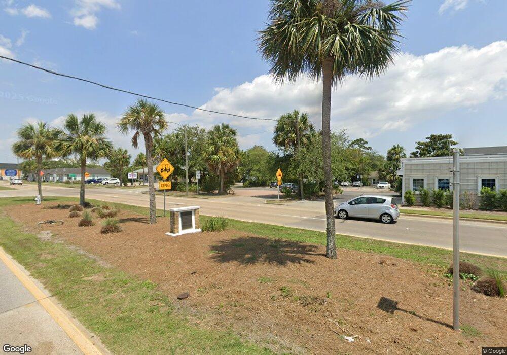
2005 Sr Unit 30-a Port St. Joe, FL 32456
Estimated Value: $493,000
--
Bed
--
Bath
--
Sq Ft
0.5
Acres
About This Home
This home is located at 2005 Sr Unit 30-a, Port St. Joe, FL 32456 and is currently estimated at $493,000. 2005 Sr Unit 30-a is a home located in Gulf County.
Ownership History
Date
Name
Owned For
Owner Type
Purchase Details
Closed on
Aug 31, 2018
Sold by
Atchison E Thomas and Atchison Deborah A
Bought by
Blacks Island Landing Llc
Current Estimated Value
Home Financials for this Owner
Home Financials are based on the most recent Mortgage that was taken out on this home.
Original Mortgage
$300,000
Outstanding Balance
$261,079
Interest Rate
4.5%
Mortgage Type
New Conventional
Estimated Equity
$231,921
Purchase Details
Closed on
Mar 6, 2008
Sold by
Bowdoin William R and Bowdoin Douglas
Bought by
Bowdoin Douglas and Bowdoin John Michael
Purchase Details
Closed on
Oct 10, 2002
Sold by
Huettel Wilfred J and Huettel Cathryn I
Bought by
Atchison E Thomas and Atchison Deborah A
Home Financials for this Owner
Home Financials are based on the most recent Mortgage that was taken out on this home.
Original Mortgage
$396,000
Interest Rate
6.21%
Mortgage Type
Purchase Money Mortgage
Create a Home Valuation Report for This Property
The Home Valuation Report is an in-depth analysis detailing your home's value as well as a comparison with similar homes in the area
Home Values in the Area
Average Home Value in this Area
Purchase History
| Date | Buyer | Sale Price | Title Company |
|---|---|---|---|
| Blacks Island Landing Llc | $400,000 | Attorney | |
| Bowdoin Douglas | -- | Attorney | |
| Atchison E Thomas | $440,000 | -- |
Source: Public Records
Mortgage History
| Date | Status | Borrower | Loan Amount |
|---|---|---|---|
| Open | Blacks Island Landing Llc | $300,000 | |
| Previous Owner | Atchison E Thomas | $396,000 |
Source: Public Records
Tax History Compared to Growth
Tax History
| Year | Tax Paid | Tax Assessment Tax Assessment Total Assessment is a certain percentage of the fair market value that is determined by local assessors to be the total taxable value of land and additions on the property. | Land | Improvement |
|---|---|---|---|---|
| 2024 | $5,199 | $448,000 | $448,000 | -- |
| 2023 | $5,216 | $448,000 | $448,000 | $0 |
| 2022 | $4,627 | $358,400 | $358,400 | $0 |
| 2021 | $4,549 | $336,000 | $336,000 | $0 |
| 2020 | $4,474 | $322,000 | $322,000 | $0 |
| 2019 | $4,531 | $322,000 | $322,000 | $0 |
| 2018 | $3,905 | $276,192 | $0 | $0 |
| 2017 | $3,527 | $246,400 | $0 | $0 |
| 2016 | $3,663 | $246,400 | $0 | $0 |
| 2015 | $3,755 | $246,400 | $0 | $0 |
| 2014 | $3,541 | $246,400 | $0 | $0 |
Source: Public Records
Map
Nearby Homes
- 2049 State Road 30a Unit 20
- 2238 County Road 30a
- 146 Sly St
- 2300 Sr 30-A
- 2331 State Road 30a
- 196 Colors Way
- 192 196 Colors Way
- 192 Colors Way
- 131 Colors Way
- 277 Country Club Rd Unit A-2
- 277 Country Club Rd
- Lot 2 Simmons Way Dr
- Lot 3 Simmons Way Dr
- LOT 15 Country Club Rd
- Lot 7 Simmons Way Dr
- Lot 35 Sr 30-A
- Lot 34 Sr 30-A
- Lot 27 Sr 30-A
- Lot 24 Shallow Reed Dr
- 2629 County Road 30a
- 2049 State Road 30a
- 2049 County Road 30a Unit 14
- 2049 County Road 30a Unit 3
- 1953 County Road 30a
- 1953 State Road 30a
- 2071 State Road 30a
- 1 Gulf Side Dr
- 131 Scallop Cir
- 1 Easy St
- 1942 State Road 30a
- 2093 County Road 30a
- 1934 County Road 30a
- 2115 State Road 30a Unit A 318
- 2115 State Road 30a Unit B401
- 2115 State Road 30a Unit B304
- 2115 State Road 30a Unit B404
- 2115 State Road 30a Unit B301
- 2115 State Road 30a Unit B203hi
- 2115 State Road 30a Unit A 316
- 2115 State Road 30a Unit B405
