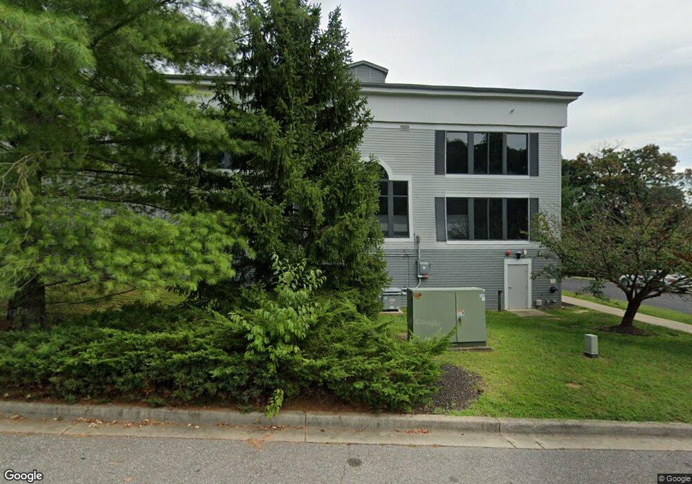
2005 Trout Rd Annapolis, MD 21401
Parole NeighborhoodEstimated Value: $17,466,016
--
Bed
--
Bath
75,280
Sq Ft
$232/Sq Ft
Est. Value
About This Home
This home is located at 2005 Trout Rd, Annapolis, MD 21401 and is currently estimated at $17,466,016, approximately $232 per square foot. 2005 Trout Rd is a home located in Anne Arundel County with nearby schools including Rolling Knolls Elementary School, Wiley H. Bates Middle School, and Annapolis High School.
Ownership History
Date
Name
Owned For
Owner Type
Purchase Details
Closed on
Apr 26, 2007
Sold by
Annapolis Self Storage Llc
Bought by
Extra Space Of Annapolis Llc
Current Estimated Value
Purchase Details
Closed on
Apr 18, 2007
Sold by
Annapolis Self Storage Llc
Bought by
Extra Space Of Annapolis Llc
Purchase Details
Closed on
Feb 18, 2005
Sold by
Trout Road Storage L & Llc
Bought by
Annapolis Self Storage Llc
Purchase Details
Closed on
Apr 17, 2000
Sold by
Generals Highway Llc
Bought by
Trout Road Storage Land Llc
Create a Home Valuation Report for This Property
The Home Valuation Report is an in-depth analysis detailing your home's value as well as a comparison with similar homes in the area
Home Values in the Area
Average Home Value in this Area
Purchase History
| Date | Buyer | Sale Price | Title Company |
|---|---|---|---|
| Extra Space Of Annapolis Llc | $12,487,500 | -- | |
| Extra Space Of Annapolis Llc | $12,487,500 | -- | |
| Annapolis Self Storage Llc | -- | -- | |
| Trout Road Storage Land Llc | $1,500,000 | -- |
Source: Public Records
Mortgage History
| Date | Status | Borrower | Loan Amount |
|---|---|---|---|
| Closed | Trout Road Storage Land Llc | -- |
Source: Public Records
Tax History Compared to Growth
Tax History
| Year | Tax Paid | Tax Assessment Tax Assessment Total Assessment is a certain percentage of the fair market value that is determined by local assessors to be the total taxable value of land and additions on the property. | Land | Improvement |
|---|---|---|---|---|
| 2025 | $134,636 | $12,199,900 | $4,570,000 | $7,629,900 |
| 2024 | $134,636 | $12,199,900 | $4,570,000 | $7,629,900 |
| 2023 | $134,229 | $12,199,900 | $4,570,000 | $7,629,900 |
| 2022 | $139,948 | $13,300,500 | $4,570,000 | $8,730,500 |
| 2021 | $151,700 | $14,425,000 | $0 | $0 |
| 2020 | $142,856 | $13,565,600 | $0 | $0 |
| 2019 | $133,984 | $12,706,200 | $3,958,200 | $8,748,000 |
| 2018 | $117,347 | $11,572,633 | $0 | $0 |
| 2017 | $107,276 | $10,439,067 | $0 | $0 |
| 2016 | -- | $9,305,500 | $0 | $0 |
| 2015 | -- | $8,735,067 | $0 | $0 |
| 2014 | -- | $8,164,633 | $0 | $0 |
Source: Public Records
Map
Nearby Homes
- 2175 Glencrest Cir
- 2175 Glencrest Circle - Taft Model
- 2175
- 524 Ridge Rd
- 622 Sean Dr
- 40 Oak Ct
- 39 Oak Ct
- 1974 Scotts Crossing Way
- 553 Choptank Cove Ct
- 2155 Scotts Crossing Ct Unit 303
- 1737 Point no Point Dr
- 629 Admiral Dr Unit H8-305
- 1915 Towne Centre Blvd Unit 606
- 1915 Towne Centre Blvd Unit 1001
- 1915 Towne Centre Blvd Unit 502
- 1915 Towne Centre Blvd Unit 301
- 1915 Towne Centre Blvd Unit 807
- 1915 Towne Centre Blvd Unit 405 & 406
- 1915 Towne Centre Blvd Unit 1210
- 1915 Towne Centre Blvd Unit 1004
- 2000 Trout Rd
- 2015 Renard Ct
- 2017 Renard Ct
- 2040 Generals Hwy
- 2042 Generals Hwy
- 2014 Renard Ct Unit P
- 2014 Renard Ct Unit 2014-B
- 2014 Renard Ct
- 2014 Renard Ct Unit B
- 2023 Renard Ct
- 2065 Generals Hwy
- 2061 Generals Hwy
- 2102 Renard Ct
- 2104 Renard Ct
- 2050 Generals Hwy
- 2059 Generals Hwy
- 2124 Renard Ct
- 2120 Renard Ct Unit S1PH
- 2120 Renard Ct
- 2019 Valley Rd