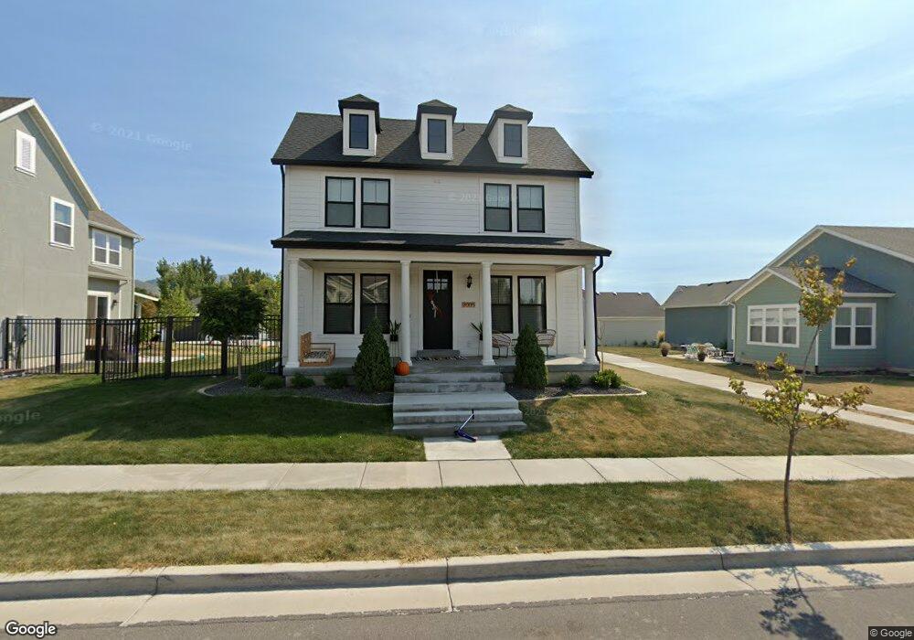
2005 W Phillips St Kaysville, UT 84037
West Kaysville NeighborhoodEstimated Value: $738,000 - $862,000
4
Beds
4
Baths
3,625
Sq Ft
$223/Sq Ft
Est. Value
About This Home
This home is located at 2005 W Phillips St, Kaysville, UT 84037 and is currently estimated at $807,752, approximately $222 per square foot. 2005 W Phillips St is a home located in Davis County with nearby schools including Kay's Creek Elementary School, Shoreline Junior High School, and Davis High School.
Ownership History
Date
Name
Owned For
Owner Type
Purchase Details
Closed on
Aug 31, 2022
Sold by
Adams Brock and Brooke Mary
Bought by
Watkins Nicholas M
Current Estimated Value
Home Financials for this Owner
Home Financials are based on the most recent Mortgage that was taken out on this home.
Original Mortgage
$636,000
Outstanding Balance
$608,241
Interest Rate
5.55%
Estimated Equity
$199,511
Purchase Details
Closed on
Aug 30, 2022
Sold by
Watkins Nicholas M
Bought by
Watkins Nicholas M and Watkins Claire
Home Financials for this Owner
Home Financials are based on the most recent Mortgage that was taken out on this home.
Original Mortgage
$636,000
Outstanding Balance
$608,241
Interest Rate
5.55%
Estimated Equity
$199,511
Purchase Details
Closed on
May 23, 2019
Sold by
Adams Brock
Bought by
Adams Brock and Adams Brooke Mary
Home Financials for this Owner
Home Financials are based on the most recent Mortgage that was taken out on this home.
Original Mortgage
$411,404
Interest Rate
4.1%
Mortgage Type
New Conventional
Purchase Details
Closed on
May 22, 2019
Sold by
Adams Brock and Adams Brooke Mary
Bought by
Adams Brock
Home Financials for this Owner
Home Financials are based on the most recent Mortgage that was taken out on this home.
Original Mortgage
$411,404
Interest Rate
4.1%
Mortgage Type
New Conventional
Purchase Details
Closed on
Mar 7, 2018
Sold by
Adams Brock
Bought by
Adams Brock and Adams Brooke Mary
Home Financials for this Owner
Home Financials are based on the most recent Mortgage that was taken out on this home.
Original Mortgage
$383,796
Interest Rate
4.15%
Mortgage Type
New Conventional
Purchase Details
Closed on
Nov 6, 2017
Sold by
Mountain View Title & Escrow Inc
Bought by
Destination Homes Inc
Home Financials for this Owner
Home Financials are based on the most recent Mortgage that was taken out on this home.
Original Mortgage
$335,920
Interest Rate
3.85%
Mortgage Type
Construction
Purchase Details
Closed on
May 2, 2016
Sold by
Golden Land Management Inc
Bought by
Mountain View Title Escrow Inc
Create a Home Valuation Report for This Property
The Home Valuation Report is an in-depth analysis detailing your home's value as well as a comparison with similar homes in the area
Home Values in the Area
Average Home Value in this Area
Purchase History
| Date | Buyer | Sale Price | Title Company |
|---|---|---|---|
| Watkins Nicholas M | -- | -- | |
| Watkins Nicholas M | -- | -- | |
| Adams Brock | -- | Stewart Title Ins | |
| Adams Brock | -- | Stewart Title Ins | |
| Adams Brock | -- | Stewart Title | |
| Adams Brock | -- | Stewart Title | |
| Destination Homes Inc | -- | Mountain View Title | |
| Mountain View Title Escrow Inc | -- | Mountain View Title | |
| Golden Land Management Inc | -- | Mountain View Title |
Source: Public Records
Mortgage History
| Date | Status | Borrower | Loan Amount |
|---|---|---|---|
| Open | Watkins Nicholas M | $636,000 | |
| Closed | Watkins Nicholas M | $636,000 | |
| Previous Owner | Adams Brock | $411,404 | |
| Previous Owner | Adams Brock | $383,796 | |
| Previous Owner | Destination Homes Inc | $335,920 |
Source: Public Records
Tax History Compared to Growth
Tax History
| Year | Tax Paid | Tax Assessment Tax Assessment Total Assessment is a certain percentage of the fair market value that is determined by local assessors to be the total taxable value of land and additions on the property. | Land | Improvement |
|---|---|---|---|---|
| 2025 | $3,974 | $442,200 | $173,836 | $268,364 |
| 2024 | $3,974 | $419,100 | $144,959 | $274,141 |
| 2023 | $3,925 | $733,000 | $275,401 | $457,599 |
| 2022 | $3,822 | $400,400 | $151,521 | $248,879 |
| 2021 | $3,579 | $562,000 | $163,674 | $398,326 |
| 2020 | $3,218 | $492,000 | $137,107 | $354,893 |
| 2019 | $3,104 | $466,000 | $149,492 | $316,508 |
| 2018 | $1,565 | $234,302 | $121,518 | $112,784 |
Source: Public Records
Map
Nearby Homes
- 2056 W Phillips St
- 1071 Shoreline Dr
- 1042 W Shoreline Dr
- 774 W Farming Way
- 2095 W 200 N
- 256 Seemore Dr
- 34 S Preston St
- Brinton Signature Plan at Pintail Estates
- 71 S Harvs Ln
- 1845 W Sherri Ln
- 37 S Preston St Unit 10
- 562 S 850 W
- 1910 W Bonneville Ln
- 1441 Bridgeview Dr
- 1873 W 75 S
- 2234 Burkhill Place Unit 425
- 557 S Angel St
- 1429 W Lincoln Way
- 129 N Mountain Vistas Rd
- Spruce Pantry Plan at West Gate
- 2013 W Phillips St
- 1983 W Phillips St Unit 247
- 1983 W Phillips St
- 1924 W Pearl Park Cir
- 1936 W Pearl Park Cir
- 2021 W Phillips St
- 1951 Phillips St
- 2002 W Phillips St
- 1948 W Pearl Park Cir
- 506 N Hill Farms Ln
- 1948 W Peach Blossom Dr Unit 229
- 1907 W Pearl Park Cir
- 2027 Hill St
- 522 N Hill Farms Ln
- 2013 Hill St
- 2011 Hill St
- 479 N Hill Farms Ln
- 467 N Hill Farms Ln Unit 228
- 455 N Hill Farms Ln Unit 227
- 455 N Hill Farms Ln