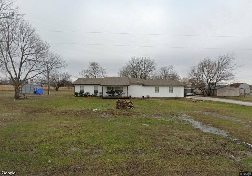
20056 E 480 Rd Claremore, OK 74019
Estimated Value: $110,000 - $263,000
3
Beds
2
Baths
1,288
Sq Ft
$144/Sq Ft
Est. Value
About This Home
This home is located at 20056 E 480 Rd, Claremore, OK 74019 and is currently estimated at $184,976, approximately $143 per square foot. 20056 E 480 Rd is a home located in Rogers County with nearby schools including Sequoyah Elementary School and Sequoyah High School.
Ownership History
Date
Name
Owned For
Owner Type
Purchase Details
Closed on
Jun 11, 2010
Sold by
U S Bank National Assn
Bought by
Horner Mathe D
Current Estimated Value
Home Financials for this Owner
Home Financials are based on the most recent Mortgage that was taken out on this home.
Original Mortgage
$74,496
Interest Rate
4.75%
Mortgage Type
FHA
Purchase Details
Closed on
Mar 24, 2010
Sold by
Martin Verlon and Martin Verlon Ray
Bought by
U S Bank Na
Purchase Details
Closed on
Dec 28, 2006
Sold by
Lane Timothy and Lane Susan Michelle
Bought by
Martin Verlon
Home Financials for this Owner
Home Financials are based on the most recent Mortgage that was taken out on this home.
Original Mortgage
$88,000
Interest Rate
8.35%
Mortgage Type
Assumption
Purchase Details
Closed on
Oct 21, 2002
Sold by
Hess David K and Or Janice~D
Purchase Details
Closed on
Jan 27, 1999
Sold by
Seller
Create a Home Valuation Report for This Property
The Home Valuation Report is an in-depth analysis detailing your home's value as well as a comparison with similar homes in the area
Home Values in the Area
Average Home Value in this Area
Purchase History
| Date | Buyer | Sale Price | Title Company |
|---|---|---|---|
| Horner Mathe D | $75,500 | Oklahoma Reo Closing &Title | |
| U S Bank Na | $86,375 | None Available | |
| Martin Verlon | $110,000 | Land Title Closing Services | |
| -- | $68,500 | -- | |
| -- | $30,000 | -- |
Source: Public Records
Mortgage History
| Date | Status | Borrower | Loan Amount |
|---|---|---|---|
| Previous Owner | Horner Mathe D | $74,496 | |
| Previous Owner | Martin Verlon | $88,000 |
Source: Public Records
Tax History Compared to Growth
Tax History
| Year | Tax Paid | Tax Assessment Tax Assessment Total Assessment is a certain percentage of the fair market value that is determined by local assessors to be the total taxable value of land and additions on the property. | Land | Improvement |
|---|---|---|---|---|
| 2025 | $982 | $9,988 | $1,459 | $8,529 |
| 2024 | $996 | $9,512 | $1,320 | $8,192 |
| 2023 | $996 | $9,059 | $1,320 | $7,739 |
| 2022 | $1,009 | $9,362 | $1,320 | $8,042 |
| 2021 | $1,089 | $10,455 | $1,320 | $9,135 |
| 2020 | $1,083 | $10,409 | $1,320 | $9,089 |
| 2019 | $1,039 | $10,124 | $1,320 | $8,804 |
| 2018 | $1,109 | $10,704 | $1,320 | $9,384 |
| 2017 | $1,085 | $10,613 | $1,320 | $9,293 |
| 2016 | $1,052 | $10,334 | $1,320 | $9,014 |
| 2015 | $1,033 | $10,104 | $1,320 | $8,784 |
| 2014 | $1,042 | $10,191 | $1,320 | $8,871 |
Source: Public Records
Map
Nearby Homes
- 19305 S Deer Trail Rd
- 19112 E 480 Rd Unit b
- 19112 E 480 Rd Unit B
- 20005 E Highway 20
- 19854 E 470 Rd
- 21095 E Barbara Blvd
- 19300 S Timber Acres
- 19075 E Timber Trail
- 19184 E Summer Ln
- 21199 E Renee Rd
- 0 E 470 Rd Unit 2537290
- 25 E 470 Rd
- 18402 E 480 Rd
- 21845 Morgan Rd
- 21870 Morgan Rd
- 1825 N 4257 Rd
- 9050 W 480
- 1523 N 426 Rd
- 17065 Honeysuckle Ln
- 19616 Helt Rd
- 20025 S 4230 Rd
- 20097 S 4230 Rd
- 20012 S 4230 Rd
- 20115 S 4230 Rd
- 19822 S 4230 Rd
- 19812 S 4230 Rd
- 20125 S 4230 Rd
- 19908 E 480 Rd
- 19796 S 4230 Rd
- 20193 S 4230 Rd
- 0 E 480 Rd Unit 401589
- 0 E 480 Rd Unit 315123
- 0 E 480 Rd Unit 10820
- 0 E 480 Rd Unit 634987
- 0 E 480 Rd Unit 728150
- 0 E 480 Rd Unit 719172
- 0 E 480 Rd Unit 1843
- 0 E 480 Rd Unit 530321
- 0 E 480 Rd Unit 409132
- 0 E 480 Rd Unit 616356