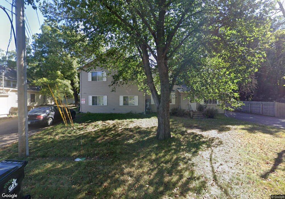
2006 5th St E Menomonie, WI 54751
Estimated Value: $368,000 - $422,000
--
Bed
--
Bath
5,176
Sq Ft
$74/Sq Ft
Est. Value
About This Home
This home is located at 2006 5th St E, Menomonie, WI 54751 and is currently estimated at $385,612, approximately $74 per square foot. 2006 5th St E is a home located in Dunn County with nearby schools including River Heights Elementary School, Menomonie Middle School, and Menomonie High School.
Ownership History
Date
Name
Owned For
Owner Type
Purchase Details
Closed on
Dec 1, 2023
Sold by
Meado-West Rental Llc
Bought by
2006 5Th St Llc A Wisconsin Limited Liab
Current Estimated Value
Purchase Details
Closed on
Sep 1, 2020
Sold by
Wiese Peter
Bought by
Meado-West Rental Llc
Home Financials for this Owner
Home Financials are based on the most recent Mortgage that was taken out on this home.
Interest Rate
2.93%
Create a Home Valuation Report for This Property
The Home Valuation Report is an in-depth analysis detailing your home's value as well as a comparison with similar homes in the area
Home Values in the Area
Average Home Value in this Area
Purchase History
| Date | Buyer | Sale Price | Title Company |
|---|---|---|---|
| 2006 5Th St Llc A Wisconsin Limited Liab | $348,000 | Dunn Co. Title Services, Inc. | |
| Meado-West Rental Llc | $348,000 | -- | |
| Meado-West Rental Llc | $348,000 | -- |
Source: Public Records
Mortgage History
| Date | Status | Borrower | Loan Amount |
|---|---|---|---|
| Previous Owner | Meado-West Rental Llc | -- |
Source: Public Records
Tax History Compared to Growth
Tax History
| Year | Tax Paid | Tax Assessment Tax Assessment Total Assessment is a certain percentage of the fair market value that is determined by local assessors to be the total taxable value of land and additions on the property. | Land | Improvement |
|---|---|---|---|---|
| 2024 | $5,974 | $295,300 | $21,200 | $274,100 |
| 2023 | $5,738 | $295,300 | $21,200 | $274,100 |
| 2022 | $5,480 | $295,300 | $21,200 | $274,100 |
| 2021 | $5,753 | $295,300 | $21,200 | $274,100 |
| 2020 | $6,058 | $235,900 | $17,300 | $218,600 |
| 2019 | $5,696 | $235,900 | $17,300 | $218,600 |
| 2018 | $5,575 | $235,900 | $17,300 | $218,600 |
| 2017 | $5,806 | $235,900 | $17,300 | $218,600 |
| 2016 | $5,685 | $235,900 | $17,300 | $218,600 |
| 2015 | $5,692 | $235,900 | $17,300 | $218,600 |
| 2014 | $5,776 | $235,900 | $17,300 | $218,600 |
| 2013 | $5,841 | $235,900 | $17,300 | $218,600 |
Source: Public Records
Map
Nearby Homes
- 1708 8th St E
- 2202 Broadway St S
- 2003 Broadway St S
- 921 14th Ave E
- 2419 Fryklund Dr
- 1321 2nd St W
- 1115 7th St E Unit 1
- 1115 7th St E
- 1314 16th Ave E
- N4856 460th St
- 207 12th Ave W
- 913 8th St E Unit 1 & 2
- 422 12th Ave W
- 422 12th Ave W Unit 1
- 1400 12th Ave E
- 813 Oakwood Blvd
- 1905 Dairyland Rd
- 503 11th St E
- 502 12th St SE
- 1762 Wilson Ave
- 2006 5th St E Unit A
- 2006 5th St E Unit A, B, & C
- 2014 5th St E
- 1918 5th St E
- 2009 5th St E
- 2020 5th St E
- 2019 5th St E
- 1907 5th St E
- 1907 5th St W
- 1907 5th St E
- 1907 5th St E
- 408 20th Ave E
- 405 20th Ave E
- 2002 4th St E
- 403 20th Ave W
- 2018 4th St E
- 403 20th Ave E
- 2103 5th St E
- 416 21st Ave E
- 1821 6th St E