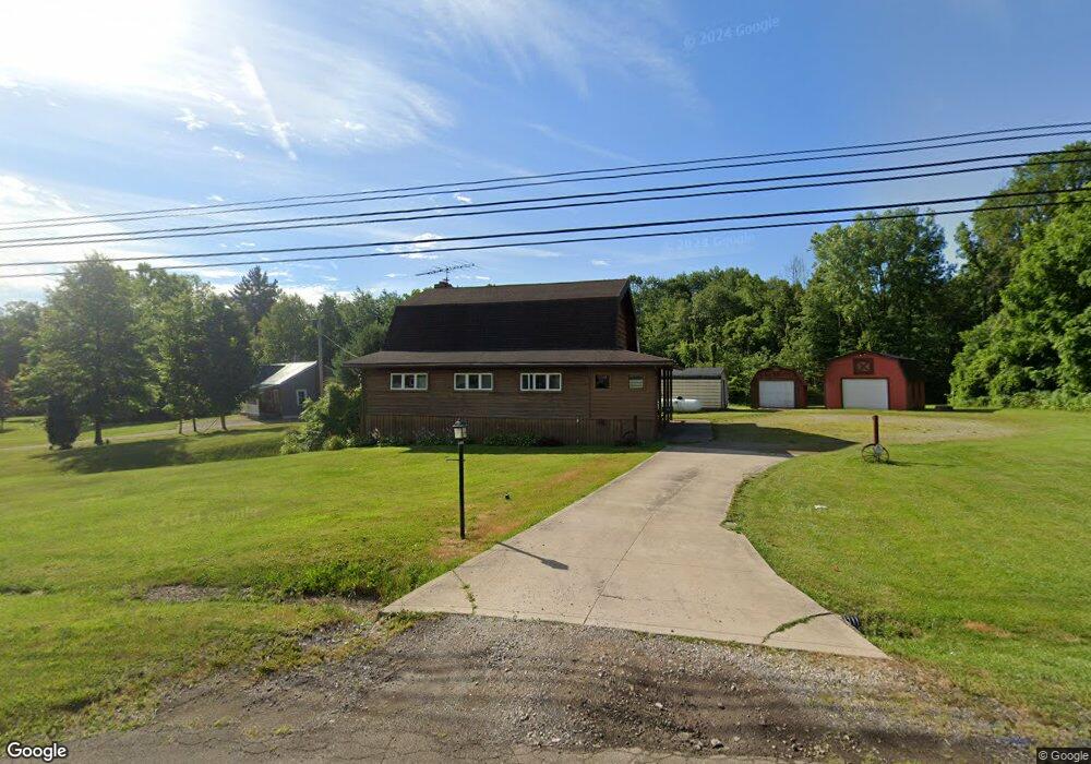
2006 Ashland Rd Mansfield, OH 44905
Estimated Value: $266,000 - $349,000
3
Beds
2
Baths
1,785
Sq Ft
$170/Sq Ft
Est. Value
About This Home
This home is located at 2006 Ashland Rd, Mansfield, OH 44905 and is currently estimated at $304,078, approximately $170 per square foot. 2006 Ashland Rd is a home located in Richland County with nearby schools including Madison High School, St. Mary Catholic School, and Temple-Christian School.
Ownership History
Date
Name
Owned For
Owner Type
Purchase Details
Closed on
May 22, 2017
Sold by
Tolley Charles R
Bought by
Strong Barbara C
Current Estimated Value
Purchase Details
Closed on
Dec 11, 2012
Sold by
Strong Barbara C
Bought by
Strong Barbara C and Tolley Charles R
Purchase Details
Closed on
May 17, 1994
Sold by
Spangler John
Bought by
Strong Thomas M
Purchase Details
Closed on
Jul 27, 1992
Bought by
The Richland Trust Company
Purchase Details
Closed on
Feb 4, 1992
Sold by
Workman Van A
Bought by
The Richland Trust Company
Purchase Details
Closed on
Jan 1, 1987
Create a Home Valuation Report for This Property
The Home Valuation Report is an in-depth analysis detailing your home's value as well as a comparison with similar homes in the area
Home Values in the Area
Average Home Value in this Area
Purchase History
| Date | Buyer | Sale Price | Title Company |
|---|---|---|---|
| Strong Barbara C | -- | Attorney | |
| Strong Barbara C | -- | None Available | |
| Strong Thomas M | $80,000 | -- | |
| The Richland Trust Company | $62,000 | -- | |
| The Richland Trust Company | -- | -- | |
| -- | $13,000 | -- |
Source: Public Records
Tax History Compared to Growth
Tax History
| Year | Tax Paid | Tax Assessment Tax Assessment Total Assessment is a certain percentage of the fair market value that is determined by local assessors to be the total taxable value of land and additions on the property. | Land | Improvement |
|---|---|---|---|---|
| 2024 | $3,429 | $77,520 | $13,880 | $63,640 |
| 2023 | $3,429 | $77,520 | $13,880 | $63,640 |
| 2022 | $2,440 | $53,160 | $11,120 | $42,040 |
| 2021 | $2,439 | $53,160 | $11,120 | $42,040 |
| 2020 | $2,458 | $53,160 | $11,120 | $42,040 |
| 2019 | $2,132 | $44,700 | $9,350 | $35,350 |
| 2018 | $2,114 | $44,700 | $9,350 | $35,350 |
| 2017 | $1,911 | $44,700 | $9,350 | $35,350 |
| 2016 | $1,747 | $38,300 | $8,880 | $29,420 |
| 2015 | $1,747 | $38,300 | $8,880 | $29,420 |
| 2014 | $1,712 | $38,300 | $8,880 | $29,420 |
| 2012 | $837 | $40,310 | $9,350 | $30,960 |
Source: Public Records
Map
Nearby Homes
- 1951 Woodmont Rd
- 1997 Hout Rd
- 1806 Richard Dr
- 1910 Crider Rd
- 2202 Lakewood Dr
- 2270 Lakecrest Dr Unit 2272
- 1106 Keller Dr Unit 1108
- 903 Mayflower Ave
- 1292 Wolford Rd
- 1151 Beal Rd
- 1585 Beal Rd
- 1791 Beal Rd
- 640 Running Brook Way
- 1158 Delwood Rd
- 1150 Delwood Dr
- 0 Satinwood Dr
- 630 Impala Dr
- 1245 N Stewart Rd
- 598 Impala Dr
- 683 Coachman Rd
- 2024 Ashland Rd
- 1989 Ashland Rd
- 1989 Ashland Rd
- 1989 Ashland Rd
- 2005 Ashland Rd
- 2019 Ashland Rd
- 2345 Ashland Rd Unit 2347
- 1982 Ashland Rd
- 1965 Ashland Rd
- 2058 Ashland Rd
- 1972 Ashland Rd
- 2052 Ashland Rd
- 2052 Ashland Rd
- 1958 Ashland Rd
- 1955 Ashland Rd
- 1518 Windsor Rd
- 1506 Windsor Rd
- 2074 Ashland Rd
- 1478 Windsor Rd
- 1526 Windsor Rd