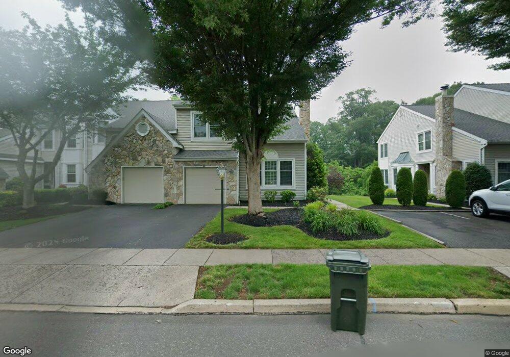
2006 Birdie Ln Doylestown, PA 18901
Estimated Value: $521,000 - $560,210
3
Beds
3
Baths
2,600
Sq Ft
$206/Sq Ft
Est. Value
About This Home
This home is located at 2006 Birdie Ln, Doylestown, PA 18901 and is currently estimated at $536,553, approximately $206 per square foot. 2006 Birdie Ln is a home located in Bucks County with nearby schools including Bridge Valley Elementary School, Lenape Middle School, and Central Bucks High School-West.
Ownership History
Date
Name
Owned For
Owner Type
Purchase Details
Closed on
Feb 23, 2009
Sold by
Tucker Marc
Current Estimated Value
Home Financials for this Owner
Home Financials are based on the most recent Mortgage that was taken out on this home.
Original Mortgage
$115,000
Outstanding Balance
$73,004
Interest Rate
5.18%
Mortgage Type
Purchase Money Mortgage
Estimated Equity
$463,549
Purchase Details
Closed on
Jun 13, 2006
Sold by
Reynolds H R Peter and Sutherland Leah
Bought by
Tucker Marc
Purchase Details
Closed on
Aug 8, 1996
Sold by
Reynolds H R Peter
Bought by
Reynolds H R Peter and Sutherland Leah
Purchase Details
Closed on
Oct 2, 1995
Sold by
Reynolds H R Peter
Bought by
Reynolds H R Peter and Sutherland Leah
Purchase Details
Closed on
Oct 8, 1994
Sold by
Martino Paul L
Bought by
Reynolds H R Peter
Create a Home Valuation Report for This Property
The Home Valuation Report is an in-depth analysis detailing your home's value as well as a comparison with similar homes in the area
Home Values in the Area
Average Home Value in this Area
Purchase History
| Date | Buyer | Sale Price | Title Company |
|---|---|---|---|
| -- | $280,000 | None Available | |
| Tucker Marc | $100,000 | None Available | |
| Reynolds H R Peter | -- | -- | |
| Reynolds H R Peter | -- | -- | |
| Reynolds H R Peter | $170,000 | -- |
Source: Public Records
Mortgage History
| Date | Status | Borrower | Loan Amount |
|---|---|---|---|
| Open | Mcnamee Thomas J | $115,000 |
Source: Public Records
Tax History Compared to Growth
Tax History
| Year | Tax Paid | Tax Assessment Tax Assessment Total Assessment is a certain percentage of the fair market value that is determined by local assessors to be the total taxable value of land and additions on the property. | Land | Improvement |
|---|---|---|---|---|
| 2025 | $5,769 | $32,600 | $4,200 | $28,400 |
| 2024 | $5,769 | $32,600 | $4,200 | $28,400 |
| 2023 | $5,501 | $32,600 | $4,200 | $28,400 |
| 2022 | $5,440 | $32,600 | $4,200 | $28,400 |
| 2021 | $5,328 | $32,600 | $4,200 | $28,400 |
| 2020 | $5,303 | $32,600 | $4,200 | $28,400 |
| 2019 | $5,246 | $32,600 | $4,200 | $28,400 |
| 2018 | $5,230 | $32,600 | $4,200 | $28,400 |
| 2017 | $5,189 | $32,600 | $4,200 | $28,400 |
| 2016 | $5,157 | $32,600 | $4,200 | $28,400 |
| 2015 | -- | $32,600 | $4,200 | $28,400 |
| 2014 | -- | $32,600 | $4,200 | $28,400 |
Source: Public Records
Map
Nearby Homes
- 125 Edison Furlong Rd
- 45 Bedford Ave
- 60 Quarry Rd
- 1249 Pebble Hill Rd
- 1997 Brook Ln
- 2226 Orchard Hill Cir
- 200 Beech Blvd Unit 301
- 137 Pebble Woods Dri Pebble Woods Dr
- 2227 Sand Trap Rd
- 82 Avalon Ct Unit 2005
- 1323 School Ln
- 612 Bethel Ln Unit THE ROOSEVELT PLAN
- 547 Mccarty Dr
- 1403 E Fernbrook Dr
- 2443 Sugar Bottom Rd
- 21 Shady Springs Dr
- 108 Eagle Ct Unit 105
- 3060 Cloverly Dr
- 2127 York Rd
- 2372 Dorchester St W Unit W