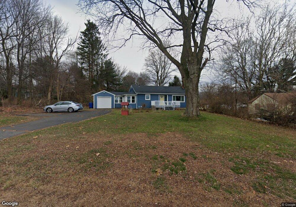
2006 Boston Turnpike Coventry, CT 06238
Estimated Value: $278,000 - $299,000
3
Beds
1
Bath
968
Sq Ft
$298/Sq Ft
Est. Value
About This Home
This home is located at 2006 Boston Turnpike, Coventry, CT 06238 and is currently estimated at $287,980, approximately $297 per square foot. 2006 Boston Turnpike is a home located in Tolland County with nearby schools including Coventry Grammar School, George Hersey Robertson School, and Capt. Nathan Hale School.
Ownership History
Date
Name
Owned For
Owner Type
Purchase Details
Closed on
Jul 31, 2003
Sold by
Davis Earl and Davis Joyce
Bought by
Kirschner Paul and Kirschner Dawn
Current Estimated Value
Home Financials for this Owner
Home Financials are based on the most recent Mortgage that was taken out on this home.
Original Mortgage
$132,000
Interest Rate
5.28%
Mortgage Type
VA
Purchase Details
Closed on
Nov 2, 1998
Sold by
Fitzgerald James and Breault Susan
Bought by
Davis Earl and Davis Joyce
Create a Home Valuation Report for This Property
The Home Valuation Report is an in-depth analysis detailing your home's value as well as a comparison with similar homes in the area
Home Values in the Area
Average Home Value in this Area
Purchase History
| Date | Buyer | Sale Price | Title Company |
|---|---|---|---|
| Kirschner Paul | $132,000 | -- | |
| Davis Earl | $103,000 | -- | |
| Kirschner Paul | $132,000 | -- | |
| Davis Earl | $103,000 | -- |
Source: Public Records
Mortgage History
| Date | Status | Borrower | Loan Amount |
|---|---|---|---|
| Open | Davis Earl | $107,565 | |
| Closed | Davis Earl | $132,000 | |
| Closed | Davis Earl | $7,800 |
Source: Public Records
Tax History Compared to Growth
Tax History
| Year | Tax Paid | Tax Assessment Tax Assessment Total Assessment is a certain percentage of the fair market value that is determined by local assessors to be the total taxable value of land and additions on the property. | Land | Improvement |
|---|---|---|---|---|
| 2025 | $3,977 | $167,400 | $39,800 | $127,600 |
| 2024 | $3,184 | $95,600 | $34,600 | $61,000 |
| 2023 | $3,034 | $95,600 | $34,600 | $61,000 |
| 2022 | $2,978 | $95,600 | $34,600 | $61,000 |
| 2021 | $2,978 | $95,600 | $34,600 | $61,000 |
| 2020 | $2,980 | $95,600 | $34,600 | $61,000 |
| 2019 | $3,078 | $95,600 | $34,600 | $61,000 |
| 2018 | $2,975 | $92,400 | $34,600 | $57,800 |
| 2017 | $2,957 | $92,400 | $34,600 | $57,800 |
| 2016 | $2,883 | $92,400 | $34,600 | $57,800 |
| 2015 | $2,883 | $92,400 | $34,600 | $57,800 |
| 2014 | $3,001 | $105,400 | $42,800 | $62,600 |
Source: Public Records
Map
Nearby Homes
- 54 Wolf Hill Rd Unit TBB
- 0 Boston Turnpike Unit 24128587
- 54 Wolf Hill (Lot#49) Rd
- 37 Wolf Hill Rd Unit Lot 40
- 37 Wolf Hill Lot (#40) Rd
- 395 Grant Hill (Mill Race Drive) Lot #21 Rd
- 395 Grant Hill Rd Unit Lot21
- 125 Brewster St
- 3224 South St
- 1230 Boston Turnpike
- 30 Tolland Rd
- 141 Broad Way
- 864 Boston Turnpike
- 1107 N River Rd
- 53 Stonecroft Ln
- 1121 Merrow Rd
- 10 Lakeside Ln
- 0 Skinner Hill Rd Unit 24077239
- 0 Rr 6 Route Unit 24064143
- 40 Old Tolland Turnpike