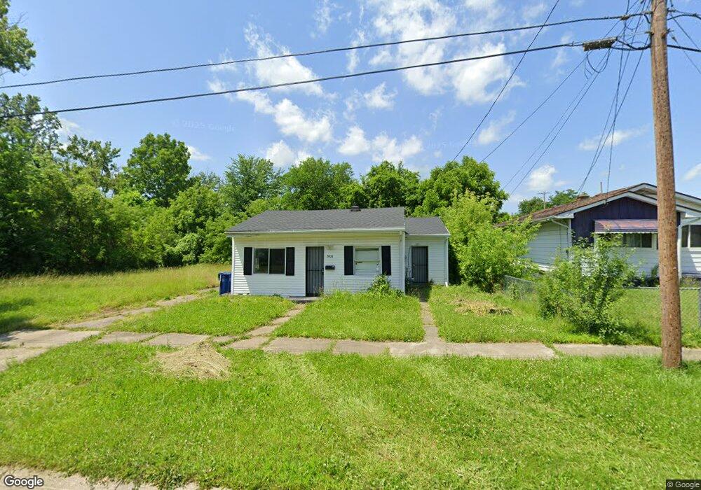
2006 Burr Blvd Flint, MI 48503
South Parks NeighborhoodEstimated Value: $39,000 - $72,000
2
Beds
1
Bath
1,056
Sq Ft
$49/Sq Ft
Est. Value
About This Home
This home is located at 2006 Burr Blvd, Flint, MI 48503 and is currently estimated at $52,224, approximately $49 per square foot. 2006 Burr Blvd is a home located in Genesee County with nearby schools including Freeman Elementary School, Flint Southwestern Classical Academy, and International Academy of Flint (K-12).
Ownership History
Date
Name
Owned For
Owner Type
Purchase Details
Closed on
Feb 16, 2024
Sold by
Buzy Bee Enterprise Inc
Bought by
Sai Chakri Enterprises Llc
Current Estimated Value
Purchase Details
Closed on
Nov 20, 2009
Sold by
Kildee Daniel T
Bought by
Buzy Bee Ent Inc
Purchase Details
Closed on
Aug 18, 2006
Sold by
Kildee Daniel T
Bought by
The Wtl Group Llc
Purchase Details
Closed on
May 5, 2004
Sold by
Winchester Phyllis
Bought by
Winchester Michael
Create a Home Valuation Report for This Property
The Home Valuation Report is an in-depth analysis detailing your home's value as well as a comparison with similar homes in the area
Home Values in the Area
Average Home Value in this Area
Purchase History
| Date | Buyer | Sale Price | Title Company |
|---|---|---|---|
| Sai Chakri Enterprises Llc | $10,000 | Liberty Title | |
| Buzy Bee Ent Inc | $450 | None Available | |
| The Wtl Group Llc | $3,300 | None Available | |
| Winchester Michael | -- | Lawyers Title Insurance Corp |
Source: Public Records
Tax History Compared to Growth
Tax History
| Year | Tax Paid | Tax Assessment Tax Assessment Total Assessment is a certain percentage of the fair market value that is determined by local assessors to be the total taxable value of land and additions on the property. | Land | Improvement |
|---|---|---|---|---|
| 2025 | $1,076 | $13,100 | $0 | $0 |
| 2024 | $1,018 | $11,100 | $0 | $0 |
| 2023 | $1,004 | $9,400 | $0 | $0 |
| 2022 | $0 | $8,200 | $0 | $0 |
| 2021 | $892 | $7,200 | $0 | $0 |
| 2020 | $842 | $7,000 | $0 | $0 |
| 2019 | $666 | $6,100 | $0 | $0 |
| 2018 | $811 | $6,500 | $0 | $0 |
| 2017 | $797 | $0 | $0 | $0 |
| 2016 | $793 | $0 | $0 | $0 |
| 2015 | -- | $0 | $0 | $0 |
| 2014 | -- | $0 | $0 | $0 |
| 2012 | -- | $8,300 | $0 | $0 |
Source: Public Records
Map
Nearby Homes
- 1601 Wayne St
- 1110 Pingree Ave
- 2029 Aitken Ave
- 1917 Whittlesey St
- 2010 Crocker Ave
- 1937 Chelan St
- 2221 Howard Ave
- 1840 Mcphail St
- 2224 Crocker Ave
- 2121 Dwight Ave
- 9211 Owen St
- 2050 Ferris Ave
- 2618 Pinetree Dr
- 420 Pingree Ave
- 1510 S Franklin Ave
- 1628 Broad Ct
- 1409 S Franklin Ave
- 930 Belmont Ave
- 2313 Brookside Dr
- 2910 Shawnee Ave
- 2002 Burr Blvd
- 2010 Burr Blvd
- 2014 Burr Blvd
- 1402 Pingree Ave
- 2013 Maybury Ave
- 2018 Burr Blvd
- 2017 Maybury Ave
- 2022 Burr Blvd
- 2015 Burr Blvd
- 2005 Burr Blvd
- 2021 Maybury Ave
- 2001 Burr Blvd
- 2009 Burr Blvd
- 2026 Burr Blvd
- 2002 Maybury Ave
- 2025 Maybury Ave
- 1941 Burr Blvd
- 2014 Maybury Ave
- 2010 Mcavoy St
- 2016 Maybury Ave