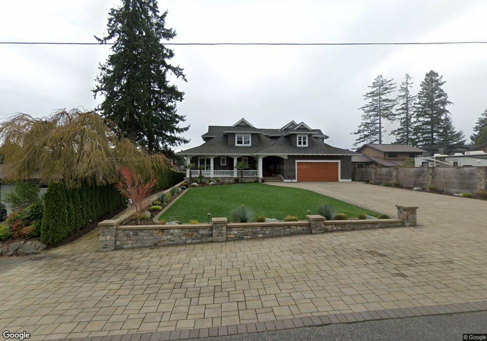
2006 Channel Rd E Lake Tapps, WA 98391
Estimated Value: $2,169,000 - $3,073,000
4
Beds
3
Baths
3,120
Sq Ft
$837/Sq Ft
Est. Value
About This Home
This home is located at 2006 Channel Rd E, Lake Tapps, WA 98391 and is currently estimated at $2,610,046, approximately $836 per square foot. 2006 Channel Rd E is a home located in Pierce County with nearby schools including Dieringer Heights Elementary School, Lake Tapps Elementary School, and North Tapps Middle School.
Ownership History
Date
Name
Owned For
Owner Type
Purchase Details
Closed on
Feb 25, 2008
Sold by
T & S Properties Llc
Bought by
2006 Channel Drive Llc
Current Estimated Value
Purchase Details
Closed on
Aug 14, 2007
Sold by
Corliss Robert W and Corliss Beverly V
Bought by
T & S Properties Llc
Purchase Details
Closed on
Sep 25, 1997
Sold by
Olsen Thorvald O
Bought by
Corliss Robert W and Corliss Beverly
Home Financials for this Owner
Home Financials are based on the most recent Mortgage that was taken out on this home.
Original Mortgage
$299,250
Interest Rate
7.54%
Create a Home Valuation Report for This Property
The Home Valuation Report is an in-depth analysis detailing your home's value as well as a comparison with similar homes in the area
Home Values in the Area
Average Home Value in this Area
Purchase History
| Date | Buyer | Sale Price | Title Company |
|---|---|---|---|
| 2006 Channel Drive Llc | -- | None Available | |
| T & S Properties Llc | $855,000 | Ticor Title Company | |
| Corliss Robert W | $315,000 | -- |
Source: Public Records
Mortgage History
| Date | Status | Borrower | Loan Amount |
|---|---|---|---|
| Previous Owner | Corliss Robert W | $299,250 |
Source: Public Records
Tax History Compared to Growth
Tax History
| Year | Tax Paid | Tax Assessment Tax Assessment Total Assessment is a certain percentage of the fair market value that is determined by local assessors to be the total taxable value of land and additions on the property. | Land | Improvement |
|---|---|---|---|---|
| 2025 | $22,496 | $2,476,600 | $735,200 | $1,741,400 |
| 2024 | $22,496 | $2,343,300 | $754,300 | $1,589,000 |
| 2023 | $22,496 | $2,258,200 | $795,600 | $1,462,600 |
| 2022 | $14,352 | $2,039,300 | $733,600 | $1,305,700 |
| 2021 | $13,327 | $1,014,200 | $521,800 | $492,400 |
| 2019 | $5,841 | $806,800 | $445,000 | $361,800 |
| 2018 | $6,531 | $450,000 | $445,000 | $5,000 |
| 2017 | $8,170 | $414,400 | $409,900 | $4,500 |
| 2016 | $6,675 | $468,200 | $283,200 | $185,000 |
| 2014 | $6,513 | $416,400 | $256,200 | $160,200 |
| 2013 | $6,513 | $403,100 | $226,500 | $176,600 |
Source: Public Records
Map
Nearby Homes
- 18107 25th Street Ct E
- 2202 Tacoma Point Dr E
- 18306 14th Street Ct E
- 2422 179th Ave E
- 17521 25th Street Ct E
- 17612 16th Street Ct E
- 17608 16th Street Ct E
- 2804 179th Ave E
- 17510 16th Street Ct E
- 1827 176th Ave E
- 1828 176th Ave E
- 1024 184th Avenue Ct E
- 2517 173rd Avenue Ct E
- 923 187th Ave E
- 2909 65th St SE
- 1 xxx 179th Ave E
- 2168 69th St SE
- 1618 73rd St SE Unit 16
- 7205 Perry Ave SE Unit 25
- 6672 Udall Place SE
- 1926 Channel Rd E
- 2018 Channel Rd E
- 2018 Channel Rd E
- 1920 Channel Rd E
- 2024 Channel Rd E
- 1912 Channel Rd E
- 2011 Channel Rd E
- 2005 Channel Rd E
- 2017 Channel Rd E
- 1925 Channel Rd E
- 1904 Channel Rd E
- 2023 Channel Rd E
- 1919 Channel Rd E
- 1919 Channel Rd E
- 1822 Channel Rd E
- 2103 Channel Rd E
- 1903 Channel Rd E
- 1821 Channel Rd E