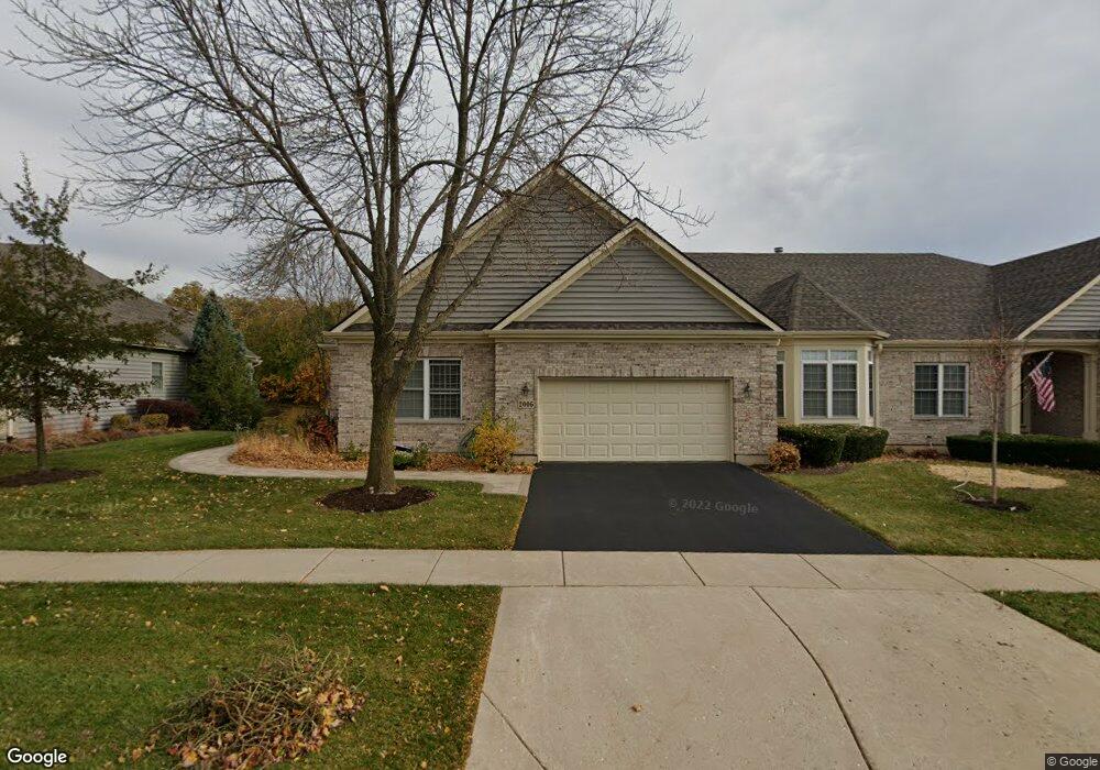
2006 Harrow Gate Dr Woodstock, IL 60098
Estimated Value: $398,000 - $491,000
2
Beds
2
Baths
1,882
Sq Ft
$235/Sq Ft
Est. Value
About This Home
This home is located at 2006 Harrow Gate Dr, Woodstock, IL 60098 and is currently estimated at $442,427, approximately $235 per square foot. 2006 Harrow Gate Dr is a home located in McHenry County with nearby schools including Olson Elementary School, Creekside Middle School, and Woodstock High School.
Ownership History
Date
Name
Owned For
Owner Type
Purchase Details
Closed on
May 4, 2004
Sold by
Chwalisz David A and Chwalisz Bette C
Bought by
Chwalisz David A and Chwalisz Bette C
Current Estimated Value
Home Financials for this Owner
Home Financials are based on the most recent Mortgage that was taken out on this home.
Original Mortgage
$330,000
Interest Rate
4.25%
Mortgage Type
Unknown
Purchase Details
Closed on
Mar 10, 2004
Sold by
Par Development Inc
Bought by
Chwalisz David A and Chwalisz Bette C
Home Financials for this Owner
Home Financials are based on the most recent Mortgage that was taken out on this home.
Original Mortgage
$330,000
Interest Rate
4.25%
Mortgage Type
Unknown
Create a Home Valuation Report for This Property
The Home Valuation Report is an in-depth analysis detailing your home's value as well as a comparison with similar homes in the area
Home Values in the Area
Average Home Value in this Area
Purchase History
| Date | Buyer | Sale Price | Title Company |
|---|---|---|---|
| Chwalisz David A | -- | -- | |
| Chwalisz David A | $348,430 | Chicago Title |
Source: Public Records
Mortgage History
| Date | Status | Borrower | Loan Amount |
|---|---|---|---|
| Previous Owner | Chwalisz David A | $330,000 |
Source: Public Records
Tax History Compared to Growth
Tax History
| Year | Tax Paid | Tax Assessment Tax Assessment Total Assessment is a certain percentage of the fair market value that is determined by local assessors to be the total taxable value of land and additions on the property. | Land | Improvement |
|---|---|---|---|---|
| 2024 | $9,602 | $120,215 | $10,740 | $109,475 |
| 2023 | $9,070 | $108,713 | $9,712 | $99,001 |
| 2022 | $9,329 | $96,479 | $8,619 | $87,860 |
| 2021 | $8,880 | $90,142 | $8,053 | $82,089 |
| 2020 | $8,558 | $85,654 | $7,652 | $78,002 |
| 2019 | $8,860 | $86,764 | $7,751 | $79,013 |
| 2018 | $8,670 | $83,788 | $8,841 | $74,947 |
| 2017 | $8,522 | $78,859 | $8,321 | $70,538 |
| 2016 | $8,458 | $73,018 | $7,705 | $65,313 |
| 2013 | -- | $70,246 | $10,398 | $59,848 |
Source: Public Records
Map
Nearby Homes
- 1350 Galloway Dr
- Lot 13 Duncan Place
- 12 Duncan Place
- 1312 Galloway Dr
- 10630 White Face Ct
- 2101 Red Barn Ct
- 1322 Bull Valley Dr
- LOT 7 Dillard Ct
- 1551 Bobolink Cir
- 2019 Aspen Dr
- 1419 White Oak Ln
- 1601 Bobolink Cir
- 1624 Bull Valley Dr
- 1133 Bull Valley Dr
- 2108 Aspen Dr
- lot 1 Mcconnell Rd
- 10500 Bull Valley Dr
- Lot #10 Oakmont Ct
- Lot #9 Oakmont Ct
- Lot #6 Oakmont Ct
- 2004 Harrow Gate Dr
- 2008 Harrow Gate Dr
- 2010 Harrow Gate Dr
- 2000 Harrow Gate Dr
- 2012 Harrow Gate Dr
- 2014 Harrow Gate Dr
- 2009 Harrow Gate Dr
- 2009 Harrow Gate Dr Unit 39A
- 1026 Harrow Gate Dr
- 2011 Harrow Gate Dr Unit 39B
- 2011 Harrow Gate Dr
- 1024 Harrow Gate Dr
- 2016 Harrow Gate Dr
- 1023 Harrow Gate Dr
- 2013 Harrow Gate Dr
- 2018 Harrow Gate Dr
- 1022 Harrow Gate Dr
- 1021 Harrow Gate Dr
- 2015 Harrow Gate Dr
- 1020 Harrow Gate Dr