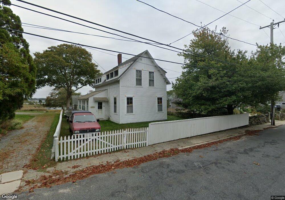
2006 Main Rd Unit Winter Westport, MA 02790
Westport Point NeighborhoodEstimated Value: $798,000 - $1,408,000
4
Beds
2
Baths
1,790
Sq Ft
$636/Sq Ft
Est. Value
About This Home
This home is located at 2006 Main Rd Unit Winter, Westport, MA 02790 and is currently estimated at $1,138,401, approximately $635 per square foot. 2006 Main Rd Unit Winter is a home located in Bristol County with nearby schools including Alice A. Macomber Primary School, Westport Elementary School, and Westport Middle-High School.
Create a Home Valuation Report for This Property
The Home Valuation Report is an in-depth analysis detailing your home's value as well as a comparison with similar homes in the area
Home Values in the Area
Average Home Value in this Area
Tax History Compared to Growth
Tax History
| Year | Tax Paid | Tax Assessment Tax Assessment Total Assessment is a certain percentage of the fair market value that is determined by local assessors to be the total taxable value of land and additions on the property. | Land | Improvement |
|---|---|---|---|---|
| 2025 | $8,416 | $1,129,700 | $877,000 | $252,700 |
| 2024 | $8,205 | $1,061,400 | $812,500 | $248,900 |
| 2023 | $8,025 | $983,400 | $750,000 | $233,400 |
| 2022 | $7,031 | $829,100 | $714,300 | $114,800 |
| 2021 | $6,037 | $700,400 | $584,400 | $116,000 |
| 2020 | $5,707 | $677,000 | $561,000 | $116,000 |
| 2019 | $5,524 | $667,900 | $561,000 | $106,900 |
| 2018 | $4,075 | $498,800 | $398,600 | $100,200 |
| 2017 | $3,955 | $496,200 | $398,600 | $97,600 |
| 2016 | $3,893 | $492,100 | $398,600 | $93,500 |
| 2015 | $3,865 | $487,400 | $409,300 | $78,100 |
Source: Public Records
Map
Nearby Homes
- 1881 Main Rd
- 1702J Drift Rd
- 1702 Drift Rd
- 1749 Main Rd
- 1580 Main Rd
- 19 Seabury Ln
- 238-242 E Beach Rd
- 99 Sylvia Ln
- 1346 Main Rd Unit B
- 189 Brayton Point Rd
- 304 Brayton Point Rd
- Lot 2 Horseneck Rd
- 255 John Dyer Rd
- 245 John Dyer Rd
- 225 Hixbridge Rd
- 920 Drift Rd
- 17 Quail Trail
- 101 Adamsville Rd
- Lot 2E Horseneck Rd
- 505 Long Hwy