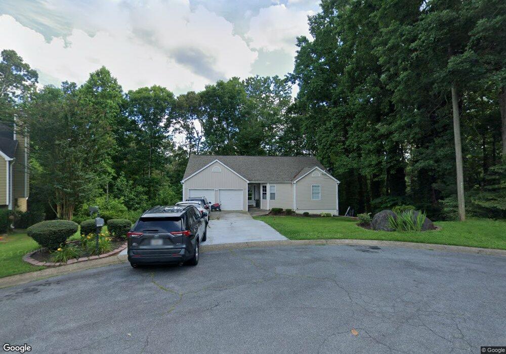
2006 River Ct Unit 4 Woodstock, GA 30188
Union Hill NeighborhoodEstimated Value: $386,620 - $389,000
3
Beds
2
Baths
1,630
Sq Ft
$238/Sq Ft
Est. Value
About This Home
This home is located at 2006 River Ct Unit 4, Woodstock, GA 30188 and is currently estimated at $387,810, approximately $237 per square foot. 2006 River Ct Unit 4 is a home located in Cherokee County with nearby schools including Arnold Mill Elementary School, Mill Creek Middle School, and River Ridge High School.
Ownership History
Date
Name
Owned For
Owner Type
Purchase Details
Closed on
Aug 1, 2000
Sold by
Cabrera Fernando
Bought by
Cabrera Fernando
Current Estimated Value
Home Financials for this Owner
Home Financials are based on the most recent Mortgage that was taken out on this home.
Original Mortgage
$126,100
Outstanding Balance
$44,138
Interest Rate
8.12%
Mortgage Type
New Conventional
Estimated Equity
$343,672
Create a Home Valuation Report for This Property
The Home Valuation Report is an in-depth analysis detailing your home's value as well as a comparison with similar homes in the area
Home Values in the Area
Average Home Value in this Area
Purchase History
| Date | Buyer | Sale Price | Title Company |
|---|---|---|---|
| Cabrera Fernando | -- | -- | |
| Cabrera Fernando | $130,000 | -- |
Source: Public Records
Mortgage History
| Date | Status | Borrower | Loan Amount |
|---|---|---|---|
| Open | Cabrera Fernando | $126,100 |
Source: Public Records
Tax History Compared to Growth
Tax History
| Year | Tax Paid | Tax Assessment Tax Assessment Total Assessment is a certain percentage of the fair market value that is determined by local assessors to be the total taxable value of land and additions on the property. | Land | Improvement |
|---|---|---|---|---|
| 2025 | $4,116 | $156,732 | $32,000 | $124,732 |
| 2024 | $3,742 | $144,012 | $30,400 | $113,612 |
| 2023 | $3,699 | $142,332 | $28,800 | $113,532 |
| 2022 | $3,612 | $137,412 | $23,600 | $113,812 |
| 2021 | $3,055 | $107,608 | $18,000 | $89,608 |
| 2020 | $2,703 | $95,128 | $14,000 | $81,128 |
| 2019 | $2,510 | $88,320 | $14,000 | $74,320 |
| 2018 | $2,247 | $78,600 | $14,000 | $64,600 |
| 2017 | $2,155 | $187,000 | $14,000 | $60,800 |
| 2016 | $1,949 | $167,400 | $12,400 | $54,560 |
| 2015 | $1,876 | $159,500 | $12,400 | $51,400 |
| 2014 | $1,639 | $139,100 | $11,600 | $44,040 |
Source: Public Records
Map
Nearby Homes
- 414 Spring View Dr
- 124 Riverside Ln
- 321 Burdock Trace
- 202 Little River Way
- 236 Persimmon Dr
- 585 Arnold Mill Rd
- 4006 N Arnold Mill Rd
- 624 Arnold Mill Rd
- 522 Watercress Dr
- 632 Arnold Mill Rd
- 4020 N Arnold Mill Rd
- 636 Arnold Mill Rd
- 809 Araya Ct
- 436 Silver Brook Dr
- 338 Westover Dr
- 114 Neetle Close Dr
- 200 Dahlia Dr
- 116 Neetle Close Dr
- 427 Silver Brook Dr
- 905 Nickolaus Place
- 2004 River Ct
- 2005 River Ct
- 903 Nickolaus Place
- 2003 River Ct
- 906 Nickolaus Place Unit None
- 906 Nickolaus Place
- 123 River Oaks Dr
- 1811 River Rock Trail
- 2002 River Ct
- 121 River Oaks Dr
- 2001 River Ct
- 2001 River Ct Unit 316
- 901 Nickolaus Place
- 1809 River Rock Trail
- 1817 River Rock Trail
- 1819 River Rock Trail
- 0 River Rock Trail Unit 8630095
- 0 River Rock Trail Unit 8218167
- 0 River Rock Trail